
| FAIRVIEW MUNI FAIRVIEW OK |
| |
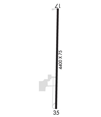
| Lat: N 3617.5 Long: W 09828.5 Elev: 1274 Var: -04 Longest Runway: 4400 | ||
| CTAF: 122.8 | ||
| ||||||||||||||||||||||||||||||||||||||||||||
| ||||||||||||||||||||||||||||||||||||||||||||
| Rwy | Rwy | |||||||
| 4400x75 | 4400' | 4400x75 | 4400' | |||||
| Runway ID | Single Wheel | Double Wheel | Double Tandem Wheel | Dual Double Wheel |
| 17/35 | 30,000 | N/A | N/A | N/A |
| These numbers are Advisory and are not limits. The Airport Manager should have more accurate Weight Limits | ||||
 Airport Diagram might not be current. | |
| Facility Name: | FAIRVIEW MUNI |
| City Name: | FAIRVIEW |
| County: | MAJOR |
| State abbrev: | OK |
| State Name: | OKLAHOMA |
| Ownership: | PUBLICLY OWNED |
| Use: | OPEN TO THE PUBLIC |
| Owner's Name: | CITY OF FAIRVIEW |
| Address: | CITY HALL 203 E. CENTRAL |
| FAIRVIEW, OK 73737 | |
| Owner's Phone: | 580-227-4416 |
| Manager's Name: | MATTHEW REGIER |
| Address: | 224 E. OKLAHOMA AVENUE |
| FAIRVIEW, OK 73737 | |
| Phone: | 580-227-3788 |
| FAA Region: | SOUTHWEST |
| FAA Field Office: | AOK |
| Date | Sunrise | Sunset |
|---|---|---|
| 06/08/26 Monday | 6:16 | 20:50 |
| 06/09/26 Tuesday | 6:16 | 20:50 |
| 06/10/26 Wednesday | 6:16 | 20:51 |
| 06/11/26 Thursday | 6:16 | 20:51 |
| 06/12/26 Friday | 6:16 | 20:52 |
| 06/13/26 Saturday | 6:16 | 20:52 |
| 06/14/26 Sunday | 6:16 | 20:53 |
| 06/15/26 Monday | 6:16 | 20:53 |
| 06/16/26 Tuesday | 6:16 | 20:53 |
| 06/17/26 Wednesday | 6:16 | 20:54 |
| 06/18/26 Thursday | 6:16 | 20:54 |
| 06/19/26 Friday | 6:16 | 20:54 |
| 06/20/26 Saturday | 6:16 | 20:55 |
| 06/21/26 Sunday | 6:17 | 20:55 |
| Airport Attendance Schedule | MON-SAT DALGT |
| Airport Status | OPERATIONAL (This Status can change at any time - please check NOTAMS) |
| Airport Lighting Schedule | SS-SR |
| Airport Storage Available | Tie Downs |
| Extra Services Available | Crop Dusting |
| Wind Indicator | YES - (lighted) |
| Control Tower | NO |
| CTAF Frequency | 122.800 |
| Unicom Frequency | 122.800 |
| Rotating Beacon Color | WG |
| Segmented Circle | YES |
| Landing Fee | NO |
| Airport Inspected | STATE - performed by STATE AERONAUTICAL PERSONNEL |
| Inspection Date | 07/09/2024 |
| Type of Fuel Available | Grade 100LL; -10AVBL DURG WINT MONTHS. |
| Airframe Repair Service | NONE |
| Power Plant Repair Service | NONE |
| Latitude | N3617.5 |
| Longitude | W09828.5 (ESTIMATED) |
| Arpt Elevation | 1273ft (SURVEYED) |
| Magnetic Variation | 04E |
| 1 miles N | of FAIRVIEW |
| Traffic Pattern Altitude | |
| Sectional Chart | WICHITA |
| Operations (Reported) | Yearly | Avg. Daily |
|---|---|---|
| General Aviation Transient | 0 | 0 |
| General Aviation Local | 0 | 0 |
| Air Taxi | 0 | 0 |
| Commerical | 0 | 0 |
| Commuter | 0 | 0 |
| Military | 0 | 0 |
| Aircraft based on Field | |
|---|---|
| General Aviation Singles | 0 |
| General Aviation Multi | 0 |
| Jet Aircraft | 0 |
| General Aviation Helicopters | 0 |
| Military Aircraft | 0 |
| Gliders | 0 |
| Ultralights | 0 |
| FSS on field | NO |
| FSS tie-in | MC ALESTER |
| FSS Phone | 1-800-WX-BRIEF |
| Who issues Notams | MLC |
| Notam D service at airport | YES |
| ARTCC Name | KANSAS CITY |
| Airport Certification | |
| Aircraft Rescue & Firefighting Index | None |
| Airport of Entry | No |
| Custom Landing Rights | No |
| Joint Civil/Military | No |
| Military Landing rights | YES |
| NATIONAL PLAN OF INTEGRATED AIRPORT SYSTEMS (NPIAS) |
| GRANT AGREEMENTS UNDER FAAP/ADAP/AIP |
| ASSURANCES PURSUANT TO TITLE VI, CIVIL RIGHTS ACT OF 1964 |
| FOR CD CTC VANCE APCH AT 580-213-6765. WHEN VANCE APCH IS CLSD, CTC KANSAS CITY ARTCC AT 913-254-8508. |
Airport Communications & Frequencies:
| |||||||||||||||||
| Runway: 17 | Runway: 35 | ||
| Mag heading: | 176° | Mag heading: | 356° |
| Rwy Slope: | .18% Up | Rwy Slope: | -.18% Down |
| Approach: | Approach: | ||
| Pattern: | Left Traffic | Pattern: | Left Traffic |
| Markings: | NONPRECISION INSTRUMENT | Markings: | NONPRECISION INSTRUMENT |
| Marking Condition: | GOOD | Marking Condition: | GOOD |
| Arresting Dev: | Arresting Dev: | ||
| Lat & Long: | N3617.8 W09828.5 | Lat. & Long.: | N3617.1 W09828.6 |
| Elev: | 1264.7 ft. MSL | Elev: | 1272.5 ft. MSL |
| TCH: | TCH: | ||
| Visual Glide Path: | Visual Glide Path: | ||
| Displaced Threshold: | No | Displaced Threshold: | No |
| Touchdown Zone: | YES | Touchdown Zone: | YES |
| Touchdown Elev.: | 1273.7 feet | Touchdown Elev.: | 1273.8 feet |
| Visual Glide Slope: | Visual Glide Slope: | ||
| RVR Equipment: | RVR Equipment: | ||
| RVV Equipment: | NO | RVV Equipment: | NO |
| Approach Lights: | Approach Lights: | ||
| REIL: | NO | REIL: | NO |
| Centerline Lights: | NO | Centerline Lights: | NO |
| Touchdown lights: | NO | Touchdown lights: | NO |
| Runway Category: | Runway with a Non-precision Approach having visibility minimums greater than 3/4 mile | Runway Category: | Runway with a Visual Approach |
| Declared Distances: | Declared Distances: | ||
| Obstructions: | TREE 1037 FT FM RWY END 36 FT LEFT OF APCH CREATES 15:1 APCH CLC SLOPE. | Obstructions: | TREES |
| Marked: | NOT Marked/Lighted | Marked: | NOT Marked/Lighted |
| Clearance slope: | 34:1 | Clearance slope: | 6:1 |
| Obstruction height: | Obstruction height: | 45 feet AGL | |
| Dist. from runway: | Dist. from runway: | 512 feet | |
| Centerline offset: | Centerline offset: | 261 feet left of centerline | |
| Comments: | Comments: |
Thanks for using FltPlan.com
all rights reserved © 1999-2026 by Flight Plan LLC
