
| IOSCO COUNTY EAST TAWAS MI |
| |
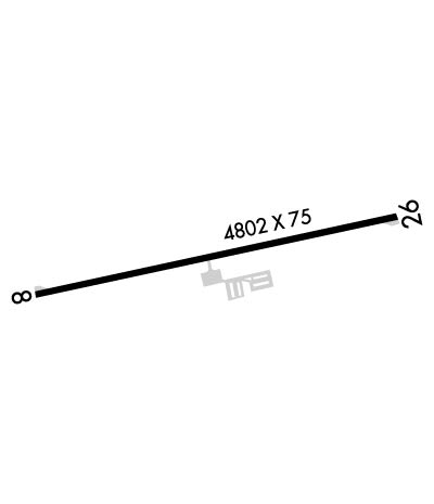
| Lat: N 4418.8 Long: W 08325.3 Elev: 605 Var: +08 Longest Runway: 4802 | ||
| CTAF: 122.8 | ||
| ||||||
|
| Rwy | Rwy | |||||||
| 4802x75 | 4802' | 4802x75 | 4802' | |||||
| Runway ID | Single Wheel | Double Wheel | Double Tandem Wheel | Dual Double Wheel |
| 08/26 | 12,000 | N/A | N/A | N/A |
| These numbers are Advisory and are not limits. The Airport Manager should have more accurate Weight Limits | ||||
 Airport Diagram might not be current. | |
| Facility Name: | IOSCO COUNTY |
| City Name: | EAST TAWAS |
| County: | IOSCO |
| State abbrev: | MI |
| State Name: | MICHIGAN |
| Ownership: | PUBLICLY OWNED |
| Use: | OPEN TO THE PUBLIC |
| Owner's Name: | IOSCO COUNTY |
| Address: | 422 LAKE ST |
| TAWAS CITY, MI 48763 | |
| Owner's Phone: | 989-362-5832 |
| Manager's Name: | JAY SAMUELS |
| Address: | 1131 AULERICH RD |
| EAST TAWAS, MI 48730-9565 | |
| Phone: | 989-820-0738; HOME TEL AFT 1700 LCL. |
| FAA Region: | GREAT LAKES |
| FAA Field Office: | DET |
| Date | Sunrise | Sunset |
|---|---|---|
| 09/24/21 Friday | 7:23 | 19:28 |
| 09/25/21 Saturday | 7:24 | 19:26 |
| 09/26/21 Sunday | 7:25 | 19:24 |
| 09/27/21 Monday | 7:26 | 19:22 |
| 09/28/21 Tuesday | 7:28 | 19:20 |
| 09/29/21 Wednesday | 7:29 | 19:19 |
| 09/30/21 Thursday | 7:30 | 19:17 |
| 10/01/21 Friday | 7:31 | 19:15 |
| 10/02/21 Saturday | 7:32 | 19:13 |
| 10/03/21 Sunday | 7:34 | 19:11 |
| 10/04/21 Monday | 7:35 | 19:09 |
| 10/05/21 Tuesday | 7:36 | 19:08 |
| 10/06/21 Wednesday | 7:37 | 19:06 |
| 10/07/21 Thursday | 7:38 | 19:04 |
| Airport Attendance Schedule | SUN ON CALL, MON-FRI IREG; FOR SER SUNDAYS CALL AMGR. |
| Airport Status | OPERATIONAL (This Status can change at any time - please check NOTAMS) |
| Airport Lighting Schedule | ACTVT REIL RWY 08 & 26; PAPI RWY 08 & 26; MIRL RWY 08/26 - 122.85. |
| Airport Storage Available | Tie Downs |
| Extra Services Available | Parachute Jumping |
| Wind Indicator | YES - (lighted) |
| Control Tower | NO |
| CTAF Frequency | 122.800 |
| Unicom Frequency | 122.800 |
| Rotating Beacon Color | CLEAR-GREEN (Light Land Airport) |
| Segmented Circle | YES |
| Landing Fee | NO |
| Airport Inspected | STATE - performed by STATE AERONAUTICAL PERSONNEL |
| Inspection Date | 08/26/2020 |
| Type of Fuel Available | Grade 100LL |
| Airframe Repair Service | MAJOR; CALL AMGR FOR RPRS. |
| Power Plant Repair Service | MAJOR |
| Latitude | N4418.8 |
| Longitude | W08325.3 (ESTIMATED) |
| Arpt Elevation | 605ft (SURVEYED) |
| Magnetic Variation | 08W |
| 3 miles NE | of EAST TAWAS |
| Traffic Pattern Altitude | |
| Sectional Chart | LAKE HURON |
| Operations (Reported) | Yearly | Avg. Daily |
|---|---|---|
| General Aviation Transient | 965 | 3 |
| General Aviation Local | 2269 | 6 |
| Air Taxi | 0 | 0 |
| Commerical | 0 | 0 |
| Commuter | 0 | 0 |
| Military | 0 | 0 |
| Aircraft based on Field | |
|---|---|
| General Aviation Singles | 24 |
| General Aviation Multi | 1 |
| Jet Aircraft | 0 |
| General Aviation Helicopters | 0 |
| Military Aircraft | 0 |
| Gliders | 0 |
| Ultralights | 0 |
| FSS on field | NO |
| FSS tie-in | LANSING |
| FSS Phone | 1-800-WX-BRIEF |
| Who issues Notams | LAN |
| Notam D service at airport | YES |
| ARTCC Name | MINNEAPOLIS |
| Airport Certification | |
| Aircraft Rescue & Firefighting Index | None |
| Airport of Entry | No |
| Custom Landing Rights | No |
| Joint Civil/Military | No |
| Military Landing rights | YES |
| GRANT AGREEMENTS UNDER FAAP/ADAP/AIP |
| CONVEYANCE UNDER SCETION 16, FEDERAL AIRPORT ACT OF 1946 OR SECTION 23, AIRPORT AND AIRWAY DEVELOPMENT ACT OF 1970 |
| ASSURANCES PURSUANT TO TITLE VI, CIVIL RIGHTS ACT OF 1964 |
| DEER & BIRDS ON & INVOF ARPT. |
| FOR CD CTC MINNEAPOLIS ARTCC AT 651-463-5588. |
Airport Communications & Frequencies:
| |||||||||
| Runway: 08 | Runway: 26 | ||
| Mag heading: | 86° | Mag heading: | 266° |
| Rwy Slope: | -.02% Down | Rwy Slope: | .02% Up |
| Approach: | Approach: | ||
| Pattern: | Left Traffic | Pattern: | Left Traffic |
| Markings: | NONPRECISION INSTRUMENT | Markings: | NONPRECISION INSTRUMENT |
| Marking Condition: | GOOD | Marking Condition: | GOOD |
| Arresting Dev: | Arresting Dev: | ||
| Lat & Long: | N4418.7 W08325.9 | Lat. & Long.: | N4418.9 W08324.8 |
| Elev: | 605.3 ft. MSL | Elev: | 604.2 ft. MSL |
| TCH: | 39 ft. AGL | TCH: | 32 ft. AGL |
| Visual Glide Path: | 3.00 degrees | Visual Glide Path: | 3.00 degrees |
| Displaced Threshold: | No | Displaced Threshold: | No |
| Touchdown Zone: | YES | Touchdown Zone: | YES |
| Touchdown Elev.: | 605.3 feet | Touchdown Elev.: | 604.6 feet |
| Visual Glide Slope: | 2-Light PAPI on LEFT side of Runway | Visual Glide Slope: | 2-Light PAPI on LEFT side of Runway |
| RVR Equipment: | RVR Equipment: | ||
| RVV Equipment: | NO | RVV Equipment: | NO |
| Approach Lights: | Approach Lights: | ||
| REIL: | YES | REIL: | YES |
| Centerline Lights: | NO | Centerline Lights: | NO |
| Touchdown lights: | NO | Touchdown lights: | NO |
| Runway Category: | Runway with a Non-precision Approach | Runway Category: | Runway with a Visual Approach |
| Declared Distances: | Declared Distances: | ||
| Obstructions: | TREE | Obstructions: | TREE |
| Marked: | NOT Marked/Lighted | Marked: | NOT Marked/Lighted |
| Clearance slope: | 1:1 | Clearance slope: | 7:1 |
| Obstruction height: | 8 feet AGL | Obstruction height: | 17 feet AGL |
| Dist. from runway: | 208 feet | Dist. from runway: | 320 feet |
| Centerline offset: | 235 left of centerline | Centerline offset: | 245 feet right of centerline |
| Comments: | Comments: |
Thanks for using FltPlan.com
all rights reserved © 1999-2021 by Flight Plan LLC
