
| FORT ATKINSON MUNI FORT ATKINSON WI |
| |
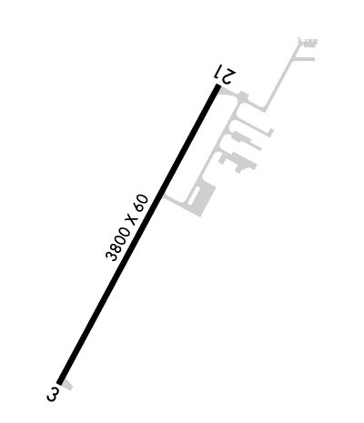
| Lat: N 4257.8 Long: W 08849.1 Elev: 800 Var: +02 Longest Runway: 3800 | ||
| CTAF: 122.9 | ||
| ||||||||||||||||||||||||||||||||
| ||||||||||||||||||||||||||||||||
| Rwy | Rwy | |||||||
| 3800x60 | 3800' | 3800x60 | 3800' | |||||
| Runway ID | Single Wheel | Double Wheel | Double Tandem Wheel | Dual Double Wheel |
| 03/21 | 12,000 | N/A | N/A | N/A |
| These numbers are Advisory and are not limits. The Airport Manager should have more accurate Weight Limits | ||||
 Airport Diagram might not be current. | |
| Facility Name: | FORT ATKINSON MUNI |
| City Name: | FORT ATKINSON |
| County: | JEFFERSON |
| State abbrev: | WI |
| State Name: | WISCONSIN |
| Ownership: | PUBLICLY OWNED |
| Use: | OPEN TO THE PUBLIC |
| Owner's Name: | CITY OF FT. ATKINSON |
| Address: | 101 NORTH MAIN ST |
| FORT ATKINSON, WI 53538 | |
| Owner's Phone: | 920-397-9901 |
| Manager's Name: | JEDIDIAH DRAEGER |
| Address: | 101 N MAIN ST; EMAIL ADDRESS: JDRAEGER@FORTATKINSONWI.GOV |
| FORT ATKINSON, WI 53538 | |
| Phone: | 920-397-9901 |
| FAA Region: | GREAT LAKES |
| FAA Field Office: | CHI |
| Date | Sunrise | Sunset |
|---|---|---|
| 06/12/26 Friday | 5:16 | 20:35 |
| 06/13/26 Saturday | 5:16 | 20:35 |
| 06/14/26 Sunday | 5:16 | 20:36 |
| 06/15/26 Monday | 5:16 | 20:36 |
| 06/16/26 Tuesday | 5:16 | 20:36 |
| 06/17/26 Wednesday | 5:16 | 20:37 |
| 06/18/26 Thursday | 5:16 | 20:37 |
| 06/19/26 Friday | 5:16 | 20:37 |
| 06/20/26 Saturday | 5:16 | 20:38 |
| 06/21/26 Sunday | 5:16 | 20:38 |
| 06/22/26 Monday | 5:16 | 20:38 |
| 06/23/26 Tuesday | 5:17 | 20:38 |
| 06/24/26 Wednesday | 5:17 | 20:38 |
| 06/25/26 Thursday | 5:17 | 20:38 |
| Airport Attendance Schedule | UNATTENDED |
| Airport Status | OPERATIONAL (This Status can change at any time - please check NOTAMS) |
| Airport Lighting Schedule | MIRL RWY 03/21 PRESET TO LOW SS-SR; TO INCR INTST & ACTVT PAPI RWY 03 & 21; MIRL RWY 03/21 - CTAF. |
| Airport Storage Available | Tie Downs |
| Extra Services Available | Parachute Jumping |
| Wind Indicator | YES - (lighted) |
| Control Tower | NO |
| CTAF Frequency | 122.900 |
| Unicom Frequency | |
| Rotating Beacon Color | WG |
| Segmented Circle | YES |
| Landing Fee | NO |
| Airport Inspected | STATE - performed by STATE AERONAUTICAL PERSONNEL |
| Inspection Date | 07/10/2024 |
| Type of Fuel Available | Grade 100LL, JET A; -1024 HR SELF SVC FUEL AVBL WITH CREDIT CARD. |
| Airframe Repair Service | NONE |
| Power Plant Repair Service | NONE |
| Latitude | N4257.8 |
| Longitude | W08849.1 (ESTIMATED) |
| Arpt Elevation | 800ft (SURVEYED) |
| Magnetic Variation | 02W |
| 3 miles NE | of FORT ATKINSON |
| Traffic Pattern Altitude | |
| Sectional Chart | CHICAGO |
| Operations (Reported) | Yearly | Avg. Daily |
|---|---|---|
| General Aviation Transient | 0 | 0 |
| General Aviation Local | 0 | 0 |
| Air Taxi | 0 | 0 |
| Commerical | 0 | 0 |
| Commuter | 0 | 0 |
| Military | 0 | 0 |
| Aircraft based on Field | |
|---|---|
| General Aviation Singles | 0 |
| General Aviation Multi | 0 |
| Jet Aircraft | 0 |
| General Aviation Helicopters | 0 |
| Military Aircraft | 0 |
| Gliders | 0 |
| Ultralights | 0 |
| FSS on field | NO |
| FSS tie-in | GREEN BAY |
| FSS Phone | 1-800-WX-BRIEF |
| Who issues Notams | GRB |
| Notam D service at airport | YES |
| ARTCC Name | CHICAGO |
| Airport Certification | |
| Aircraft Rescue & Firefighting Index | None |
| Airport of Entry | No |
| Custom Landing Rights | No |
| Joint Civil/Military | No |
| Military Landing rights | No |
| NATIONAL PLAN OF INTEGRATED AIRPORT SYSTEMS (NPIAS) |
| GRANT AGREEMENTS UNDER FAAP/ADAP/AIP |
| ASSURANCES PURSUANT TO TITLE VI, CIVIL RIGHTS ACT OF 1964 |
| RY 03/21 PILOTS REQUESTED TO FLY RY HEADING & CLIMB TO 1400 FT MSL BEFORE TURNING EAST. |
| ULTRALIGHT ACTVTY ON & IN VCNTY OF ARPT. |
| FOR CD CTC MADISON APP/DEP CON AT 608-249-8240. WHEN MADISON APCH CLSD, FOR CD CTC CHICAGO ARTCC AT 630-906-8921. |
Airport Communications & Frequencies:
| |||||||||||||||
| Runway: 03 | Runway: 21 | ||
| Mag heading: | 30° | Mag heading: | 210° |
| Rwy Slope: | -.07% Down | Rwy Slope: | .07% Up |
| Approach: | Approach: | ||
| Pattern: | Left Traffic | Pattern: | Left Traffic |
| Markings: | NONPRECISION INSTRUMENT | Markings: | NONPRECISION INSTRUMENT |
| Marking Condition: | GOOD | Marking Condition: | GOOD |
| Arresting Dev: | Arresting Dev: | ||
| Lat & Long: | N4257.5 W08849.3 | Lat. & Long.: | N4258.1 W08848.9 |
| Elev: | 798.5 ft. MSL | Elev: | 795.7 ft. MSL |
| TCH: | 32 ft. AGL | TCH: | 33 ft. AGL |
| Visual Glide Path: | 3.00 degrees | Visual Glide Path: | 3.00 degrees |
| Displaced Threshold: | No | Displaced Threshold: | No |
| Touchdown Zone: | YES | Touchdown Zone: | YES |
| Touchdown Elev.: | 800.1 feet | Touchdown Elev.: | 800.1 feet |
| Visual Glide Slope: | 2-Light PAPI on LEFT side of Runway | Visual Glide Slope: | 2-Light PAPI on LEFT side of Runway |
| RVR Equipment: | RVR Equipment: | ||
| RVV Equipment: | NO | RVV Equipment: | NO |
| Approach Lights: | Approach Lights: | ||
| REIL: | NO | REIL: | NO |
| Centerline Lights: | NO | Centerline Lights: | NO |
| Touchdown lights: | NO | Touchdown lights: | NO |
| Runway Category: | Runway with a Non-precision Approach | Runway Category: | Runway with a Non-precision Approach |
| Declared Distances: | Declared Distances: | ||
| Obstructions: | Obstructions: | BRUSH | |
| Marked: | Marked: | NOT Marked/Lighted | |
| Clearance slope: | 20:1 | Clearance slope: | 2:1 |
| Obstruction height: | Obstruction height: | 10 feet AGL | |
| Dist. from runway: | Dist. from runway: | 220 feet | |
| Centerline offset: | Centerline offset: | 120 feet right of centerline | |
| Comments: | 10 FT BRUSH 30 FT FM THR; 100 FT L. | Comments: | 10 FT BRUSH 100 FT FM THR; 115 FT R. |
Thanks for using FltPlan.com
all rights reserved © 1999-2026 by Flight Plan LLC
