
| SKYWAY ESTATES EATON RAPIDS MI |
| |
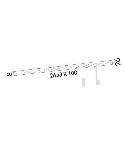
| Lat: N 4235.0 Long: W 08439.1 Elev: 931 Var: +05 Longest Runway: 2653 | ||
| CTAF: 122.9 | ||
| ||||||||||||||||||||||||||||||||
| ||||||||||||||||||||||||||||||||
| Rwy | Rwy | |||||||
| 2653x100 | 1968' | 2653x100 | 2253' | |||||
| Runway ID | Single Wheel | Double Wheel | Double Tandem Wheel | Dual Double Wheel |
| 08/26 | N/A | N/A | N/A | N/A |
| These numbers are Advisory and are not limits. The Airport Manager should have more accurate Weight Limits | ||||
| FltPlan does not have IFR approach charts available for K60G. |
 Airport Diagram might not be current. | |
| Facility Name: | SKYWAY ESTATES |
| City Name: | EATON RAPIDS |
| County: | EATON |
| State abbrev: | MI |
| State Name: | MICHIGAN |
| Ownership: | PRIVATELY OWNED |
| Use: | OPEN TO THE PUBLIC |
| Owner's Name: | SKYWAY ESTATES ASSN, INC |
| Address: | 9449 COLUMBIA HWY |
| EATON RAPIDS, MI 48827-8357 | |
| Owner's Phone: | 517-667-0182 |
| Manager's Name: | KEITH GIBBS |
| Address: | 9445 COLUMBIA HWY |
| EATON RAPIDS, MI 48827-8357 | |
| Phone: | 517-667-0182 |
| FAA Region: | GREAT LAKES |
| FAA Field Office: | DET |
| Date | Sunrise | Sunset |
|---|---|---|
| 06/07/26 Sunday | 6:01 | 21:14 |
| 06/08/26 Monday | 6:01 | 21:14 |
| 06/09/26 Tuesday | 6:01 | 21:15 |
| 06/10/26 Wednesday | 6:01 | 21:15 |
| 06/11/26 Thursday | 6:01 | 21:16 |
| 06/12/26 Friday | 6:00 | 21:17 |
| 06/13/26 Saturday | 6:00 | 21:17 |
| 06/14/26 Sunday | 6:00 | 21:17 |
| 06/15/26 Monday | 6:00 | 21:18 |
| 06/16/26 Tuesday | 6:00 | 21:18 |
| 06/17/26 Wednesday | 6:00 | 21:19 |
| 06/18/26 Thursday | 6:00 | 21:19 |
| 06/19/26 Friday | 6:01 | 21:19 |
| 06/20/26 Saturday | 6:01 | 21:20 |
| Airport Attendance Schedule | IRREGULAR |
| Airport Status | OPERATIONAL (This Status can change at any time - please check NOTAMS) |
| Airport Lighting Schedule | ACTVT MIRL RWY 08/26 - CTAF.; ACTVT ABN SS-SR - CTAF. |
| Airport Storage Available | Tie Downs |
| Extra Services Available | NONE |
| Wind Indicator | YES - (lighted) |
| Control Tower | NO |
| CTAF Frequency | 122.900 |
| Unicom Frequency | |
| Rotating Beacon Color | WG |
| Segmented Circle | YES |
| Landing Fee | NO |
| Airport Inspected | STATE - performed by STATE AERONAUTICAL PERSONNEL |
| Inspection Date | 05/10/2023 |
| Type of Fuel Available | None |
| Airframe Repair Service | None |
| Power Plant Repair Service | None |
| Latitude | N4235.0 |
| Longitude | W08439.1 (ESTIMATED) |
| Arpt Elevation | 931ft (ESTIMATED) |
| Magnetic Variation | 05W |
| 4 miles N | of EATON RAPIDS |
| Traffic Pattern Altitude | |
| Sectional Chart | DETROIT |
| Operations (Reported) | Yearly | Avg. Daily |
|---|---|---|
| General Aviation Transient | 0 | 0 |
| General Aviation Local | 0 | 0 |
| Air Taxi | 0 | 0 |
| Commerical | 0 | 0 |
| Commuter | 0 | 0 |
| Military | 0 | 0 |
| Aircraft based on Field | |
|---|---|
| General Aviation Singles | 0 |
| General Aviation Multi | 0 |
| Jet Aircraft | 0 |
| General Aviation Helicopters | 0 |
| Military Aircraft | 0 |
| Gliders | 0 |
| Ultralights | 0 |
| FSS on field | NO |
| FSS tie-in | LANSING |
| FSS Phone | 1-800-WX-BRIEF |
| Who issues Notams | LAN |
| Notam D service at airport | YES |
| ARTCC Name | CLEVELAND |
| Airport Certification | |
| Aircraft Rescue & Firefighting Index | None |
| Airport of Entry | No |
| Custom Landing Rights | No |
| Joint Civil/Military | No |
| Military Landing rights | No |
| UAS OPS S OF RWY 08/26. |
| FOR CD CTC GREAT LAKES APCH AT 269-459-3345, WHEN APCH CLSD CTC CLEVELAND ARTCC AT 440-774-0224/0490. |
| RWY 08/2 6 SOFT WHEN WET, VFY FLD CONDS WITH AMGR. |
Airport Communications & Frequencies:
| |||||||||||||||
| Runway: 08 | Runway: 26 | ||
| Mag heading: | 88° | Mag heading: | 268° |
| Rwy Slope: | .00% | Rwy Slope: | .00% |
| Approach: | Approach: | ||
| Pattern: | Left Traffic | Pattern: | Left Traffic |
| Markings: | Markings: | ||
| Marking Condition: | RWY & DTHR MKD WITH 3 FT YELLOW CONES. | Marking Condition: | RWY & DTHR MKD WITH 3 FT YELLOW CONES. |
| Arresting Dev: | Arresting Dev: | ||
| Lat & Long: | N4235.0 W08439.4 | Lat. & Long.: | N4235.1 W08438.8 |
| Elev: | 931.0 ft. MSL | Elev: | 931.0 ft. MSL |
| TCH: | TCH: | ||
| Visual Glide Path: | Visual Glide Path: | ||
| Displaced Threshold: | 685 feet | Displaced Threshold: | 400 feet |
| Touchdown Zone: | YES | Touchdown Zone: | YES |
| Touchdown Elev.: | 931.0 feet | Touchdown Elev.: | 931.0 feet |
| Visual Glide Slope: | Visual Glide Slope: | ||
| RVR Equipment: | RVR Equipment: | ||
| RVV Equipment: | NO | RVV Equipment: | NO |
| Approach Lights: | Approach Lights: | ||
| REIL: | NO | REIL: | NO |
| Centerline Lights: | NO | Centerline Lights: | NO |
| Touchdown lights: | NO | Touchdown lights: | NO |
| Runway Category: | Runway with a Visual Approach | Runway Category: | Runway with a Visual Approach |
| Declared Distances: | Declared Distances: | ||
| Obstructions: | TREES; ALSO 64 FT TREES, 600 FT DIST, 0 FT B, APCH RATIO 9:1. | Obstructions: | TREES |
| Marked: | NOT Marked/Lighted | Marked: | NOT Marked/Lighted |
| Clearance slope: | CTLG OBSTN EXCEEDS A 45 DEG SLP. APCH RATIO 20:1 TO DTHR BASED ON STRAIGHT OUT OVR 69 FT TREES, 1400 FT DIST, 0 FT B. | Clearance slope: | CTLG OBSTN EXCEEDS A 45 DEG SLP. APCH RATIO 21:1 TO DTHR BASED ON STRAIGHT OUT OVR 35 FT TREES, 750 FT DIST, 0 FT B. |
| Obstruction height: | 45 feet AGL | Obstruction height: | 30 feet AGL |
| Dist. from runway: | 0 feet | Dist. from runway: | 25 feet |
| Centerline offset: | 112 left of centerline | Centerline offset: | |
| Comments: | Comments: |
Thanks for using FltPlan.com
all rights reserved © 1999-2026 by Flight Plan LLC
