
| HARTSELLE-MORGAN COUNTY RGNL HARTSELLE AL |
| |
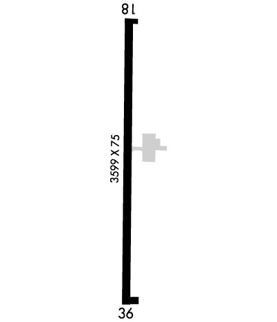
| Lat: N 3424.5 Long: W 08656.0 Elev: 629 Var: +03 Longest Runway: 3599 | ||
| CTAF: 122.8 | ||
| ||||||||||||||||||||||||||||||||||||||||||||
| ||||||||||||||||||||||||||||||||||||||||||||
| Rwy | Rwy | |||||||
| 3599x75 | 3599' | 3599x75 | 3599' | |||||
| Runway ID | Single Wheel | Double Wheel | Double Tandem Wheel | Dual Double Wheel |
| 18/36 | 20,000 | N/A | N/A | N/A |
| These numbers are Advisory and are not limits. The Airport Manager should have more accurate Weight Limits | ||||
 Airport Diagram might not be current. | |
| Facility Name: | HARTSELLE/MORGAN COUNTY RGNL |
| City Name: | HARTSELLE |
| County: | MORGAN |
| State abbrev: | AL |
| State Name: | ALABAMA |
| Ownership: | PUBLICLY OWNED |
| Use: | OPEN TO THE PUBLIC |
| Owner's Name: | CITY OF HARTSELLE |
| Address: | 200 SPARKMAN ST, NW |
| HARTSELLE, AL 35640 | |
| Owner's Phone: | 256-502-1935 |
| Manager's Name: | STONEY POWELL |
| Address: | 450 AIRPORT RD SW |
| HARTSELLE, AL 35640 | |
| Phone: | 256-773-1130; AFT HRS 256-303-2777. |
| FAA Region: | SOUTHERN |
| FAA Field Office: | JAN |
| Date | Sunrise | Sunset |
|---|---|---|
| 06/07/26 Sunday | 5:35 | 19:58 |
| 06/08/26 Monday | 5:35 | 19:59 |
| 06/09/26 Tuesday | 5:35 | 19:59 |
| 06/10/26 Wednesday | 5:35 | 20:00 |
| 06/11/26 Thursday | 5:35 | 20:00 |
| 06/12/26 Friday | 5:35 | 20:00 |
| 06/13/26 Saturday | 5:35 | 20:01 |
| 06/14/26 Sunday | 5:35 | 20:01 |
| 06/15/26 Monday | 5:35 | 20:02 |
| 06/16/26 Tuesday | 5:35 | 20:02 |
| 06/17/26 Wednesday | 5:35 | 20:02 |
| 06/18/26 Thursday | 5:35 | 20:03 |
| 06/19/26 Friday | 5:35 | 20:03 |
| 06/20/26 Saturday | 5:35 | 20:03 |
| Airport Attendance Schedule | 7 Days A Week 0800-1700 |
| Airport Status | OPERATIONAL (This Status can change at any time - please check NOTAMS) |
| Airport Lighting Schedule | ACTVT MIRL RY 18/36 & VASI RY 36 - CTAF. MIRL RY 18/36 PRESET HIGH INTST. |
| Airport Storage Available | Tie Downs, Hanger |
| Extra Services Available | Flight Instruction, Aircraft Rental |
| Wind Indicator | YES - (lighted) |
| Control Tower | NO |
| CTAF Frequency | 122.800 |
| Unicom Frequency | 122.800 |
| Rotating Beacon Color | WG |
| Segmented Circle | YES |
| Landing Fee | NO |
| Airport Inspected | STATE - performed by STATE AERONAUTICAL PERSONNEL |
| Inspection Date | 05/13/2025 |
| Type of Fuel Available | Grade 100LL |
| Airframe Repair Service | MAJOR |
| Power Plant Repair Service | MAJOR |
| Latitude | N3424.5 |
| Longitude | W08656.0 (ESTIMATED) |
| Arpt Elevation | 628ft (SURVEYED) |
| Magnetic Variation | 03W |
| 2 miles S | of HARTSELLE |
| Traffic Pattern Altitude | |
| Sectional Chart | ATLANTA |
| Operations (Reported) | Yearly | Avg. Daily |
|---|---|---|
| General Aviation Transient | 0 | 0 |
| General Aviation Local | 0 | 0 |
| Air Taxi | 0 | 0 |
| Commerical | 0 | 0 |
| Commuter | 0 | 0 |
| Military | 0 | 0 |
| Aircraft based on Field | |
|---|---|
| General Aviation Singles | 0 |
| General Aviation Multi | 0 |
| Jet Aircraft | 0 |
| General Aviation Helicopters | 0 |
| Military Aircraft | 0 |
| Gliders | 0 |
| Ultralights | 0 |
| FSS on field | NO |
| FSS tie-in | ANNISTON |
| FSS Phone | 1-800-WX-BRIEF |
| Who issues Notams | ANB |
| Notam D service at airport | YES |
| ARTCC Name | MEMPHIS |
| Airport Certification | |
| Aircraft Rescue & Firefighting Index | None |
| Airport of Entry | No |
| Custom Landing Rights | No |
| Joint Civil/Military | No |
| Military Landing rights | YES |
| NATIONAL PLAN OF INTEGRATED AIRPORT SYSTEMS (NPIAS) |
| GRANT AGREEMENTS UNDER FAAP/ADAP/AIP |
| ASSURANCES PURSUANT TO TITLE VI, CIVIL RIGHTS ACT OF 1964 |
| FOR CD CTC HUNTSVILLE APCH AT 256-542-2070, WHEN APCH CLSD CTC MEMPHIS ARTCC AT 901-368-8453/8449. |
Airport Communications & Frequencies:
| |||||||||||||||||
| Runway: 18 | Runway: 36 | ||
| Mag heading: | 184° | Mag heading: | 4° |
| Rwy Slope: | -.84% Down | Rwy Slope: | .84% Up |
| Approach: | Approach: | ||
| Pattern: | Left Traffic | Pattern: | Left Traffic |
| Markings: | NONPRECISION INSTRUMENT | Markings: | NONPRECISION INSTRUMENT |
| Marking Condition: | POOR; ALL MKNGS OBSCD OR FADED | Marking Condition: | POOR; ALL MKNGS OBSCD OR FADED |
| Arresting Dev: | Arresting Dev: | ||
| Lat & Long: | N3424.8 W08656.0 | Lat. & Long.: | N3424.2 W08656.0 |
| Elev: | 628.5 ft. MSL | Elev: | 598.3 ft. MSL |
| TCH: | TCH: | 34 ft. AGL | |
| Visual Glide Path: | Visual Glide Path: | 3.00 degrees | |
| Displaced Threshold: | No | Displaced Threshold: | No |
| Touchdown Zone: | YES | Touchdown Zone: | YES |
| Touchdown Elev.: | 628.5 feet | Touchdown Elev.: | 619.7 feet |
| Visual Glide Slope: | Visual Glide Slope: | 2-Box VASI on LEFT side of Runway | |
| RVR Equipment: | RVR Equipment: | ||
| RVV Equipment: | NO | RVV Equipment: | NO |
| Approach Lights: | Approach Lights: | ||
| REIL: | NO | REIL: | NO |
| Centerline Lights: | NO | Centerline Lights: | NO |
| Touchdown lights: | NO | Touchdown lights: | NO |
| Runway Category: | Runway with a Non-precision Approach having visibility minimums greater than 3/4 mile | Runway Category: | Runway with a Non-precision Approach having visibility minimums greater than 3/4 mile |
| Declared Distances: | Declared Distances: | ||
| Obstructions: | TREE | Obstructions: | TREE |
| Marked: | NOT Marked/Lighted | Marked: | NOT Marked/Lighted |
| Clearance slope: | 4:1 | Clearance slope: | 13:1 |
| Obstruction height: | 26 feet AGL | Obstruction height: | 79 feet AGL |
| Dist. from runway: | 312 feet | Dist. from runway: | 1249 feet |
| Centerline offset: | 138 left of centerline | Centerline offset: | 151 feet left of centerline |
| Comments: | Comments: |
Thanks for using FltPlan.com
all rights reserved © 1999-2026 by Flight Plan LLC
