
| TRIBUNE MUNI TRIBUNE KS |
| |
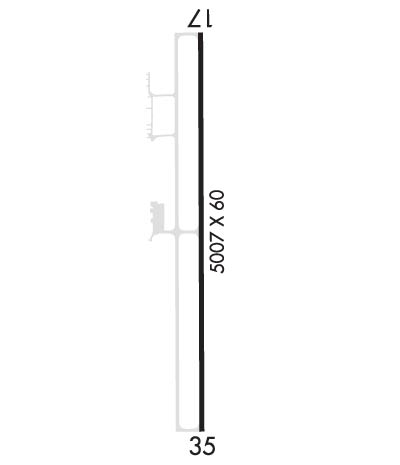
| Lat: N 3827.1 Long: W 10145.0 Elev: 3610 Var: -07 Longest Runway: 5007 | ||
| AWOS: 119.07 CTAF: 122.8 | ||
| ||||||||||||||||||||||||||||||||||||||||||||
| ||||||||||||||||||||||||||||||||||||||||||||
| ||||||||||||||||||||||||||||||||||||||||||||
| Rwy | Rwy | |||||||
| 5007x60 | 5007' | 5007x60 | 5007' | |||||
| Runway ID | Single Wheel | Double Wheel | Double Tandem Wheel | Dual Double Wheel |
| 17/35 | 30,000 | N/A | N/A | N/A |
| These numbers are Advisory and are not limits. The Airport Manager should have more accurate Weight Limits | ||||
 Airport Diagram might not be current. | |
| Facility Name: | TRIBUNE MUNI |
| City Name: | TRIBUNE |
| County: | GREELEY |
| State abbrev: | KS |
| State Name: | KANSAS |
| Ownership: | PUBLICLY OWNED |
| Use: | OPEN TO THE PUBLIC |
| Owner's Name: | CITY AND COUNTY |
| Address: | BOX 277 |
| TRIBUNE, KS 67879-0277 | |
| Owner's Phone: | 620-376-4256 |
| Manager's Name: | STEPHANIE REICHERT |
| Address: | 508 BROADWAY, PO BOX 577 |
| TRIBUNE, KS 67879 | |
| Phone: | 620-376-4278; 620-376-8367 FOR REFUELING. |
| FAA Region: | CENTRAL |
| FAA Field Office: | NONE |
| Date | Sunrise | Sunset |
|---|---|---|
| 06/08/26 Monday | 5:23 | 20:09 |
| 06/09/26 Tuesday | 5:23 | 20:10 |
| 06/10/26 Wednesday | 5:23 | 20:10 |
| 06/11/26 Thursday | 5:22 | 20:11 |
| 06/12/26 Friday | 5:22 | 20:11 |
| 06/13/26 Saturday | 5:22 | 20:12 |
| 06/14/26 Sunday | 5:22 | 20:12 |
| 06/15/26 Monday | 5:22 | 20:13 |
| 06/16/26 Tuesday | 5:22 | 20:13 |
| 06/17/26 Wednesday | 5:23 | 20:13 |
| 06/18/26 Thursday | 5:23 | 20:14 |
| 06/19/26 Friday | 5:23 | 20:14 |
| 06/20/26 Saturday | 5:23 | 20:14 |
| 06/21/26 Sunday | 5:23 | 20:14 |
| Airport Attendance Schedule | UNATTENDED |
| Airport Status | OPERATIONAL (This Status can change at any time - please check NOTAMS) |
| Airport Lighting Schedule | ACTVT MIRLS RWY 17/35, & PAPI RWY 35 - CTAF |
| Airport Storage Available | Tie Downs |
| Extra Services Available | Crop Dusting |
| Wind Indicator | YES - (lighted) |
| Control Tower | NO |
| CTAF Frequency | 122.800 |
| Unicom Frequency | 122.800 |
| Rotating Beacon Color | WG |
| Segmented Circle | NO |
| Landing Fee | NO |
| Airport Inspected | STATE - performed by PRIVATE CONTRACT PERSONNEL |
| Inspection Date | 09/26/2024 |
| Type of Fuel Available | Grade 100LL; -10FOR FUEL CALL 620-376-4299. |
| Airframe Repair Service | None |
| Power Plant Repair Service | None |
| Latitude | N3827.1 |
| Longitude | W10145.0 (ESTIMATED) |
| Arpt Elevation | 3609ft (SURVEYED) |
| Magnetic Variation | 07E |
| 1 miles S | of TRIBUNE |
| Traffic Pattern Altitude | |
| Sectional Chart | WICHITA |
| Operations (Reported) | Yearly | Avg. Daily |
|---|---|---|
| General Aviation Transient | 0 | 0 |
| General Aviation Local | 0 | 0 |
| Air Taxi | 0 | 0 |
| Commerical | 0 | 0 |
| Commuter | 0 | 0 |
| Military | 0 | 0 |
| Aircraft based on Field | |
|---|---|
| General Aviation Singles | 0 |
| General Aviation Multi | 0 |
| Jet Aircraft | 0 |
| General Aviation Helicopters | 0 |
| Military Aircraft | 0 |
| Gliders | 0 |
| Ultralights | 0 |
| FSS on field | NO |
| FSS tie-in | WICHITA |
| FSS Phone | 1-800-WX-BRIEF |
| Who issues Notams | ICT |
| Notam D service at airport | YES |
| ARTCC Name | DENVER |
| Airport Certification | |
| Aircraft Rescue & Firefighting Index | None |
| Airport of Entry | No |
| Custom Landing Rights | No |
| Joint Civil/Military | No |
| Military Landing rights | No |
| NATIONAL PLAN OF INTEGRATED AIRPORT SYSTEMS (NPIAS) |
| PUB TELEPHONE AVBL 24 HRS 620-376-2285. |
| FOR CD CTC DENVER ARTCC AT 303-651-4257. |
| (CONTACT TITLE) ADDRESS QUESTIONS TO: PO BOX 577 508 BROADWAY TRIBUNE, KS 67879 CITYOFTRIBUNE@WBSNET.ORG |
Airport Communications & Frequencies:
| |||||||||
| Runway: 17 | Runway: 35 | ||
| Mag heading: | 173° | Mag heading: | 353° |
| Rwy Slope: | .12% Up | Rwy Slope: | -.12% Down |
| Approach: | Approach: | ||
| Pattern: | Left Traffic | Pattern: | Left Traffic |
| Markings: | NONPRECISION INSTRUMENT | Markings: | NONPRECISION INSTRUMENT |
| Marking Condition: | GOOD | Marking Condition: | GOOD |
| Arresting Dev: | Arresting Dev: | ||
| Lat & Long: | N3827.5 W10145.0 | Lat. & Long.: | N3826.7 W10145.0 |
| Elev: | 3603.7 ft. MSL | Elev: | 3609.9 ft. MSL |
| TCH: | TCH: | 43 ft. AGL | |
| Visual Glide Path: | Visual Glide Path: | 3.00 degrees | |
| Displaced Threshold: | No | Displaced Threshold: | No |
| Touchdown Zone: | YES | Touchdown Zone: | YES |
| Touchdown Elev.: | 3606.3 feet | Touchdown Elev.: | 3609.9 feet |
| Visual Glide Slope: | Visual Glide Slope: | 2-Light PAPI on LEFT side of Runway | |
| RVR Equipment: | RVR Equipment: | ||
| RVV Equipment: | NO | RVV Equipment: | NO |
| Approach Lights: | Approach Lights: | ||
| REIL: | NO | REIL: | NO |
| Centerline Lights: | NO | Centerline Lights: | NO |
| Touchdown lights: | NO | Touchdown lights: | NO |
| Runway Category: | Runway with a Non-precision Approach having visibility minimums greater than 3/4 mile | Runway Category: | Runway with a Non-precision Approach having visibility minimums greater than 3/4 mile |
| Declared Distances: | Declared Distances: | ||
| Obstructions: | ROAD | Obstructions: | PLINE |
| Marked: | NOT Marked/Lighted | Marked: | MARKED |
| Clearance slope: | 32:1 | Clearance slope: | 47:1 |
| Obstruction height: | 10 feet AGL | Obstruction height: | 55 feet AGL |
| Dist. from runway: | 522 feet | Dist. from runway: | 2835 feet |
| Centerline offset: | 300B | Centerline offset: | 650 feet right of centerline |
| Comments: | Comments: |
Thanks for using FltPlan.com
all rights reserved © 1999-2026 by Flight Plan LLC
