
| WYANDOT COUNTY UPPER SANDUSKY OH |
| |
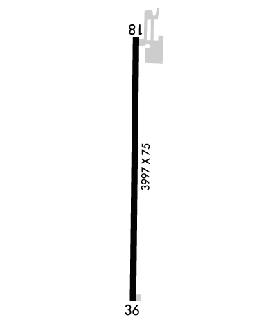
| Lat: N 4053.0 Long: W 08318.9 Elev: 830 Var: +05 Longest Runway: 3997 | ||
| CTAF: 123.05 | ||
| ||||||||||||||||||||||||||||||||
| ||||||||||||||||||||||||||||||||
| Rwy | Rwy | |||||||
| 3997x75 | 3997' | 3997x75 | 3997' | |||||
| Runway ID | Single Wheel | Double Wheel | Double Tandem Wheel | Dual Double Wheel |
| 18/36 | 12,500 | N/A | N/A | N/A |
| These numbers are Advisory and are not limits. The Airport Manager should have more accurate Weight Limits | ||||
 Airport Diagram might not be current. | |
| Facility Name: | WYANDOT COUNTY |
| City Name: | UPPER SANDUSKY |
| County: | WYANDOT |
| State abbrev: | OH |
| State Name: | OHIO |
| Ownership: | PUBLICLY OWNED |
| Use: | OPEN TO THE PUBLIC |
| Owner's Name: | COUNTY AIRPORT AUTHORITY |
| Address: | 109 S SANDUSKY AVE |
| UPPER SANDUSKY, OH 43351 | |
| Owner's Phone: | |
| Manager's Name: | MITCHEL GRENWALT; MGRENWALT@SCHMIDTMACHINE.COM. |
| Address: | 10841 COUNTY HIGHWAY 42 |
| UPPER SANDUSKY, OH 43351-9139 | |
| Phone: | 419-294-8766; OR 419-294-3814. |
| FAA Region: | GREAT LAKES |
| FAA Field Office: | DET |
| Date | Sunrise | Sunset |
|---|---|---|
| 09/24/21 Friday | 7:22 | 19:27 |
| 09/25/21 Saturday | 7:23 | 19:26 |
| 09/26/21 Sunday | 7:24 | 19:24 |
| 09/27/21 Monday | 7:25 | 19:22 |
| 09/28/21 Tuesday | 7:27 | 19:21 |
| 09/29/21 Wednesday | 7:28 | 19:19 |
| 09/30/21 Thursday | 7:29 | 19:17 |
| 10/01/21 Friday | 7:30 | 19:16 |
| 10/02/21 Saturday | 7:31 | 19:14 |
| 10/03/21 Sunday | 7:32 | 19:12 |
| 10/04/21 Monday | 7:33 | 19:11 |
| 10/05/21 Tuesday | 7:34 | 19:09 |
| 10/06/21 Wednesday | 7:35 | 19:07 |
| 10/07/21 Thursday | 7:36 | 19:06 |
| Airport Attendance Schedule | UNATTENDED |
| Airport Status | OPERATIONAL (This Status can change at any time - please check NOTAMS) |
| Airport Lighting Schedule | ACTVT LIRL RWY 18/36 - CTAF.; ACTVT ABN - CTAF. |
| Airport Storage Available | Tie Downs |
| Extra Services Available | NONE |
| Wind Indicator | YES - (lighted) |
| Control Tower | NO |
| CTAF Frequency | 123.050 |
| Unicom Frequency | 123.050 |
| Rotating Beacon Color | CLEAR-GREEN (Light Land Airport) |
| Segmented Circle | NO |
| Landing Fee | NO |
| Airport Inspected | STATE - performed by STATE AERONAUTICAL PERSONNEL |
| Inspection Date | 09/08/2020 |
| Type of Fuel Available | None |
| Airframe Repair Service | None |
| Power Plant Repair Service | None |
| Latitude | N4053.0 |
| Longitude | W08318.9 (ESTIMATED) |
| Arpt Elevation | 829ft (ESTIMATED) |
| Magnetic Variation | 05W |
| 4 miles NW | of UPPER SANDUSKY |
| Traffic Pattern Altitude | |
| Sectional Chart | DETROIT |
| Operations (Reported) | Yearly | Avg. Daily |
|---|---|---|
| General Aviation Transient | 1800 | 5 |
| General Aviation Local | 5100 | 14 |
| Air Taxi | 100 | 0 |
| Commerical | 0 | 0 |
| Commuter | 0 | 0 |
| Military | 0 | 0 |
| Aircraft based on Field | |
|---|---|
| General Aviation Singles | 12 |
| General Aviation Multi | 0 |
| Jet Aircraft | 0 |
| General Aviation Helicopters | 0 |
| Military Aircraft | 0 |
| Gliders | 0 |
| Ultralights | 0 |
| FSS on field | NO |
| FSS tie-in | CLEVELAND |
| FSS Phone | 1-800-WX-BRIEF |
| Who issues Notams | CLE |
| Notam D service at airport | YES |
| ARTCC Name | CLEVELAND |
| Airport Certification | |
| Aircraft Rescue & Firefighting Index | None |
| Airport of Entry | No |
| Custom Landing Rights | No |
| Joint Civil/Military | No |
| Military Landing rights | No |
| NATIONAL PLAN OF INTEGRATED AIRPORT SYSTEMS (NPIAS) |
| THIS AIRPORT HAS BEEN SURVEYED BY THE NATIONAL GEODETIC SURVEY. |
| RWY 36 RP DUE TO +205 FT LGTD BLDG W OF ARPT. |
| DEER, BIRDS, & OTR WILDLIFE ON & INVOF ARPT; BIRD ACT AT LANDFILL 1.5 NM NNW OF ARPT. |
| FOR CD CTC CLEVELAND APCH AT 216-352-2323, WHEN APCH CLSD CTC CLEVELAND ARTCC AT 440-774-0222. |
| RWY 18 CALM WIND RWY. |
| RWY 18 1 NSTD BASIC DUE TO THR MKGS. |
| RWY 36 1 NSTD BASIC DUE TO THR MKGS. |
Airport Communications & Frequencies:
| |||||||||||||||||
| Runway: 18 | Runway: 36 | ||
| Mag heading: | 185° | Mag heading: | 5° |
| Rwy Slope: | .11% Up | Rwy Slope: | -.11% Down |
| Approach: | Approach: | ||
| Pattern: | Left Traffic | Pattern: | Right Traffic |
| Markings: | NONSTANDARD | Markings: | NONSTANDARD |
| Marking Condition: | POOR; FADED. | Marking Condition: | POOR; FADED. |
| Arresting Dev: | Arresting Dev: | ||
| Lat & Long: | N4053.3 W08318.9 | Lat. & Long.: | N4052.7 W08318.9 |
| Elev: | 824.0 ft. MSL | Elev: | 828.4 ft. MSL |
| TCH: | TCH: | ||
| Visual Glide Path: | Visual Glide Path: | ||
| Displaced Threshold: | No | Displaced Threshold: | No |
| Touchdown Zone: | YES | Touchdown Zone: | YES |
| Touchdown Elev.: | 829.8 feet | Touchdown Elev.: | 829.8 feet |
| Visual Glide Slope: | Visual Glide Slope: | ||
| RVR Equipment: | RVR Equipment: | ||
| RVV Equipment: | NO | RVV Equipment: | NO |
| Approach Lights: | Approach Lights: | ||
| REIL: | NO | REIL: | NO |
| Centerline Lights: | NO | Centerline Lights: | NO |
| Touchdown lights: | NO | Touchdown lights: | NO |
| Runway Category: | Runway with a Visual Approach | Runway Category: | Runway with a Visual Approach |
| Declared Distances: | Declared Distances: | ||
| Obstructions: | TREE | Obstructions: | BRUSH |
| Marked: | NOT Marked/Lighted | Marked: | NOT Marked/Lighted |
| Clearance slope: | 13:1 | Clearance slope: | 6:1 |
| Obstruction height: | 55 feet AGL | Obstruction height: | 11 feet AGL |
| Dist. from runway: | 940 feet | Dist. from runway: | 270 feet |
| Centerline offset: | 167 right of centerline | Centerline offset: | 126 feet left of centerline |
| Comments: | Comments: | OBST CLNC SLP 0:1 DUE TO +5-10 FT BRUSH, 0-200 FT DIST, 120 FT L; +1-7 FT BRUSH, 0-200 FT DIST, 92 FT R. |
Thanks for using FltPlan.com
all rights reserved © 1999-2021 by Flight Plan LLC
