
| LAKES OF THE NORTH GAYLORD MI |
| |
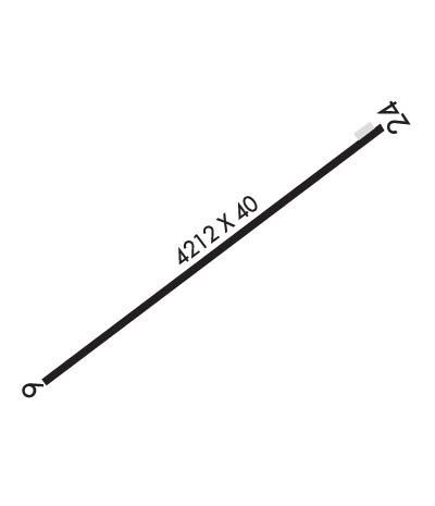
| Lat: N 4454.7 Long: W 08452.5 Elev: 1287 Var: +05 Longest Runway: 4212 | ||
| CTAF: 122.9 | ||
| ||||||||||||||||||||||||||||||||
| ||||||||||||||||||||||||||||||||
| Rwy | Rwy | |||||||
| 4212x40 | 4212' | 4212x40 | 4212' | |||||
| Runway ID | Single Wheel | Double Wheel | Double Tandem Wheel | Dual Double Wheel |
| 06/24 | N/A | N/A | N/A | N/A |
| These numbers are Advisory and are not limits. The Airport Manager should have more accurate Weight Limits | ||||
| FltPlan does not have IFR approach charts available for K4Y4. |
 Airport Diagram might not be current. | |
| Facility Name: | LAKES OF THE NORTH |
| City Name: | GAYLORD |
| County: | ANTRIM |
| State abbrev: | MI |
| State Name: | MICHIGAN |
| Ownership: | PRIVATELY OWNED |
| Use: | OPEN TO THE PUBLIC |
| Owner's Name: | LAKES OF THE NORTH ASSN |
| Address: | 5950 SKYTRAILS CT |
| MANCELONA, MI 49659-9174 | |
| Owner's Phone: | 231-585-6000 |
| Manager's Name: | DARYN HOOGERHYDE |
| Address: | 5950 SKYTRAILS CT |
| MANCELONA, MI 49659-9174 | |
| Phone: | 231-585-6000 |
| FAA Region: | GREAT LAKES |
| FAA Field Office: | DET |
| Date | Sunrise | Sunset |
|---|---|---|
| 06/08/26 Monday | 5:53 | 21:24 |
| 06/09/26 Tuesday | 5:53 | 21:24 |
| 06/10/26 Wednesday | 5:53 | 21:25 |
| 06/11/26 Thursday | 5:53 | 21:26 |
| 06/12/26 Friday | 5:53 | 21:26 |
| 06/13/26 Saturday | 5:53 | 21:27 |
| 06/14/26 Sunday | 5:52 | 21:27 |
| 06/15/26 Monday | 5:52 | 21:28 |
| 06/16/26 Tuesday | 5:52 | 21:28 |
| 06/17/26 Wednesday | 5:52 | 21:28 |
| 06/18/26 Thursday | 5:53 | 21:29 |
| 06/19/26 Friday | 5:53 | 21:29 |
| 06/20/26 Saturday | 5:53 | 21:29 |
| 06/21/26 Sunday | 5:53 | 21:29 |
| Airport Attendance Schedule | MON-FRI 0900-1700, SAT 0900-1300 |
| Airport Status | OPERATIONAL (This Status can change at any time - please check NOTAMS) |
| Airport Lighting Schedule | ACTVT LIRL RWY 06/24 - CTAF. |
| Airport Storage Available | Tie Downs |
| Extra Services Available | NONE |
| Wind Indicator | YES - (lighted) |
| Control Tower | NO |
| CTAF Frequency | 122.900 |
| Unicom Frequency | |
| Rotating Beacon Color | WG |
| Segmented Circle | NO |
| Landing Fee | NO |
| Airport Inspected | STATE - performed by STATE AERONAUTICAL PERSONNEL |
| Inspection Date | 09/08/2025 |
| Type of Fuel Available | None |
| Airframe Repair Service | NONE |
| Power Plant Repair Service | NONE |
| Latitude | N4454.7 |
| Longitude | W08452.5 (ESTIMATED) |
| Arpt Elevation | 1287ft (SURVEYED) |
| Magnetic Variation | 05W |
| 11 miles SW | of GAYLORD |
| Traffic Pattern Altitude | |
| Sectional Chart | LAKE HURON |
| Operations (Reported) | Yearly | Avg. Daily |
|---|---|---|
| General Aviation Transient | 0 | 0 |
| General Aviation Local | 0 | 0 |
| Air Taxi | 0 | 0 |
| Commerical | 0 | 0 |
| Commuter | 0 | 0 |
| Military | 0 | 0 |
| Aircraft based on Field | |
|---|---|
| General Aviation Singles | 0 |
| General Aviation Multi | 0 |
| Jet Aircraft | 0 |
| General Aviation Helicopters | 0 |
| Military Aircraft | 0 |
| Gliders | 0 |
| Ultralights | 0 |
| FSS on field | NO |
| FSS tie-in | LANSING |
| FSS Phone | 1-800-WX-BRIEF |
| Who issues Notams | LAN |
| Notam D service at airport | YES |
| ARTCC Name | MINNEAPOLIS |
| Airport Certification | |
| Aircraft Rescue & Firefighting Index | None |
| Airport of Entry | No |
| Custom Landing Rights | No |
| Joint Civil/Military | No |
| Military Landing rights | No |
| DEER & LRG BIRDS ON & INVOF ARPT. |
| RWY UPSLOPE FM EAST TO WEST, APRXLY 20 FT HYR ON WEST END. |
| GOLF CRS & RESTAURANT ADJ. |
| UAS OPS INVOF ARPT. |
| FOR CD CTC MINNEAPOLIS ARTCC AT 651-463-5588. |
| Runway: 06 | Runway: 24 | ||
| Mag heading: | 56° | Mag heading: | 236° |
| Rwy Slope: | -.24% Down | Rwy Slope: | .24% Up |
| Approach: | Approach: | ||
| Pattern: | Left Traffic | Pattern: | Left Traffic |
| Markings: | BASIC | Markings: | BASIC |
| Marking Condition: | GOOD | Marking Condition: | GOOD |
| Arresting Dev: | Arresting Dev: | ||
| Lat & Long: | N4454.5 W08452.9 | Lat. & Long.: | N4454.9 W08452.1 |
| Elev: | 1285.8 ft. MSL | Elev: | 1275.5 ft. MSL |
| TCH: | TCH: | ||
| Visual Glide Path: | Visual Glide Path: | ||
| Displaced Threshold: | No | Displaced Threshold: | No |
| Touchdown Zone: | NO | Touchdown Zone: | NO |
| Touchdown Elev.: | Touchdown Elev.: | ||
| Visual Glide Slope: | Visual Glide Slope: | ||
| RVR Equipment: | RVR Equipment: | ||
| RVV Equipment: | NO | RVV Equipment: | NO |
| Approach Lights: | Approach Lights: | ||
| REIL: | NO | REIL: | NO |
| Centerline Lights: | NO | Centerline Lights: | NO |
| Touchdown lights: | NO | Touchdown lights: | NO |
| Runway Category: | Runway with a Visual Approach | Runway Category: | Runway with a Visual Approach |
| Declared Distances: | Declared Distances: | ||
| Obstructions: | ROAD | Obstructions: | FENCE |
| Marked: | NOT Marked/Lighted | Marked: | NOT Marked/Lighted |
| Clearance slope: | 6:1 | Clearance slope: | 1:1 |
| Obstruction height: | 4 feet AGL | Obstruction height: | 4 feet AGL |
| Dist. from runway: | 224 feet | Dist. from runway: | 201 feet |
| Centerline offset: | 125 right of centerline | Centerline offset: | 123 feet left of centerline |
| Comments: | Comments: |
Thanks for using FltPlan.com
all rights reserved © 1999-2026 by Flight Plan LLC
