
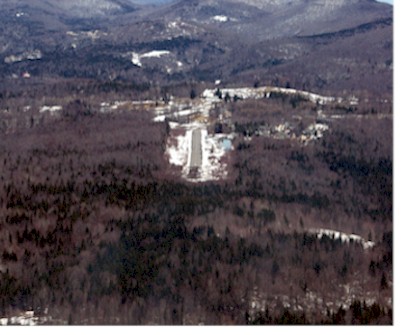
| MOUNT SNOW WEST DOVER VT |
| |
| Lat: N 4255.6 Long: W 07251.9 Elev: 1953 Var: +15 Longest Runway: 2650 | ||
| CTAF: 122.8 | ||
| ||||||||||||||||||||||||||||||||
| ||||||||||||||||||||||||||||||||
| Rwy | Rwy | |||||||
| 2650x75 | 2650' | 2650x75 | 2650' | |||||
| Runway ID | Single Wheel | Double Wheel | Double Tandem Wheel | Dual Double Wheel |
| 01/19 | N/A | N/A | N/A | N/A |
| These numbers are Advisory and are not limits. The Airport Manager should have more accurate Weight Limits | ||||
 Airport Diagram might not be current. | |
| Facility Name: | DEERFIELD VALLEY RGNL |
| City Name: | WEST DOVER |
| County: | WINDHAM |
| State abbrev: | VT |
| State Name: | VERMONT |
| Ownership: | PRIVATELY OWNED |
| Use: | OPEN TO THE PUBLIC |
| Owner's Name: | DEERFIELD VALLEY REG AIRPORT, LLC |
| Address: | HERMITAGE REALTY ESTATE HOLDING CO., 25 HANDLE ROAD |
| WEST DOVER, VT 05356 | |
| Owner's Phone: | (802) 490-0775 |
| Manager's Name: | JIM BARNES |
| Address: | P.O. BOX 2210, 69 AIRPORT ROAD |
| WEST DOVER, VT 05356 | |
| Phone: | (802) 490-0775; GTOOLE@GMAIL.COM |
| FAA Region: | NEW ENGLAND |
| FAA Field Office: | NONE |
| Date | Sunrise | Sunset |
|---|---|---|
| 09/24/21 Friday | 6:41 | 18:46 |
| 09/25/21 Saturday | 6:42 | 18:44 |
| 09/26/21 Sunday | 6:43 | 18:42 |
| 09/27/21 Monday | 6:44 | 18:40 |
| 09/28/21 Tuesday | 6:45 | 18:39 |
| 09/29/21 Wednesday | 6:46 | 18:37 |
| 09/30/21 Thursday | 6:47 | 18:35 |
| 10/01/21 Friday | 6:48 | 18:33 |
| 10/02/21 Saturday | 6:50 | 18:31 |
| 10/03/21 Sunday | 6:51 | 18:30 |
| 10/04/21 Monday | 6:52 | 18:28 |
| 10/05/21 Tuesday | 6:53 | 18:26 |
| 10/06/21 Wednesday | 6:54 | 18:24 |
| 10/07/21 Thursday | 6:55 | 18:23 |
| Airport Attendance Schedule | UNATTND |
| Airport Status | OPERATIONAL (This Status can change at any time - please check NOTAMS) |
| Airport Lighting Schedule | SS-SR |
| Airport Storage Available | Tie Downs, Hanger |
| Extra Services Available | NONE |
| Wind Indicator | YES - (lighted) |
| Control Tower | NO |
| CTAF Frequency | 122.800 |
| Unicom Frequency | 122.800 |
| Rotating Beacon Color | |
| Segmented Circle | NO |
| Landing Fee | YES |
| Airport Inspected | STATE - performed by STATE AERONAUTICAL PERSONNEL |
| Inspection Date | 09/15/2015 |
| Type of Fuel Available | None |
| Airframe Repair Service | None |
| Power Plant Repair Service | None |
| Latitude | N4255.6 |
| Longitude | W07251.9 (ESTIMATED) |
| Arpt Elevation | 1953ft (SURVEYED) |
| Magnetic Variation | 15W |
| 1 miles SW | of WEST DOVER |
| Traffic Pattern Altitude | |
| Sectional Chart | NEW YORK |
| Operations (Reported) | Yearly | Avg. Daily |
|---|---|---|
| General Aviation Transient | 1300 | 4 |
| General Aviation Local | 1800 | 5 |
| Air Taxi | 0 | 0 |
| Commerical | 0 | 0 |
| Commuter | 0 | 0 |
| Military | 0 | 0 |
| Aircraft based on Field | |
|---|---|
| General Aviation Singles | 5 |
| General Aviation Multi | 2 |
| Jet Aircraft | 0 |
| General Aviation Helicopters | 0 |
| Military Aircraft | 0 |
| Gliders | 0 |
| Ultralights | 0 |
| FSS on field | NO |
| FSS tie-in | BURLINGTON |
| FSS Phone | 1-800-WX-BRIEF |
| Who issues Notams | BTV |
| Notam D service at airport | YES |
| ARTCC Name | BOSTON |
| Airport Certification | |
| Aircraft Rescue & Firefighting Index | None |
| Airport of Entry | No |
| Custom Landing Rights | No |
| Joint Civil/Military | No |
| Military Landing rights | No |
| THIS AIRPORT HAS BEEN SURVEYED BY THE NATIONAL GEODETIC SURVEY. |
| FOR CD CTC BOSTON ARTCC AT 603-879-6859. |
| RWY 01/1 9 NSTD ALNMT. |
Airport Communications & Frequencies:
| |||||||||
| Runway: 01 | Runway: 19 | ||
| Mag heading: | 5° | Mag heading: | 185° |
| Rwy Slope: | .08% Up | Rwy Slope: | -.08% Down |
| Approach: | Approach: | ||
| Pattern: | Left Traffic | Pattern: | Left Traffic |
| Markings: | NONPRECISION INSTRUMENT | Markings: | BASIC |
| Marking Condition: | GOOD | Marking Condition: | GOOD |
| Arresting Dev: | Arresting Dev: | ||
| Lat & Long: | N4255.4 W07251.9 | Lat. & Long.: | N4255.8 W07252.0 |
| Elev: | 1948.0 ft. MSL | Elev: | 1950.0 ft. MSL |
| TCH: | TCH: | ||
| Visual Glide Path: | Visual Glide Path: | ||
| Displaced Threshold: | No | Displaced Threshold: | No |
| Touchdown Zone: | YES | Touchdown Zone: | NO |
| Touchdown Elev.: | 1953.0 feet | Touchdown Elev.: | |
| Visual Glide Slope: | Visual Glide Slope: | ||
| RVR Equipment: | RVR Equipment: | ||
| RVV Equipment: | NO | RVV Equipment: | NO |
| Approach Lights: | Approach Lights: | ||
| REIL: | NO | REIL: | NO |
| Centerline Lights: | NO | Centerline Lights: | NO |
| Touchdown lights: | NO | Touchdown lights: | NO |
| Runway Category: | Runway with a Non-precision Approach | Runway Category: | Runway with a Visual Approach |
| Declared Distances: | Declared Distances: | ||
| Obstructions: | TREES | Obstructions: | TREES |
| Marked: | NOT Marked/Lighted | Marked: | NOT Marked/Lighted |
| Clearance slope: | 7:1 | Clearance slope: | 25:1 |
| Obstruction height: | 61 feet AGL | Obstruction height: | 29 feet AGL |
| Dist. from runway: | 662 feet | Dist. from runway: | 945 feet |
| Centerline offset: | 54 right of centerline | Centerline offset: | 160 feet left of centerline |
| Comments: | Comments: |
Thanks for using FltPlan.com
all rights reserved © 1999-2021 by Flight Plan LLC