
| RANGELY RANGELY CO |
| |
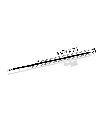
| Lat: N 4005.6 Long: W 10845.8 Elev: 5278 Var: -10 Longest Runway: 6409 | ||
| AWOS: 119.02 CTAF: 122.8 | ||
| ||||||||||||||||||||||||||||||||||||||||||||
| ||||||||||||||||||||||||||||||||||||||||||||
| ||||||||||||||||||||||||||||||||||||||||||||
| Rwy | Rwy | |||||||
| 6409x75 | 6409' | 6409x75 | 6409' | |||||
| Runway ID | Single Wheel | Double Wheel | Double Tandem Wheel | Dual Double Wheel |
| 07/25 | 28,000 | 28,000 | N/A | N/A |
| These numbers are Advisory and are not limits. The Airport Manager should have more accurate Weight Limits | ||||
 Airport Diagram might not be current. | |
| Facility Name: | RANGELY |
| City Name: | RANGELY |
| County: | RIO BLANCO |
| State abbrev: | CO |
| State Name: | COLORADO |
| Ownership: | PUBLICLY OWNED |
| Use: | OPEN TO THE PUBLIC |
| Owner's Name: | RIO BLANCO COUNTY |
| Address: | CO COURTHOUSE PO BOX 599 |
| MEEKER, CO 81641 | |
| Owner's Phone: | 970-878-4001 |
| Manager's Name: | ZACHARY GUTHRIE |
| Address: | 2248 E MAIN |
| RANGELY, CO 81648 | |
| Phone: | 970-549-7709 |
| FAA Region: | NORTHWEST MOUNTAIN |
| FAA Field Office: | DEN |
| Date | Sunrise | Sunset |
|---|---|---|
| 06/07/26 Sunday | 5:46 | 20:42 |
| 06/08/26 Monday | 5:46 | 20:42 |
| 06/09/26 Tuesday | 5:46 | 20:43 |
| 06/10/26 Wednesday | 5:46 | 20:44 |
| 06/11/26 Thursday | 5:45 | 20:44 |
| 06/12/26 Friday | 5:45 | 20:45 |
| 06/13/26 Saturday | 5:45 | 20:45 |
| 06/14/26 Sunday | 5:45 | 20:45 |
| 06/15/26 Monday | 5:45 | 20:46 |
| 06/16/26 Tuesday | 5:45 | 20:46 |
| 06/17/26 Wednesday | 5:45 | 20:47 |
| 06/18/26 Thursday | 5:45 | 20:47 |
| 06/19/26 Friday | 5:46 | 20:47 |
| 06/20/26 Saturday | 5:46 | 20:47 |
| Airport Attendance Schedule | 7 Days A Week 0800-1700; FOR SERVCIE CALL 970-675-2316 |
| Airport Status | OPERATIONAL (This Status can change at any time - please check NOTAMS) |
| Airport Lighting Schedule | ACTVT REIL RWY 07 & 25; MIRL RWY 07/25 - CTAF. PAPI RWY 07 OPER 24 HRS. |
| Airport Storage Available | Tie Downs |
| Extra Services Available | Flight Instruction |
| Wind Indicator | YES - (lighted) |
| Control Tower | NO |
| CTAF Frequency | 122.800 |
| Unicom Frequency | 122.800; AUTOMATED UNICOM. |
| Rotating Beacon Color | WG |
| Segmented Circle | YES |
| Landing Fee | NO |
| Airport Inspected | STATE - performed by STATE AERONAUTICAL PERSONNEL |
| Inspection Date | 06/16/2025 |
| Type of Fuel Available | Grade 100LL; -10SELF SVC FUEL AVBL WITH CREDIT CARD. |
| Airframe Repair Service | NONE; MINOR EMERGENCY SERVICES UPON REQUEST. |
| Power Plant Repair Service | NONE |
| Latitude | N4005.6 |
| Longitude | W10845.8 (ESTIMATED) |
| Arpt Elevation | 5278ft (SURVEYED) |
| Magnetic Variation | 10E |
| 2 miles E | of RANGELY |
| Traffic Pattern Altitude | |
| Sectional Chart | CHEYENNE |
| Operations (Reported) | Yearly | Avg. Daily |
|---|---|---|
| General Aviation Transient | 0 | 0 |
| General Aviation Local | 0 | 0 |
| Air Taxi | 0 | 0 |
| Commerical | 0 | 0 |
| Commuter | 0 | 0 |
| Military | 0 | 0 |
| Aircraft based on Field | |
|---|---|
| General Aviation Singles | 0 |
| General Aviation Multi | 0 |
| Jet Aircraft | 0 |
| General Aviation Helicopters | 0 |
| Military Aircraft | 0 |
| Gliders | 0 |
| Ultralights | 0 |
| FSS on field | NO |
| FSS tie-in | DENVER |
| FSS Phone | 1-800-WX-BRIEF |
| Who issues Notams | DEN |
| Notam D service at airport | YES |
| ARTCC Name | DENVER |
| Airport Certification | |
| Aircraft Rescue & Firefighting Index | None |
| Airport of Entry | No |
| Custom Landing Rights | No |
| Joint Civil/Military | No |
| Military Landing rights | YES |
| NATIONAL PLAN OF INTEGRATED AIRPORT SYSTEMS (NPIAS) |
| GRANT AGREEMENTS UNDER FAAP/ADAP/AIP |
| ASSURANCES PURSUANT TO TITLE VI, CIVIL RIGHTS ACT OF 1964 |
| THREE FLASHING HAZ BCNS OUTLINE OBSTN HILLS E. |
| COLD TEMPERATURE AIRPORT. ALTITUDE CORRECTION REQUIRED AT OR BELOW -17C. |
| NMRS PRAIRIE DOG HOLES ON AND INVOF RWY SAFETY AREAS. |
| DEER PERIODICALLY ON & INVOF ARPT. |
| TWY MARKED WITH BLUE REFLECTORS. |
| RWY 07/25 SHOULDERS SOFT WHEN WET. |
| RWY 07 HAS 8 FT FENCE LINE 520 FT FM THLD OB, 66 FT TREES 2500 FT FM THLD 600 FT LEFT OF CNTRLN. |
| RWY 25 HAS 10 FT FENCE LINE 615 FT FM THLD OB. |
| FOR CD IF UNA TO CTC ON FSS FREQ, CTC DENVER ARTCC AT 303-651-4257. |
Airport Communications & Frequencies:
| |||||||||
| Runway: 07 | Runway: 25 | ||
| Mag heading: | 67° | Mag heading: | 247° |
| Rwy Slope: | .63% Up | Rwy Slope: | -.63% Down |
| Approach: | Approach: | ||
| Pattern: | Right Traffic | Pattern: | Left Traffic |
| Markings: | NONPRECISION INSTRUMENT | Markings: | NONPRECISION INSTRUMENT |
| Marking Condition: | FAIR | Marking Condition: | FAIR |
| Arresting Dev: | Arresting Dev: | ||
| Lat & Long: | N4005.5 W10846.5 | Lat. & Long.: | N4005.8 W10845.1 |
| Elev: | 5237.4 ft. MSL | Elev: | 5277.8 ft. MSL |
| TCH: | 40 ft. AGL | TCH: | |
| Visual Glide Path: | 3.00 degrees | Visual Glide Path: | |
| Displaced Threshold: | No | Displaced Threshold: | No |
| Touchdown Zone: | YES | Touchdown Zone: | YES |
| Touchdown Elev.: | 5249.2 feet | Touchdown Elev.: | 5278.0 feet |
| Visual Glide Slope: | 2-Light PAPI on LEFT side of Runway | Visual Glide Slope: | |
| RVR Equipment: | RVR Equipment: | ||
| RVV Equipment: | NO | RVV Equipment: | NO |
| Approach Lights: | Approach Lights: | ||
| REIL: | YES | REIL: | YES |
| Centerline Lights: | NO | Centerline Lights: | NO |
| Touchdown lights: | NO | Touchdown lights: | NO |
| Runway Category: | Runway with a Visual Approach | Runway Category: | Runway with a Visual Approach |
| Declared Distances: | Declared Distances: |
Thanks for using FltPlan.com
all rights reserved © 1999-2026 by Flight Plan LLC
