| GREENWOOD LAKE WEST MILFORD NJ |
| |
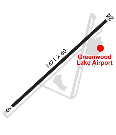
| Lat: N 4107.7 Long: W 07420.8 Elev: 790 Var: +13 Longest Runway: 3471 | ||
| CTAF: 122.9 | ||
| ||||||||||||||||||||||||||||||||||||||||||||||||||||||||||||||||||||
| ||||||||||||||||||||||||||||||||||||||||||||||||||||||||||||||||||||
| Rwy | Rwy | |||||||
| 3471x60 | 3471' | 3471x60 | 3471' | |||||
| Runway ID | Single Wheel | Double Wheel | Double Tandem Wheel | Dual Double Wheel |
| 06/24 | N/A | N/A | N/A | N/A |
| These numbers are Advisory and are not limits. The Airport Manager should have more accurate Weight Limits | ||||
 Airport Diagram might not be current. | |
| Facility Name: | GREENWOOD LAKE |
| City Name: | WEST MILFORD |
| County: | PASSAIC |
| State abbrev: | NJ |
| State Name: | NEW JERSEY |
| Ownership: | PUBLICLY OWNED |
| Use: | OPEN TO THE PUBLIC |
| Owner's Name: | N.J. DEPT. TRANSPORTATION |
| Address: | 1035 PARKWAY AVE. P.O. BOX 610 |
| TRENTON, NJ 08625 | |
| Owner's Phone: | 609-963-2100 |
| Manager's Name: | TIM WAGNER |
| Address: | 126A AIRPORT RD BOX 1 |
| WEST MILFORD, NJ 07480 | |
| Phone: | 973-728-7721 |
| FAA Region: | EASTERN |
| FAA Field Office: | HAR |
| Date | Sunrise | Sunset |
|---|---|---|
| 06/08/26 Monday | 5:25 | 20:28 |
| 06/09/26 Tuesday | 5:25 | 20:29 |
| 06/10/26 Wednesday | 5:24 | 20:29 |
| 06/11/26 Thursday | 5:24 | 20:30 |
| 06/12/26 Friday | 5:24 | 20:30 |
| 06/13/26 Saturday | 5:24 | 20:31 |
| 06/14/26 Sunday | 5:24 | 20:31 |
| 06/15/26 Monday | 5:24 | 20:32 |
| 06/16/26 Tuesday | 5:24 | 20:32 |
| 06/17/26 Wednesday | 5:24 | 20:32 |
| 06/18/26 Thursday | 5:24 | 20:33 |
| 06/19/26 Friday | 5:24 | 20:33 |
| 06/20/26 Saturday | 5:25 | 20:33 |
| 06/21/26 Sunday | 5:25 | 20:33 |
| Airport Attendance Schedule | 7 Days A Week 0800-1700 |
| Airport Status | OPERATIONAL (This Status can change at any time - please check NOTAMS) |
| Airport Lighting Schedule | ACTVT MIRL RWY 06/24 - CTAF, 5 CLICKS. PAPI RWY 24 OPR CONSLY. |
| Airport Storage Available | Tie Downs |
| Extra Services Available | Air Ambulance, Flight Instruction, Parachute Jumping, Aircraft Rental, Aircraft Sales |
| Wind Indicator | YES - (lighted) |
| Control Tower | NO |
| CTAF Frequency | 122.900; AUTOMATED UNICOM; 3 CLICKS TO ACTVT. |
| Unicom Frequency | |
| Rotating Beacon Color | WG |
| Segmented Circle | NO |
| Landing Fee | NO |
| Airport Inspected | STATE - performed by STATE AERONAUTICAL PERSONNEL |
| Inspection Date | 05/13/2025 |
| Type of Fuel Available | Grade 100LL, JET A (freeze point -40C) |
| Airframe Repair Service | MAJOR |
| Power Plant Repair Service | MAJOR |
| Latitude | N4107.7 |
| Longitude | W07420.8 (ESTIMATED) |
| Arpt Elevation | 789ft (SURVEYED) |
| Magnetic Variation | 13W |
| 1 miles E | of WEST MILFORD |
| Traffic Pattern Altitude | |
| Sectional Chart | NEW YORK |
| Operations (Reported) | Yearly | Avg. Daily |
|---|---|---|
| General Aviation Transient | 0 | 0 |
| General Aviation Local | 0 | 0 |
| Air Taxi | 0 | 0 |
| Commerical | 0 | 0 |
| Commuter | 0 | 0 |
| Military | 0 | 0 |
| Aircraft based on Field | |
|---|---|
| General Aviation Singles | 0 |
| General Aviation Multi | 0 |
| Jet Aircraft | 0 |
| General Aviation Helicopters | 0 |
| Military Aircraft | 0 |
| Gliders | 0 |
| Ultralights | 0 |
| FSS on field | NO |
| FSS tie-in | MILLVILLE |
| FSS Phone | 1-800-WX-BRIEF |
| Who issues Notams | MIV |
| Notam D service at airport | YES |
| ARTCC Name | NEW YORK |
| Airport Certification | |
| Aircraft Rescue & Firefighting Index | None |
| Airport of Entry | No |
| Custom Landing Rights | No |
| Joint Civil/Military | No |
| Military Landing rights | No |
| NATIONAL PLAN OF INTEGRATED AIRPORT SYSTEMS (NPIAS) |
| RY 06/24 STEEP ROCK LEDGES LCTD JUST BYD BOTH RY ENDS. |
| ARPT SUBJECT TO GUSTING WIND & FREQUENT CROSSWINDS. |
| SOME RWY AND TWY LGTS TALLER THAN STANDARD. |
| DEER AND BIRDS ON AND INVOF ARPT. |
| FOR CD CTC NEWARK APCH AT 800-645-3206. |
| DROP ZONE LCTD SE SIDE OF RWY. |
Airport Communications & Frequencies:
| ||||||||||||
| Runway: 06 | Runway: 24 | ||
| Mag heading: | 61° | Mag heading: | 241° |
| Rwy Slope: | .00% Up | Rwy Slope: | .00% Down |
| Approach: | Approach: | ||
| Pattern: | Right Traffic | Pattern: | Left Traffic |
| Markings: | NONPRECISION INSTRUMENT | Markings: | NONPRECISION INSTRUMENT |
| Marking Condition: | GOOD | Marking Condition: | GOOD |
| Arresting Dev: | Arresting Dev: | ||
| Lat & Long: | N4107.5 W07421.1 | Lat. & Long.: | N4107.9 W07420.5 |
| Elev: | 789.3 ft. MSL | Elev: | 789.4 ft. MSL |
| TCH: | TCH: | 44 ft. AGL | |
| Visual Glide Path: | Visual Glide Path: | 3.50 degrees | |
| Displaced Threshold: | No | Displaced Threshold: | No |
| Touchdown Zone: | YES | Touchdown Zone: | YES |
| Touchdown Elev.: | 789.6 feet | Touchdown Elev.: | 789.6 feet |
| Visual Glide Slope: | Visual Glide Slope: | 2-Light PAPI on LEFT side of Runway | |
| RVR Equipment: | RVR Equipment: | ||
| RVV Equipment: | NO | RVV Equipment: | NO |
| Approach Lights: | Approach Lights: | ||
| REIL: | NO | REIL: | NO |
| Centerline Lights: | NO | Centerline Lights: | NO |
| Touchdown lights: | NO | Touchdown lights: | NO |
| Runway Category: | Runway with a Non-precision Approach | Runway Category: | Runway with a Non-precision Approach |
| Declared Distances: | Declared Distances: | ||
| Obstructions: | TREES; TREES BELOW RWY END, CLIFF. | Obstructions: | TREE |
| Marked: | NOT Marked/Lighted | Marked: | NOT Marked/Lighted |
| Clearance slope: | 9:1 | Clearance slope: | 20:1 |
| Obstruction height: | 192 feet AGL | Obstruction height: | 23 feet AGL |
| Dist. from runway: | 1988 feet | Dist. from runway: | 680 feet |
| Centerline offset: | 170 right of centerline | Centerline offset: | 132 feet left of centerline |
| Comments: | Comments: |
Thanks for using FltPlan.com
all rights reserved © 1999-2026 by Flight Plan LLC