
| FAIRMONT MUNI-FRANKMAN FIELD FAIRMONT WV |
| |
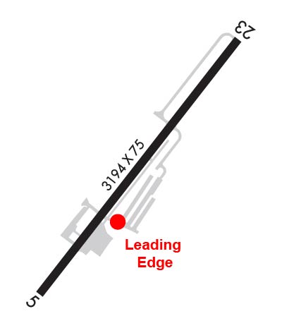
| Lat: N 3926.9 Long: W 08010.1 Elev: 1032 Var: +09 Longest Runway: 2965 | ||
| Clr Del: 118.35 CTAF: 122.8 | ||
| ||||||||||||||||||||||||||||||||||||||||||||||||||||||||||||||||||||
| ||||||||||||||||||||||||||||||||||||||||||||||||||||||||||||||||||||
| Rwy | Rwy | |||||||
| 2965x75 | 2245' | 2965x75 | 2965' | |||||
| Runway ID | Single Wheel | Double Wheel | Double Tandem Wheel | Dual Double Wheel |
| 05/23 | 12,500 | N/A | N/A | N/A |
| These numbers are Advisory and are not limits. The Airport Manager should have more accurate Weight Limits | ||||
 Airport Diagram might not be current. | |
| Facility Name: | FAIRMONT MUNI-FRANKMAN FLD |
| City Name: | FAIRMONT |
| County: | MARION |
| State abbrev: | WV |
| State Name: | WEST VIRGINIA |
| Ownership: | PUBLICLY OWNED |
| Use: | OPEN TO THE PUBLIC |
| Owner's Name: | FAIRMONT-MARION CO REG ARPT AUTH |
| Address: | P.O. BOX 387 |
| FAIRMONT, WV 26555-0387 | |
| Owner's Phone: | 304-282-5289 |
| Manager's Name: | DONNIE TUCKER |
| Address: | PO BOX 387 |
| FAIRMONT, WV 26555 | |
| Phone: | 304-366-1300; 304-612-4015 MGR CELL |
| FAA Region: | EASTERN |
| FAA Field Office: | BKW |
| Date | Sunrise | Sunset |
|---|---|---|
| 06/08/26 Monday | 5:54 | 20:46 |
| 06/09/26 Tuesday | 5:53 | 20:47 |
| 06/10/26 Wednesday | 5:53 | 20:47 |
| 06/11/26 Thursday | 5:53 | 20:48 |
| 06/12/26 Friday | 5:53 | 20:48 |
| 06/13/26 Saturday | 5:53 | 20:49 |
| 06/14/26 Sunday | 5:53 | 20:49 |
| 06/15/26 Monday | 5:53 | 20:49 |
| 06/16/26 Tuesday | 5:53 | 20:50 |
| 06/17/26 Wednesday | 5:53 | 20:50 |
| 06/18/26 Thursday | 5:53 | 20:50 |
| 06/19/26 Friday | 5:53 | 20:51 |
| 06/20/26 Saturday | 5:53 | 20:51 |
| 06/21/26 Sunday | 5:54 | 20:51 |
| Airport Attendance Schedule | MON-FRI 0830-1430 |
| Airport Status | OPERATIONAL (This Status can change at any time - please check NOTAMS) |
| Airport Lighting Schedule | ACTVT REIL RWY 23; MIRL RWY 5/23 - CTAF. |
| Airport Storage Available | Tie Downs |
| Extra Services Available | NONE |
| Wind Indicator | YES - (lighted) |
| Control Tower | NO |
| CTAF Frequency | 122.800 |
| Unicom Frequency | 122.800 |
| Rotating Beacon Color | WG |
| Segmented Circle | NO |
| Landing Fee | NO |
| Airport Inspected | STATE - performed by PRIVATE CONTRACT PERSONNEL |
| Inspection Date | 07/09/2024 |
| Type of Fuel Available | Grade 100LL |
| Airframe Repair Service | MAJOR |
| Power Plant Repair Service | MAJOR |
| Latitude | N3926.9 |
| Longitude | W08010.1 (ESTIMATED) |
| Arpt Elevation | 1032ft (SURVEYED) |
| Magnetic Variation | 09W |
| 2 miles SW | of FAIRMONT |
| Traffic Pattern Altitude | |
| Sectional Chart | CINCINNATI |
| Operations (Reported) | Yearly | Avg. Daily |
|---|---|---|
| General Aviation Transient | 0 | 0 |
| General Aviation Local | 0 | 0 |
| Air Taxi | 0 | 0 |
| Commerical | 0 | 0 |
| Commuter | 0 | 0 |
| Military | 0 | 0 |
| Aircraft based on Field | |
|---|---|
| General Aviation Singles | 0 |
| General Aviation Multi | 0 |
| Jet Aircraft | 0 |
| General Aviation Helicopters | 0 |
| Military Aircraft | 0 |
| Gliders | 0 |
| Ultralights | 0 |
| FSS on field | NO |
| FSS tie-in | ELKINS |
| FSS Phone | 1-800-WX-BRIEF |
| Who issues Notams | EKN |
| Notam D service at airport | YES |
| ARTCC Name | CLEVELAND |
| Airport Certification | |
| Aircraft Rescue & Firefighting Index | None |
| Airport of Entry | No |
| Custom Landing Rights | No |
| Joint Civil/Military | No |
| Military Landing rights | No |
| NATIONAL PLAN OF INTEGRATED AIRPORT SYSTEMS (NPIAS) |
| RADIO TOWERS APRX 300' AGL 2 MILES NE AND 2.5 MILES NW OF ARPT. |
| DEER ON & INVOF ARPT. |
| RWY 23 HAS 100 FT DROP OFF, NE END. |
| RWY 5 HAS +30 FT HILL AT SW END. |
| FOR CD CTC CLARKSBURG APCH AT 304-842-2011, WHEN APCH CLSD CTC CLEVELAND ARTCC AT 440-774-0226. |
| AFTR HRS ATNDT 304-933-4399 - CALL IN FEE. |
Airport Communications & Frequencies:
| |||||||||||||||||||
| Runway: 05 | Runway: 23 | ||
| Mag heading: | 46° | Mag heading: | 226° |
| Rwy Slope: | -.67% Down | Rwy Slope: | .67% Up |
| Approach: | Approach: | ||
| Pattern: | Left Traffic | Pattern: | Left Traffic |
| Markings: | BASIC | Markings: | NONPRECISION INSTRUMENT |
| Marking Condition: | FAIR | Marking Condition: | FAIR |
| Arresting Dev: | Arresting Dev: | ||
| Lat & Long: | N3926.7 W08010.2 | Lat. & Long.: | N3927.0 W08009.9 |
| Elev: | 1032.4 ft. MSL | Elev: | 1012.6 ft. MSL |
| TCH: | TCH: | ||
| Visual Glide Path: | Visual Glide Path: | ||
| Displaced Threshold: | 720 feet | Displaced Threshold: | No |
| Touchdown Zone: | YES | Touchdown Zone: | YES |
| Touchdown Elev.: | 1026.9 feet | Touchdown Elev.: | 1032.4 feet |
| Visual Glide Slope: | Visual Glide Slope: | ||
| RVR Equipment: | RVR Equipment: | ||
| RVV Equipment: | NO | RVV Equipment: | NO |
| Approach Lights: | Approach Lights: | ||
| REIL: | NO | REIL: | YES |
| Centerline Lights: | NO | Centerline Lights: | NO |
| Touchdown lights: | NO | Touchdown lights: | NO |
| Runway Category: | Runway with a Visual Approach | Runway Category: | Runway with a Non-precision Approach |
| Declared Distances: | Declared Distances: | ||
| Obstructions: | GND | Obstructions: | TREES |
| Marked: | NOT Marked/Lighted | Marked: | NOT Marked/Lighted |
| Clearance slope: | APCH RATIO O:1 AT DSPLCD THLD OVR 6 FT FENCE, 0 FT DSTC, 130 FT L. ALSO 15 FT TREES, 270 FT DISTC 70 FT L/R. | Clearance slope: | ALSO 15 FT TREES, 270 FT DSTCM 70 FT L/R. |
| Obstruction height: | 30 feet AGL | Obstruction height: | 30 feet AGL |
| Dist. from runway: | 201 feet | Dist. from runway: | 201 feet |
| Centerline offset: | 73 left of centerline | Centerline offset: | 240 feet right of centerline |
| Comments: | +30 FT HILL 201 FT FM THLD 0B. | Comments: | 12 FT TREES, 199 FT DSTC, 235 R. |
Thanks for using FltPlan.com
all rights reserved © 1999-2026 by Flight Plan LLC


