| SIMSBURY SIMSBURY CT |
| |
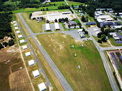
| Lat: N 4155.0 Long: W 07246.6 Elev: 195 Var: +14 Longest Runway: 2205 | ||
| CTAF: 122.7 | ||
| |||||||||||||||||||||||
| |||||||||||||||||||||||
| Rwy | Rwy | |||||||
| 2205x50 | 2205' | 2205x50 | 1935' | |||||
| Runway ID | Single Wheel | Double Wheel | Double Tandem Wheel | Dual Double Wheel |
| 03/21 | 25,000 | N/A | N/A | N/A |
| These numbers are Advisory and are not limits. The Airport Manager should have more accurate Weight Limits | ||||
| FltPlan does not have IFR approach charts available for K4B9. |
| Facility Name: | SIMSBURY |
| City Name: | SIMSBURY |
| County: | HARTFORD |
| State abbrev: | CT |
| State Name: | CONNECTICUT |
| Ownership: | PRIVATELY OWNED |
| Use: | OPEN TO THE PUBLIC |
| Owner's Name: | AIRPORT REALTY ASSOC. LLC |
| Address: | 37 SUNSET FARMS ROAD |
| WEST HARTFORD, CT 06107 | |
| Owner's Phone: | 860-236-3301 |
| Manager's Name: | BRAD GRISWOLD |
| Address: | 119 PARK RD |
| PLEASANT VALLEY, CT 06063 | |
| Phone: | 860-459-1575 |
| FAA Region: | NEW ENGLAND |
| FAA Field Office: | NONE |
| Date | Sunrise | Sunset |
|---|---|---|
| 09/24/21 Friday | 6:40 | 18:45 |
| 09/25/21 Saturday | 6:41 | 18:44 |
| 09/26/21 Sunday | 6:42 | 18:42 |
| 09/27/21 Monday | 6:43 | 18:40 |
| 09/28/21 Tuesday | 6:45 | 18:38 |
| 09/29/21 Wednesday | 6:46 | 18:37 |
| 09/30/21 Thursday | 6:47 | 18:35 |
| 10/01/21 Friday | 6:48 | 18:33 |
| 10/02/21 Saturday | 6:49 | 18:31 |
| 10/03/21 Sunday | 6:50 | 18:30 |
| 10/04/21 Monday | 6:51 | 18:28 |
| 10/05/21 Tuesday | 6:52 | 18:26 |
| 10/06/21 Wednesday | 6:53 | 18:25 |
| 10/07/21 Thursday | 6:54 | 18:23 |
| Airport Attendance Schedule | 7 Days A Week 0830-1700 |
| Airport Status | OPERATIONAL (This Status can change at any time - please check NOTAMS) |
| Airport Lighting Schedule | DUSK-DAWN. ACTVT MIRL RY 03/21 - CTAF. |
| Airport Storage Available | Tie Downs |
| Extra Services Available | Flight Instruction |
| Wind Indicator | YES - (lighted) |
| Control Tower | NO |
| CTAF Frequency | 122.700 |
| Unicom Frequency | 122.700 |
| Rotating Beacon Color | |
| Segmented Circle | YES |
| Landing Fee | NO |
| Airport Inspected | STATE - performed by STATE AERONAUTICAL PERSONNEL |
| Inspection Date | 03/11/2014 |
| Type of Fuel Available | Grade 100LL |
| Airframe Repair Service | MAJOR |
| Power Plant Repair Service | MAJOR |
| Latitude | N4155.0 |
| Longitude | W07246.6 (ESTIMATED) |
| Arpt Elevation | 195ft (ESTIMATED) |
| Magnetic Variation | 14W |
| 3 miles NE | of SIMSBURY |
| Traffic Pattern Altitude | |
| Sectional Chart | NEW YORK |
| Operations (Reported) | Yearly | Avg. Daily |
|---|---|---|
| General Aviation Transient | 1200 | 3 |
| General Aviation Local | 11500 | 32 |
| Air Taxi | 75 | 0 |
| Commerical | 0 | 0 |
| Commuter | 0 | 0 |
| Military | 0 | 0 |
| Aircraft based on Field | |
|---|---|
| General Aviation Singles | 10 |
| General Aviation Multi | 0 |
| Jet Aircraft | 0 |
| General Aviation Helicopters | 0 |
| Military Aircraft | 0 |
| Gliders | 0 |
| Ultralights | 0 |
| FSS on field | NO |
| FSS tie-in | BRIDGEPORT |
| FSS Phone | 1-800-WX-BRIEF |
| Who issues Notams | BDR |
| Notam D service at airport | YES |
| ARTCC Name | BOSTON |
| Airport Certification | |
| Aircraft Rescue & Firefighting Index | None |
| Airport of Entry | No |
| Custom Landing Rights | No |
| Joint Civil/Military | No |
| Military Landing rights | No |
| CAUTION DEER AND BIRDS ON & INVOF ARPT - BIRDS PARTICULARLY IN APCH TO RY 03. |
| RY 03 HAS AN UP-HILL GRADE. |
| FOR CD CTC YANKEE APCH AT 860-386-3597. IF UNA, CTC FSS. |
| RWY 03/2 1 RY 3/21 SAFETY BARRIER 15 FT NE THRESHOLD BARRICADED NOT LGTD. |
| RWY 03/2 1 NSTD THLD LIGHTS GREEN/GREEN. |
| Runway: 03 | Runway: 21 | ||
| Mag heading: | N/A | Mag heading: | N/A |
| Approach: | Approach: | ||
| Pattern: | Left Traffic | Pattern: | Left Traffic |
| Markings: | BASIC | Markings: | BASIC |
| Marking Condition: | FAIR | Marking Condition: | FAIR |
| Arresting Dev: | Arresting Dev: | ||
| Lat & Long: | N4154.8 W07246.7 | Lat. & Long.: | N4155.1 W07246.6 |
| Elev: | N/A | Elev: | N/A |
| TCH: | TCH: | ||
| Visual Glide Path: | Visual Glide Path: | ||
| Displaced Threshold: | No | Displaced Threshold: | 270 feet |
| Touchdown Zone: | NO | Touchdown Zone: | NO |
| Touchdown Elev.: | Touchdown Elev.: | ||
| Visual Glide Slope: | Visual Glide Slope: | ||
| RVR Equipment: | RVR Equipment: | ||
| RVV Equipment: | NO | RVV Equipment: | NO |
| Approach Lights: | Approach Lights: | ||
| REIL: | NO | REIL: | NO |
| Centerline Lights: | NO | Centerline Lights: | NO |
| Touchdown lights: | NO | Touchdown lights: | NO |
| Runway Category: | Runway with a Visual Approach | Runway Category: | Runway with a Visual Approach |
| Declared Distances: | Declared Distances: | ||
| Obstructions: | TREES | Obstructions: | ROAD |
| Marked: | NOT Marked/Lighted | Marked: | NOT Marked/Lighted |
| Clearance slope: | 6:1 | Clearance slope: | APCH RATIO 21:1 TO DSPLCD THLD. |
| Obstruction height: | 38 feet AGL | Obstruction height: | 15 feet AGL |
| Dist. from runway: | 411 feet | Dist. from runway: | 200 feet |
| Centerline offset: | 150 right of centerline | Centerline offset: | 120 feet right of centerline |
| Comments: | RY 03 HAS 10 FT BRUSH ON CNTRLN 306 FT FM THLD. | Comments: | WALCOTT ROAD AT THR 60 FT R. |
Thanks for using FltPlan.com
all rights reserved © 1999-2021 by Flight Plan LLC