
| SALINA-GUNNISON SALINA UT |
| |
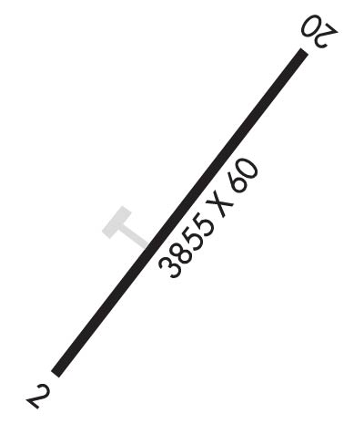
| Lat: N 3901.7 Long: W 11150.3 Elev: 5159 Var: -14 Longest Runway: 3855 | ||
| CTAF: 122.9 | ||
| ||||||||||||||||||||||||||||||||
| ||||||||||||||||||||||||||||||||
| Rwy | Rwy | |||||||
| 3855x60 | 3855' | 3855x60 | 3855' | |||||
| Runway ID | Single Wheel | Double Wheel | Double Tandem Wheel | Dual Double Wheel |
| 02/20 | 6,000 | N/A | N/A | N/A |
| These numbers are Advisory and are not limits. The Airport Manager should have more accurate Weight Limits | ||||
| FltPlan does not have IFR approach charts available for K44U. |
 Airport Diagram might not be current. | |
| Facility Name: | SALINA-GUNNISON |
| City Name: | SALINA |
| County: | SEVIER |
| State abbrev: | UT |
| State Name: | UTAH |
| Ownership: | PUBLICLY OWNED |
| Use: | OPEN TO THE PUBLIC |
| Owner's Name: | CITIES OF SALINA & GUNNISION |
| Address: | 90 N 200 W |
| SALINA, UT 84654 | |
| Owner's Phone: | (435) 529-7304 |
| Manager's Name: | RICHARD NAY |
| Address: | 90 N 200 W |
| SALINA, UT 84654 | |
| Phone: | (435) 979-9234 |
| FAA Region: | NORTHWEST MOUNTAIN |
| FAA Field Office: | DEN |
| Date | Sunrise | Sunset |
|---|---|---|
| 06/08/26 Monday | 6:01 | 20:51 |
| 06/09/26 Tuesday | 6:01 | 20:52 |
| 06/10/26 Wednesday | 6:01 | 20:53 |
| 06/11/26 Thursday | 6:01 | 20:53 |
| 06/12/26 Friday | 6:01 | 20:53 |
| 06/13/26 Saturday | 6:01 | 20:54 |
| 06/14/26 Sunday | 6:01 | 20:54 |
| 06/15/26 Monday | 6:01 | 20:55 |
| 06/16/26 Tuesday | 6:01 | 20:55 |
| 06/17/26 Wednesday | 6:01 | 20:55 |
| 06/18/26 Thursday | 6:01 | 20:56 |
| 06/19/26 Friday | 6:01 | 20:56 |
| 06/20/26 Saturday | 6:02 | 20:56 |
| 06/21/26 Sunday | 6:02 | 20:56 |
| Airport Attendance Schedule | UNATTENDED |
| Airport Status | OPERATIONAL (This Status can change at any time - please check NOTAMS) |
| Airport Lighting Schedule | ACTVT MIRL RY 02/20 - CTAF. |
| Airport Storage Available | Tie Downs |
| Extra Services Available | NONE |
| Wind Indicator | NONE |
| Control Tower | NO |
| CTAF Frequency | 122.900 |
| Unicom Frequency | |
| Rotating Beacon Color | WG |
| Segmented Circle | NO |
| Landing Fee | NO |
| Airport Inspected | STATE - performed by STATE AERONAUTICAL PERSONNEL |
| Inspection Date | 06/25/2025 |
| Type of Fuel Available | None |
| Airframe Repair Service | NONE |
| Power Plant Repair Service | NONE |
| Latitude | N3901.7 |
| Longitude | W11150.3 (ESTIMATED) |
| Arpt Elevation | 5159ft (ESTIMATED) |
| Magnetic Variation | 14E |
| 5 miles NE | of SALINA |
| Traffic Pattern Altitude | |
| Sectional Chart | LAS VEGAS |
| Operations (Reported) | Yearly | Avg. Daily |
|---|---|---|
| General Aviation Transient | 0 | 0 |
| General Aviation Local | 0 | 0 |
| Air Taxi | 0 | 0 |
| Commerical | 0 | 0 |
| Commuter | 0 | 0 |
| Military | 0 | 0 |
| Aircraft based on Field | |
|---|---|
| General Aviation Singles | 0 |
| General Aviation Multi | 0 |
| Jet Aircraft | 0 |
| General Aviation Helicopters | 0 |
| Military Aircraft | 0 |
| Gliders | 0 |
| Ultralights | 0 |
| FSS on field | NO |
| FSS tie-in | CEDAR CITY |
| FSS Phone | 1-800-WX-BRIEF |
| Who issues Notams | CDC |
| Notam D service at airport | YES |
| ARTCC Name | SALT LAKE CITY |
| Airport Certification | |
| Aircraft Rescue & Firefighting Index | None |
| Airport of Entry | No |
| Custom Landing Rights | No |
| Joint Civil/Military | No |
| Military Landing rights | YES |
| GRANT AGREEMENT HAS EXPIRED; HOWEVER, AGREEMENT REMAINS IN EFFECT FOR THIS FACILITY AS LONG AS IT IS PUBLIC USE. |
| FOR CD CTC SALT LAKE ARTCC AT 801-320-2568. |
| Runway: 02 | Runway: 20 | ||
| Mag heading: | 22° | Mag heading: | 202° |
| Rwy Slope: | .67% Up | Rwy Slope: | -.67% Down |
| Approach: | Approach: | ||
| Pattern: | Left Traffic | Pattern: | Left Traffic |
| Markings: | BASIC | Markings: | BASIC |
| Marking Condition: | GOOD | Marking Condition: | GOOD |
| Arresting Dev: | Arresting Dev: | ||
| Lat & Long: | N3901.5 W11150.5 | Lat. & Long.: | N3902.0 W11150.0 |
| Elev: | 5133.0 ft. MSL | Elev: | 5159.0 ft. MSL |
| TCH: | TCH: | ||
| Visual Glide Path: | Visual Glide Path: | ||
| Displaced Threshold: | No | Displaced Threshold: | No |
| Touchdown Zone: | NO | Touchdown Zone: | NO |
| Touchdown Elev.: | Touchdown Elev.: | ||
| Visual Glide Slope: | Visual Glide Slope: | ||
| RVR Equipment: | RVR Equipment: | ||
| RVV Equipment: | NO | RVV Equipment: | NO |
| Approach Lights: | Approach Lights: | ||
| REIL: | NO | REIL: | NO |
| Centerline Lights: | NO | Centerline Lights: | NO |
| Touchdown lights: | NO | Touchdown lights: | NO |
| Runway Category: | Runway with a Visual Approach | Runway Category: | Runway with a Visual Approach |
| Declared Distances: | Declared Distances: |
Thanks for using FltPlan.com
all rights reserved © 1999-2026 by Flight Plan LLC
