
| DEBLOIS FLIGHT STRIP DEBLOIS ME |
| |
| Lat: N 4443.6 Long: W 06759.5 Elev: 218 Var: +16 Longest Runway: 4500 | ||
| CTAF: 122.9 | ||
| ||||||||||||||||||||||||||||||||
| ||||||||||||||||||||||||||||||||
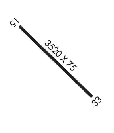
| Rwy | Rwy | |||||||
| 4500x75 | 4500' | 4500x75 | 4500' | |||||
| Runway ID | Single Wheel | Double Wheel | Double Tandem Wheel | Dual Double Wheel |
| 15/33 | 84,000 | 200,000 | 400,000 | N/A |
| These numbers are Advisory and are not limits. The Airport Manager should have more accurate Weight Limits | ||||
 Airport Diagram might not be current. | |
| Facility Name: | DEBLOIS FLIGHT STRIP |
| City Name: | DEBLOIS |
| County: | WASHINGTON |
| State abbrev: | ME |
| State Name: | MAINE |
| Ownership: | PUBLICLY OWNED |
| Use: | OPEN TO THE PUBLIC |
| Owner's Name: | STATE OF MAINE DOT |
| Address: | 16 STATE HOUSE STATION; MAINE DEPT OF TRANSPORTATION. |
| AUGUSTA, ME 04330 | |
| Owner's Phone: | 207-624-3578 |
| Manager's Name: | JOE LACERDA |
| Address: | MAINE DEPT OF TRANSPORTATION, 219 HOGAN RD |
| BANGOR, ME 04401 | |
| Phone: | 207-941-4502 |
| FAA Region: | NEW ENGLAND |
| FAA Field Office: | NONE |
| Date | Sunrise | Sunset |
|---|---|---|
| 06/08/26 Monday | 4:47 | 20:15 |
| 06/09/26 Tuesday | 4:46 | 20:16 |
| 06/10/26 Wednesday | 4:46 | 20:17 |
| 06/11/26 Thursday | 4:46 | 20:17 |
| 06/12/26 Friday | 4:46 | 20:18 |
| 06/13/26 Saturday | 4:46 | 20:18 |
| 06/14/26 Sunday | 4:46 | 20:19 |
| 06/15/26 Monday | 4:46 | 20:19 |
| 06/16/26 Tuesday | 4:46 | 20:20 |
| 06/17/26 Wednesday | 4:46 | 20:20 |
| 06/18/26 Thursday | 4:46 | 20:20 |
| 06/19/26 Friday | 4:46 | 20:21 |
| 06/20/26 Saturday | 4:46 | 20:21 |
| 06/21/26 Sunday | 4:46 | 20:21 |
| Airport Attendance Schedule | UNATTENDED |
| Airport Status | OPERATIONAL (This Status can change at any time - please check NOTAMS) |
| Airport Lighting Schedule | |
| Airport Storage Available | NONE |
| Extra Services Available | NONE |
| Wind Indicator | YES - (unlit) |
| Control Tower | NO |
| CTAF Frequency | 122.900 |
| Unicom Frequency | |
| Rotating Beacon Color | |
| Segmented Circle | YES |
| Landing Fee | NO |
| Airport Inspected | STATE - performed by PRIVATE CONTRACT PERSONNEL |
| Inspection Date | 08/20/2023 |
| Type of Fuel Available | None |
| Airframe Repair Service | NONE |
| Power Plant Repair Service | NONE |
| Latitude | N4443.6 |
| Longitude | W06759.5 (ESTIMATED) |
| Arpt Elevation | 217ft (ESTIMATED) |
| Magnetic Variation | 16W |
| 2 miles SE | of DEBLOIS |
| Traffic Pattern Altitude | |
| Sectional Chart | HALIFAX |
| Operations (Reported) | Yearly | Avg. Daily |
|---|---|---|
| General Aviation Transient | 0 | 0 |
| General Aviation Local | 0 | 0 |
| Air Taxi | 0 | 0 |
| Commerical | 0 | 0 |
| Commuter | 0 | 0 |
| Military | 0 | 0 |
| Aircraft based on Field | |
|---|---|
| General Aviation Singles | 0 |
| General Aviation Multi | 0 |
| Jet Aircraft | 0 |
| General Aviation Helicopters | 0 |
| Military Aircraft | 0 |
| Gliders | 0 |
| Ultralights | 0 |
| FSS on field | NO |
| FSS tie-in | BANGOR |
| FSS Phone | 1-800-WX-BRIEF |
| Who issues Notams | BGR |
| Notam D service at airport | YES |
| ARTCC Name | BOSTON |
| Airport Certification | |
| Aircraft Rescue & Firefighting Index | None |
| Airport of Entry | No |
| Custom Landing Rights | No |
| Joint Civil/Military | No |
| Military Landing rights | No |
| CLSD WINTER MONTHS EXCEPT TO SKI ACFT. |
| DAYLIGHT USE ONLY. |
| RWY COULD HAVE LOOSE GRVL TRKD ONTO SFC BY VEHICULAR TFC. MEN & EQUIP COULD BE NEAR OR ON RWY SFC DURG SUMMER MONTHS. |
| PAVEMENT DROP-OFFS AT THLDS OF RWY 15 & RWY 33 IN EXCESS OF 5 IN. |
| FOR CD CTC BOSTON ARTCC AT 603-879-6859. |
Airport Communications & Frequencies:
| |||||||
| Runway: 15 | Runway: 33 | ||
| Mag heading: | 151° | Mag heading: | 331° |
| Rwy Slope: | -.21% Down | Rwy Slope: | .21% Up |
| Approach: | Approach: | ||
| Pattern: | Left Traffic | Pattern: | Left Traffic |
| Markings: | BASIC | Markings: | BASIC |
| Marking Condition: | POOR; NRS AND CNTRLN FADED OR MISG. | Marking Condition: | POOR; NRS AND CNTRLN FADED OR MISG. |
| Arresting Dev: | Arresting Dev: | ||
| Lat & Long: | N4443.9 W06759.8 | Lat. & Long.: | N4443.4 W06759.1 |
| Elev: | 217.7 ft. MSL | Elev: | 208.1 ft. MSL |
| TCH: | TCH: | ||
| Visual Glide Path: | Visual Glide Path: | ||
| Displaced Threshold: | No | Displaced Threshold: | No |
| Touchdown Zone: | YES | Touchdown Zone: | YES |
| Touchdown Elev.: | 217.7 feet | Touchdown Elev.: | 216.0 feet |
| Visual Glide Slope: | Visual Glide Slope: | ||
| RVR Equipment: | RVR Equipment: | ||
| RVV Equipment: | NO | RVV Equipment: | NO |
| Approach Lights: | Approach Lights: | ||
| REIL: | NO | REIL: | NO |
| Centerline Lights: | NO | Centerline Lights: | NO |
| Touchdown lights: | NO | Touchdown lights: | NO |
| Runway Category: | Runway with a Visual Approach | Runway Category: | Runway with a Visual Approach |
| Declared Distances: | Declared Distances: |
Thanks for using FltPlan.com
all rights reserved © 1999-2026 by Flight Plan LLC
