
| COMANCHE COUNTY COLDWATER KS |
| |
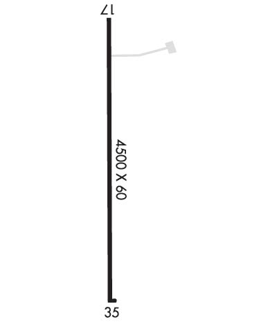
| Lat: N 3713.4 Long: W 09919.9 Elev: 2086 Var: -05 Longest Runway: 4500 | ||
| CTAF: 122.9 | ||
| ||||||||||||||||||||||||||||||||||||||||||||
| ||||||||||||||||||||||||||||||||||||||||||||
| Rwy | Rwy | |||||||
| 4500x60 | 4500' | 4500x60 | 4500' | |||||
| Runway ID | Single Wheel | Double Wheel | Double Tandem Wheel | Dual Double Wheel |
| 17/35 | 30,000 | N/A | N/A | N/A |
| These numbers are Advisory and are not limits. The Airport Manager should have more accurate Weight Limits | ||||
 Airport Diagram might not be current. | |
| Facility Name: | COMANCHE COUNTY |
| City Name: | COLDWATER |
| County: | COMANCHE |
| State abbrev: | KS |
| State Name: | KANSAS |
| Ownership: | PUBLICLY OWNED |
| Use: | OPEN TO THE PUBLIC |
| Owner's Name: | COMANCHE COUNTY |
| Address: | C/O COUNTY CLERK, 401 S. PHILADELPHIA AVE. |
| COLDWATER, KS 67029 | |
| Owner's Phone: | 620-582-2933 |
| Manager's Name: | JASON HARDY |
| Address: | 401 S. PHILADELPHIA AVE., PO BOX 685 |
| COLDWATER, KS 67029 | |
| Phone: | (620) 582-2933; AFTER HOURS AND FOR FUEL PHONE NUMBERS LISTED IN PILOT LOUNGE. |
| FAA Region: | CENTRAL |
| FAA Field Office: | NONE |
| Date | Sunrise | Sunset |
|---|---|---|
| 09/24/21 Friday | 7:27 | 19:31 |
| 09/25/21 Saturday | 7:27 | 19:30 |
| 09/26/21 Sunday | 7:28 | 19:28 |
| 09/27/21 Monday | 7:29 | 19:27 |
| 09/28/21 Tuesday | 7:30 | 19:25 |
| 09/29/21 Wednesday | 7:31 | 19:24 |
| 09/30/21 Thursday | 7:32 | 19:22 |
| 10/01/21 Friday | 7:33 | 19:21 |
| 10/02/21 Saturday | 7:33 | 19:19 |
| 10/03/21 Sunday | 7:34 | 19:18 |
| 10/04/21 Monday | 7:35 | 19:16 |
| 10/05/21 Tuesday | 7:36 | 19:15 |
| 10/06/21 Wednesday | 7:37 | 19:13 |
| 10/07/21 Thursday | 7:38 | 19:12 |
| Airport Attendance Schedule | UNATTENDED |
| Airport Status | OPERATIONAL (This Status can change at any time - please check NOTAMS) |
| Airport Lighting Schedule | ACTIVATE REIL RY 17/35; PAPI RY 17/35; MIRL RY 17/35 - CTAF. |
| Airport Storage Available | Tie Downs |
| Extra Services Available | NONE |
| Wind Indicator | YES - (lighted) |
| Control Tower | NO |
| CTAF Frequency | 122.900 |
| Unicom Frequency | |
| Rotating Beacon Color | CLEAR-GREEN (Light Land Airport) |
| Segmented Circle | NO |
| Landing Fee | NO |
| Airport Inspected | STATE - performed by STATE AERONAUTICAL PERSONNEL |
| Inspection Date | 06/26/2020 |
| Type of Fuel Available | Grade 100LL |
| Airframe Repair Service | None |
| Power Plant Repair Service | None |
| Latitude | N3713.4 |
| Longitude | W09919.9 (ESTIMATED) |
| Arpt Elevation | 2086ft (SURVEYED) |
| Magnetic Variation | 05E |
| 3 miles S | of COLDWATER |
| Traffic Pattern Altitude | |
| Sectional Chart | WICHITA |
| Operations (Reported) | Yearly | Avg. Daily |
|---|---|---|
| General Aviation Transient | 400 | 1 |
| General Aviation Local | 400 | 1 |
| Air Taxi | 0 | 0 |
| Commerical | 0 | 0 |
| Commuter | 0 | 0 |
| Military | 0 | 0 |
| Aircraft based on Field | |
|---|---|
| General Aviation Singles | 3 |
| General Aviation Multi | 0 |
| Jet Aircraft | 0 |
| General Aviation Helicopters | 0 |
| Military Aircraft | 0 |
| Gliders | 0 |
| Ultralights | 0 |
| FSS on field | NO |
| FSS tie-in | WICHITA |
| FSS Phone | 1-800-WX-BRIEF |
| Who issues Notams | ICT |
| Notam D service at airport | YES |
| ARTCC Name | KANSAS CITY |
| Airport Certification | |
| Aircraft Rescue & Firefighting Index | None |
| Airport of Entry | No |
| Custom Landing Rights | No |
| Joint Civil/Military | No |
| Military Landing rights | No |
| FOR CD CTC KANSAS CITY ARTCC AT 913-254-8508. |
| FOR FUEL CALL THE COUNTY OFFICE 620-582-2933 OR AFTER 4:30 PM CALL SHERIFF 620-582-2511 |
Airport Communications & Frequencies:
| |||||||
| Runway: 17 | Runway: 35 | ||
| Mag heading: | N/A | Mag heading: | N/A |
| Rwy Slope: | -.26% Down | Rwy Slope: | .26% Up |
| Approach: | Approach: | ||
| Pattern: | Left Traffic | Pattern: | Left Traffic |
| Markings: | NONPRECISION INSTRUMENT | Markings: | NONPRECISION INSTRUMENT |
| Marking Condition: | GOOD | Marking Condition: | GOOD |
| Arresting Dev: | Arresting Dev: | ||
| Lat & Long: | N3713.7 W09920.0 | Lat. & Long.: | N3713.0 W09919.9 |
| Elev: | 2086.1 ft. MSL | Elev: | 2074.2 ft. MSL |
| TCH: | 40 ft. AGL | TCH: | 40 ft. AGL |
| Visual Glide Path: | 3.00 degrees | Visual Glide Path: | 3.00 degrees |
| Displaced Threshold: | No | Displaced Threshold: | No |
| Touchdown Zone: | YES | Touchdown Zone: | YES |
| Touchdown Elev.: | 2086.1 feet | Touchdown Elev.: | 2082.0 feet |
| Visual Glide Slope: | 4-Light PAPI on LEFT side of Runway | Visual Glide Slope: | 4-Light PAPI on LEFT side of Runway |
| RVR Equipment: | RVR Equipment: | ||
| RVV Equipment: | NO | RVV Equipment: | NO |
| Approach Lights: | Approach Lights: | ||
| REIL: | YES | REIL: | YES |
| Centerline Lights: | NO | Centerline Lights: | NO |
| Touchdown lights: | NO | Touchdown lights: | NO |
| Runway Category: | Runway with a Visual Approach | Runway Category: | Runway with a Visual Approach |
| Declared Distances: | Declared Distances: |
Thanks for using FltPlan.com
all rights reserved © 1999-2021 by Flight Plan LLC
