| ST LOUIS METRO-EAST/SHAFER ST JACOB IL |
| |
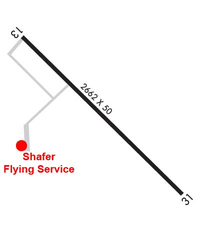
| Lat: N 3844.0 Long: W 08948.4 Elev: 477 Var: +02 Longest Runway: 2662 | ||
| CTAF: 122.8 | ||
| |||||||||||||||||||||||||||||||||||||||||||||||||||||||||||||
| |||||||||||||||||||||||||||||||||||||||||||||||||||||||||||||
| Rwy | Rwy | |||||||
| 2662x50 | 2535' | 2662x50 | 2662' | |||||
| Runway ID | Single Wheel | Double Wheel | Double Tandem Wheel | Dual Double Wheel |
| These numbers are Advisory and are not limits. The Airport Manager should have more accurate Weight Limits | ||||
 Airport Diagram might not be current. | |
| Facility Name: | ST LOUIS METRO-EAST/SHAFER FIELD |
| City Name: | ST JACOB |
| County: | MADISON |
| State abbrev: | IL |
| State Name: | ILLINOIS |
| Ownership: | PRIVATELY OWNED |
| Use: | OPEN TO THE PUBLIC |
| Owner's Name: | EDWARD B. SHAFER |
| Address: | 2070 TRIAD RD. |
| ST JACOB, IL 62281 | |
| Owner's Phone: | 618-644-5411 |
| Manager's Name: | EDWARD B. SHAFER |
| Address: | 2070 TRIAD RD.; EMAIL ADDRESS: HYFLYER33@HOTMAIL.COM (ALL LOWER CASE) |
| ST JACOB, IL 62281 | |
| Phone: | 618-644-5411; CELL NUMBER: 618-920-1393 |
| FAA Region: | GREAT LAKES |
| FAA Field Office: | CHI |
| Date | Sunrise | Sunset |
|---|---|---|
| 02/27/19 Wednesday | 6:35 | 17:50 |
| 02/28/19 Thursday | 6:33 | 17:51 |
| 03/01/19 Friday | 6:32 | 17:52 |
| 03/02/19 Saturday | 6:30 | 17:53 |
| 03/03/19 Sunday | 6:29 | 17:54 |
| 03/04/19 Monday | 6:28 | 17:55 |
| 03/05/19 Tuesday | 6:26 | 17:56 |
| 03/06/19 Wednesday | 6:25 | 17:57 |
| 03/07/19 Thursday | 6:23 | 17:58 |
| 03/08/19 Friday | 6:22 | 17:59 |
| 03/09/19 Saturday | 6:20 | 18:00 |
| 03/10/19 Sunday | 7:19 | 19:01 |
| 03/11/19 Monday | 7:17 | 19:02 |
| 03/12/19 Tuesday | 7:16 | 19:03 |
| Airport Attendance Schedule | CONTINUOUS; EMAIL ADDRESS: HYFLYER33@HOTMAIL.COM (ALL LOWER CASE) |
| Airport Status | OPERATIONAL (This Status can change at any time - please check NOTAMS) |
| Airport Lighting Schedule | MIRL RY 13/31 PRESET ON LOW INTST; TO INCR INTST ACTVT - CTAF. |
| Airport Storage Available | Tie Downs, Hanger |
| Extra Services Available | Flight Instruction, Aircraft Rental, Aircraft Sales |
| Wind Indicator | YES - (lighted) |
| Control Tower | NO |
| CTAF Frequency | 122.800 |
| Unicom Frequency | 122.800 |
| Rotating Beacon Color | CLEAR-GREEN (Light Land Airport) |
| Segmented Circle | NO |
| Landing Fee | NO |
| Airport Inspected | STATE - performed by STATE AERONAUTICAL PERSONNEL |
| Inspection Date | 06/01/2018 |
| Type of Fuel Available | Grade 100LL |
| Airframe Repair Service | MINOR |
| Power Plant Repair Service | MINOR |
| Latitude | N3844.0 |
| Longitude | W08948.4 (ESTIMATED) |
| Arpt Elevation | 477ft (SURVEYED) |
| Magnetic Variation | 02W |
| 2 miles N | of ST JACOB |
| Traffic Pattern Altitude | 800 |
| Sectional Chart | ST LOUIS |
| Operations (Reported) | Yearly | Avg. Daily |
|---|---|---|
| General Aviation Transient | 24300 | 67 |
| General Aviation Local | 26700 | 73 |
| Air Taxi | 1000 | 3 |
| Commerical | 0 | 0 |
| Commuter | 0 | 0 |
| Military | 0 | 0 |
| Aircraft based on Field | |
|---|---|
| General Aviation Singles | 0 |
| General Aviation Multi | 0 |
| Jet Aircraft | 0 |
| General Aviation Helicopters | 0 |
| Military Aircraft | 0 |
| Gliders | 1 |
| Ultralights | 1 |
| FSS on field | NO |
| FSS tie-in | SAINT LOUIS |
| FSS Phone | 1-800-WX-BRIEF |
| Who issues Notams | STL |
| Notam D service at airport | YES |
| ARTCC Name | KANSAS CITY |
| Airport Certification | |
| Aircraft Rescue & Firefighting Index | None |
| Airport of Entry | No |
| Custom Landing Rights | No |
| Joint Civil/Military | No |
| Military Landing rights | No |
| NATIONAL PLAN OF INTEGRATED AIRPORT SYSTEMS (NPIAS) |
| ASSURANCES PURSUANT TO TITLE VI, CIVIL RIGHTS ACT OF 1964 |
| THIS AIRPORT HAS BEEN SURVEYED BY THE NATIONAL GEODETIC SURVEY. |
| MIL HEL OPNS PRIOR PERMISSION ONLY. |
| FOR NOISE ABATEMENT PROCEDURES CTC AMGR 618-644-5411. |
| FOR CD CTC STL APCH AT 314-890-1017. |
| Runway: 13 | Runway: 31 | ||
| Mag heading: | 138° | Mag heading: | 318° |
| Rwy Slope: | -.30% Down | Rwy Slope: | .30% Up |
| Approach: | Approach: | ||
| Pattern: | Left Traffic | Pattern: | Left Traffic |
| Markings: | BASIC | Markings: | BASIC |
| Marking Condition: | FAIR | Marking Condition: | FAIR |
| Arresting Dev: | Arresting Dev: | ||
| Lat & Long: | N3844.1 W08948.6 | Lat. & Long.: | N3843.8 W08948.2 |
| Elev: | 477.0 ft. MSL | Elev: | 469.0 ft. MSL |
| TCH: | TCH: | ||
| Visual Glide Path: | Visual Glide Path: | ||
| Displaced Threshold: | 127 feet | Displaced Threshold: | No |
| Touchdown Zone: | NO | Touchdown Zone: | NO |
| Touchdown Elev.: | Touchdown Elev.: | ||
| Visual Glide Slope: | Visual Glide Slope: | ||
| RVR Equipment: | RVR Equipment: | ||
| RVV Equipment: | NO | RVV Equipment: | NO |
| Approach Lights: | Approach Lights: | ||
| REIL: | NO | REIL: | NO |
| Centerline Lights: | NO | Centerline Lights: | NO |
| Touchdown lights: | NO | Touchdown lights: | NO |
| Runway Category: | Runway with a Visual Approach | Runway Category: | Runway with a Visual Approach |
| Declared Distances: | Declared Distances: | ||
| Obstructions: | ROAD | Obstructions: | TREE |
| Marked: | NOT Marked/Lighted | Marked: | NOT Marked/Lighted |
| Clearance slope: | APCH SLOPE IS 21:1 TO DSPLCD THLD. | Clearance slope: | 20:1 |
| Obstruction height: | 16 feet AGL | Obstruction height: | 65 feet AGL |
| Dist. from runway: | 210 feet | Dist. from runway: | 1513 feet |
| Centerline offset: | 126 right of centerline | Centerline offset: | 225 feet right of centerline |
| Comments: | Comments: |
Thanks for using FltPlan.com
all rights reserved © 1999-2019 by Flight Plan LLC