
| STERLING STERLING MA |
| |
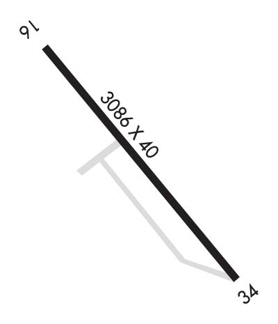
| Lat: N 4225.6 Long: W 07147.6 Elev: 459 Var: +15 Longest Runway: 3086 | ||
| CTAF: 122.9 | ||
| ||||||||||||||||||||||||||||||||||||||||||||
| ||||||||||||||||||||||||||||||||||||||||||||
| Rwy | Rwy | |||||||
| 3086x40 | 2936' | 3086x40 | 2586' | |||||
| Runway ID | Single Wheel | Double Wheel | Double Tandem Wheel | Dual Double Wheel |
| 16/34 | 8,000 | N/A | N/A | N/A |
| H1 | N/A | N/A | N/A | N/A |
| These numbers are Advisory and are not limits. The Airport Manager should have more accurate Weight Limits | ||||
| FltPlan does not have IFR approach charts available for K3B3. |
 Airport Diagram might not be current. | |
| Facility Name: | STERLING |
| City Name: | STERLING |
| County: | WORCESTER |
| State abbrev: | MA |
| State Name: | MASSACHUSETTS |
| Ownership: | PRIVATELY OWNED |
| Use: | OPEN TO THE PUBLIC |
| Owner's Name: | MONADNOCK REALTY CORP |
| Address: | LAFAYETTE RD |
| RYE, NH 03870 | |
| Owner's Phone: | (978) 422-8860 |
| Manager's Name: | THOMAS DUFFY |
| Address: | 121 GREENLAND RD |
| STERLING, MA 01564 | |
| Phone: | 978-422-8860 |
| FAA Region: | NEW ENGLAND |
| FAA Field Office: | NONE |

| Date | Sunrise | Sunset |
|---|---|---|
| 09/24/21 Friday | 6:36 | 18:41 |
| 09/25/21 Saturday | 6:37 | 18:40 |
| 09/26/21 Sunday | 6:38 | 18:38 |
| 09/27/21 Monday | 6:40 | 18:36 |
| 09/28/21 Tuesday | 6:41 | 18:34 |
| 09/29/21 Wednesday | 6:42 | 18:33 |
| 09/30/21 Thursday | 6:43 | 18:31 |
| 10/01/21 Friday | 6:44 | 18:29 |
| 10/02/21 Saturday | 6:45 | 18:27 |
| 10/03/21 Sunday | 6:46 | 18:26 |
| 10/04/21 Monday | 6:47 | 18:24 |
| 10/05/21 Tuesday | 6:48 | 18:22 |
| 10/06/21 Wednesday | 6:49 | 18:20 |
| 10/07/21 Thursday | 6:51 | 18:19 |
| Airport Attendance Schedule | THU-SUN 0800-1800 |
| Airport Status | OPERATIONAL (This Status can change at any time - please check NOTAMS) |
| Airport Lighting Schedule | ACTVT LIRL RWY 16/34 & ROTG BCN - CTAF. |
| Airport Storage Available | Tie Downs, Hanger |
| Extra Services Available | Glider, Flight Instruction, Aircraft Rental, Aircraft Sales |
| Wind Indicator | YES - (unlit) |
| Control Tower | NO |
| CTAF Frequency | 122.900 |
| Unicom Frequency | |
| Rotating Beacon Color | CLEAR-GREEN (Light Land Airport) |
| Segmented Circle | NO |
| Landing Fee | NO |
| Airport Inspected | STATE - performed by STATE AERONAUTICAL PERSONNEL |
| Inspection Date | 08/16/2019 |
| Type of Fuel Available | Grade 100LL |
| Airframe Repair Service | MINOR |
| Power Plant Repair Service | MINOR |
| Latitude | N4225.6 |
| Longitude | W07147.6 (ESTIMATED) |
| Arpt Elevation | 459ft (ESTIMATED) |
| Magnetic Variation | 15W |
| 2 miles SW | of STERLING |
| Traffic Pattern Altitude | |
| Sectional Chart | NEW YORK |
| Operations (Reported) | Yearly | Avg. Daily |
|---|---|---|
| General Aviation Transient | 14000 | 38 |
| General Aviation Local | 35200 | 96 |
| Air Taxi | 20 | 0 |
| Commerical | 0 | 0 |
| Commuter | 0 | 0 |
| Military | 35 | 0 |
| Aircraft based on Field | |
|---|---|
| General Aviation Singles | 30 |
| General Aviation Multi | 2 |
| Jet Aircraft | 0 |
| General Aviation Helicopters | 0 |
| Military Aircraft | 0 |
| Gliders | 37; INTENSIVE GLDR ACTVT ON WKENDS. |
| Ultralights | 0 |
| FSS on field | NO |
| FSS tie-in | BRIDGEPORT |
| FSS Phone | 1-800-WX-BRIEF |
| Who issues Notams | BDR |
| Notam D service at airport | YES |
| ARTCC Name | BOSTON |
| Airport Certification | |
| Aircraft Rescue & Firefighting Index | None |
| Airport of Entry | No |
| Custom Landing Rights | No |
| Joint Civil/Military | No |
| Military Landing rights | No |
| THIS AIRPORT HAS BEEN SURVEYED BY THE NATIONAL GEODETIC SURVEY. |
| GLDR OPS INVOF ARPT SR-SS DLY. |
| WILDLIFE INVOF ARPT. |
| FOR CD CTC YANKEE APCH AT 860-386-3597 |
| RWY 16/3 4 NON-STD LIRL; FIRST 190 FT RWY 16 UNLGTD; FIRST 240 FT RWY 34 UNLGTD. |
Airport Communications & Frequencies:
| |||||||
| Runway: 16 | Runway: 34 | ||
| Mag heading: | N/A | Mag heading: | N/A |
| Rwy Slope: | -.30% Down | Rwy Slope: | .30% Up |
| Approach: | Approach: | ||
| Pattern: | Left Traffic | Pattern: | Left Traffic |
| Markings: | BASIC | Markings: | BASIC |
| Marking Condition: | FAIR | Marking Condition: | FAIR |
| Arresting Dev: | Arresting Dev: | ||
| Lat & Long: | N4225.7 W07147.8 | Lat. & Long.: | N4225.4 W07147.3 |
| Elev: | 458.7 ft. MSL | Elev: | 449.4 ft. MSL |
| TCH: | TCH: | ||
| Visual Glide Path: | Visual Glide Path: | ||
| Displaced Threshold: | 150 feet | Displaced Threshold: | 500 feet |
| Touchdown Zone: | NO | Touchdown Zone: | NO |
| Touchdown Elev.: | Touchdown Elev.: | ||
| Visual Glide Slope: | Visual Glide Slope: | ||
| RVR Equipment: | RVR Equipment: | ||
| RVV Equipment: | NO | RVV Equipment: | NO |
| Approach Lights: | Approach Lights: | ||
| REIL: | NO | REIL: | NO |
| Centerline Lights: | NO | Centerline Lights: | NO |
| Touchdown lights: | NO | Touchdown lights: | NO |
| Runway Category: | Runway with a Visual Approach | Runway Category: | Runway with a Visual Approach |
| Declared Distances: | Declared Distances: | ||
| Obstructions: | TREES | Obstructions: | TREE |
| Marked: | NOT Marked/Lighted | Marked: | NOT Marked/Lighted |
| Clearance slope: | 4:1; APCH RATIO 11:1 TO DSPLCD THR. | Clearance slope: | 4:1; APCH RATIO 6:1 TO DSPLCD THR. |
| Obstruction height: | 50 feet AGL | Obstruction height: | 100 feet AGL |
| Dist. from runway: | 400 feet | Dist. from runway: | 600 feet |
| Centerline offset: | 125 right of centerline | Centerline offset: | 53 feet right of centerline |
| Comments: | Comments: |
Thanks for using FltPlan.com
all rights reserved © 1999-2021 by Flight Plan LLC