
| HAPPY CAMP HAPPY CAMP CA |
| |
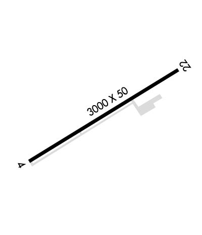
| Lat: N 4147.4 Long: W 12323.3 Elev: 1209 Var: -18 Longest Runway: 3000 | ||
| CTAF: 122.9 | ||
| ||||||||||||||||||||||||||||||||
| ||||||||||||||||||||||||||||||||
| Rwy | Rwy | |||||||
| 3000x50 | 3000' | 3000x50 | 3000' | |||||
| Runway ID | Single Wheel | Double Wheel | Double Tandem Wheel | Dual Double Wheel |
| 04/22 | 30,000 | N/A | N/A | N/A |
| These numbers are Advisory and are not limits. The Airport Manager should have more accurate Weight Limits | ||||
| FltPlan does not have IFR approach charts available for K36S. |
 Airport Diagram might not be current. | |
| Facility Name: | HAPPY CAMP |
| City Name: | HAPPY CAMP |
| County: | SISKIYOU |
| State abbrev: | CA |
| State Name: | CALIFORNIA |
| Ownership: | PUBLICLY OWNED |
| Use: | OPEN TO THE PUBLIC |
| Owner's Name: | U.S. FOREST SERVICE; OPERD/MAINTD BY SISKIYOU COUNTY. |
| Address: | 63822 HIGHWAY 96 |
| HAPPY CAMP, CA 96039-0377 | |
| Owner's Phone: | 530-493-1730 |
| Manager's Name: | JOY D HALL; DIRECTOR OF AIRPORTS OFFICE IN YREKA. ASTUMBAUGH@CO.SISKIYOU.CA.US. |
| Address: | 190 GREENHORN ROAD |
| YREKA, CA 96097 | |
| Phone: | 530-842-8259 |
| FAA Region: | WESTERN-PACIFIC |
| FAA Field Office: | SFO |
| Date | Sunrise | Sunset |
|---|---|---|
| 06/07/26 Sunday | 5:39 | 20:46 |
| 06/08/26 Monday | 5:39 | 20:47 |
| 06/09/26 Tuesday | 5:39 | 20:47 |
| 06/10/26 Wednesday | 5:38 | 20:48 |
| 06/11/26 Thursday | 5:38 | 20:48 |
| 06/12/26 Friday | 5:38 | 20:49 |
| 06/13/26 Saturday | 5:38 | 20:49 |
| 06/14/26 Sunday | 5:38 | 20:50 |
| 06/15/26 Monday | 5:38 | 20:50 |
| 06/16/26 Tuesday | 5:38 | 20:50 |
| 06/17/26 Wednesday | 5:38 | 20:51 |
| 06/18/26 Thursday | 5:38 | 20:51 |
| 06/19/26 Friday | 5:38 | 20:51 |
| 06/20/26 Saturday | 5:39 | 20:52 |
| Airport Attendance Schedule | UNATTENDED |
| Airport Status | OPERATIONAL (This Status can change at any time - please check NOTAMS) |
| Airport Lighting Schedule | |
| Airport Storage Available | Tie Downs |
| Extra Services Available | NONE |
| Wind Indicator | YES - (unlit) |
| Control Tower | NO |
| CTAF Frequency | 122.900 |
| Unicom Frequency | |
| Rotating Beacon Color | |
| Segmented Circle | YES |
| Landing Fee | NO |
| Airport Inspected | STATE - performed by STATE AERONAUTICAL PERSONNEL |
| Inspection Date | 02/10/2021 |
| Type of Fuel Available | None |
| Airframe Repair Service | NONE |
| Power Plant Repair Service | NONE |
| Latitude | N4147.4 |
| Longitude | W12323.3 (ESTIMATED) |
| Arpt Elevation | 1209ft (SURVEYED) |
| Magnetic Variation | 18E |
| 0 miles SW | of HAPPY CAMP |
| Traffic Pattern Altitude | |
| Sectional Chart | KLAMATH FALLS |
| Operations (Reported) | Yearly | Avg. Daily |
|---|---|---|
| General Aviation Transient | 0 | 0 |
| General Aviation Local | 0 | 0 |
| Air Taxi | 0 | 0 |
| Commerical | 0 | 0 |
| Commuter | 0 | 0 |
| Military | 0 | 0 |
| Aircraft based on Field | |
|---|---|
| General Aviation Singles | 0 |
| General Aviation Multi | 0 |
| Jet Aircraft | 0 |
| General Aviation Helicopters | 0; US FOREST SVC MANS HELIPORT MAY THROUGH SEP. |
| Military Aircraft | 0 |
| Gliders | 0 |
| Ultralights | 0 |
| FSS on field | NO |
| FSS tie-in | RANCHO MURIETA |
| FSS Phone | 1-800-WX-BRIEF |
| Who issues Notams | RIU |
| Notam D service at airport | YES |
| ARTCC Name | SEATTLE |
| Airport Certification | |
| Aircraft Rescue & Firefighting Index | None |
| Airport of Entry | No |
| Custom Landing Rights | No |
| Joint Civil/Military | No |
| Military Landing rights | YES |
| GRANT AGREEMENTS UNDER FAAP/ADAP/AIP |
| ASSURANCES PURSUANT TO TITLE VI, CIVIL RIGHTS ACT OF 1964 |
| RWY 22 HAS +35' TREES 600' FROM THLD 125' EITHER SIDE OF CNTRLN. |
| (E94) US FOREST SERVICE. |
| FOR CD CTC SEATTLE ARTCC AT 253-351-3694. |
| Runway: 04 | Runway: 22 | ||
| Mag heading: | N/A | Mag heading: | N/A |
| Approach: | Approach: | ||
| Pattern: | Right Traffic | Pattern: | Left Traffic |
| Markings: | BASIC | Markings: | BASIC |
| Marking Condition: | FAIR | Marking Condition: | FAIR |
| Arresting Dev: | Arresting Dev: | ||
| Lat & Long: | N4147.3 W12323.6 | Lat. & Long.: | N4147.6 W12323.1 |
| Elev: | N/A | Elev: | N/A |
| TCH: | TCH: | ||
| Visual Glide Path: | Visual Glide Path: | ||
| Displaced Threshold: | No | Displaced Threshold: | No |
| Touchdown Zone: | NO | Touchdown Zone: | NO |
| Touchdown Elev.: | Touchdown Elev.: | ||
| Visual Glide Slope: | Visual Glide Slope: | ||
| RVR Equipment: | RVR Equipment: | ||
| RVV Equipment: | NO | RVV Equipment: | NO |
| Approach Lights: | Approach Lights: | ||
| REIL: | NO | REIL: | NO |
| Centerline Lights: | NO | Centerline Lights: | NO |
| Touchdown lights: | NO | Touchdown lights: | NO |
| Runway Category: | Runway with a Visual Approach | Runway Category: | Runway with a Visual Approach |
| Declared Distances: | Declared Distances: | ||
| Obstructions: | TREE; RY 04 TREE AND SHRUB COVERED RISING TERRAIN. | Obstructions: | BRUSH; RY 22 TREE AND SHRUB COVERED RISING TERRAIN. |
| Marked: | NOT Marked/Lighted | Marked: | NOT Marked/Lighted |
| Clearance slope: | 12:1; RY 04 APCH SLOPE 12:1 DUE TO 25 FT TREE 500 FT FM THLD. | Clearance slope: | RY 22 APCH SLOPE 0:0 DUE TO 10 FT SHRUBS 200 FT FM THLD. |
| Obstruction height: | 25 feet AGL | Obstruction height: | 10 feet AGL |
| Dist. from runway: | 500 feet | Dist. from runway: | 200 feet |
| Centerline offset: | 120 left of centerline | Centerline offset: | 125 feet right of centerline |
| Comments: | RWY 04 HAS 3 FT FENCE O FEET FROM RWY END AND 80 FEET L. | Comments: | RY 22 HAS 8 FT SHRUB 0 FEET FM RY END AND 115 FT RIGHT. |
Thanks for using FltPlan.com
all rights reserved © 1999-2026 by Flight Plan LLC
