
| GRAYS CREEK FAYETTEVILLE NC |
| |
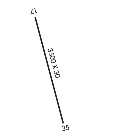
| Lat: N 3453.6 Long: W 07850.6 Elev: 160 Var: +06 Longest Runway: 3500 | ||
| CTAF: 122.9 | ||
| ||||||
|
| Rwy | Rwy | |||||||
| 3500x30 | 3500' | 3500x30 | 3150' | |||||
| Runway ID | Single Wheel | Double Wheel | Double Tandem Wheel | Dual Double Wheel |
| 17/35 | 8,000 | N/A | N/A | N/A |
| These numbers are Advisory and are not limits. The Airport Manager should have more accurate Weight Limits | ||||
| FltPlan does not have IFR approach charts available for K2GC. |
 Airport Diagram might not be current. | |
| Facility Name: | GRAYS CREEK |
| City Name: | FAYETTEVILLE |
| County: | CUMBERLAND |
| State abbrev: | NC |
| State Name: | NORTH CAROLINA |
| Ownership: | PRIVATELY OWNED |
| Use: | OPEN TO THE PUBLIC |
| Owner's Name: | ROGER DALE & CINDY SMITH |
| Address: | 7154 BUTLER NURSERY ROAD |
| FAYETTEVILLE, NC 28306 | |
| Owner's Phone: | 910-483-4114 |
| Manager's Name: | CINDY B SMITH |
| Address: | 7154 BUTLER NURSERY ROAD |
| FAYETTEVILLE, NC 28306 | |
| Phone: | 910-286-3435 |
| FAA Region: | SOUTHERN |
| FAA Field Office: | MEM |
| Date | Sunrise | Sunset |
|---|---|---|
| 09/24/21 Friday | 7:05 | 19:10 |
| 09/25/21 Saturday | 7:05 | 19:08 |
| 09/26/21 Sunday | 7:06 | 19:07 |
| 09/27/21 Monday | 7:07 | 19:05 |
| 09/28/21 Tuesday | 7:08 | 19:04 |
| 09/29/21 Wednesday | 7:08 | 19:03 |
| 09/30/21 Thursday | 7:09 | 19:01 |
| 10/01/21 Friday | 7:10 | 19:00 |
| 10/02/21 Saturday | 7:11 | 18:58 |
| 10/03/21 Sunday | 7:11 | 18:57 |
| 10/04/21 Monday | 7:12 | 18:56 |
| 10/05/21 Tuesday | 7:13 | 18:54 |
| 10/06/21 Wednesday | 7:14 | 18:53 |
| 10/07/21 Thursday | 7:15 | 18:51 |
| Airport Attendance Schedule | MON-FRI 0800-1700; WKENDS BY APPOINTMENT ONLY CALL 910-286-3435 |
| Airport Status | OPERATIONAL (This Status can change at any time - please check NOTAMS) |
| Airport Lighting Schedule | FOR LIRL RY 17/35 CALL (910) 483-4114. |
| Airport Storage Available | Tie Downs |
| Extra Services Available | Flight Instruction, Aircraft Rental |
| Wind Indicator | YES - (unlit) |
| Control Tower | NO |
| CTAF Frequency | 122.900 |
| Unicom Frequency | |
| Rotating Beacon Color | |
| Segmented Circle | NO |
| Landing Fee |
| Airport Inspected | STATE - performed by STATE AERONAUTICAL PERSONNEL |
| Inspection Date | 07/04/2019 |
| Type of Fuel Available | Grade 100LL |
| Airframe Repair Service | MAJOR |
| Power Plant Repair Service | MAJOR |
| Latitude | N3453.6 |
| Longitude | W07850.6 (ESTIMATED) |
| Arpt Elevation | 160ft (ESTIMATED) |
| Magnetic Variation | 06W |
| 9 miles S | of FAYETTEVILLE |
| Traffic Pattern Altitude | |
| Sectional Chart | CHARLOTTE |
| Operations (Reported) | Yearly | Avg. Daily |
|---|---|---|
| General Aviation Transient | 2000 | 5 |
| General Aviation Local | 5000 | 14 |
| Air Taxi | 0 | 0 |
| Commerical | 0 | 0 |
| Commuter | 0 | 0 |
| Military | 100 | 0 |
| Aircraft based on Field | |
|---|---|
| General Aviation Singles | 25 |
| General Aviation Multi | 0 |
| Jet Aircraft | 0 |
| General Aviation Helicopters | 0 |
| Military Aircraft | 0 |
| Gliders | 0 |
| Ultralights | 0 |
| FSS on field | NO |
| FSS tie-in | RALEIGH |
| FSS Phone | 1-800-WX-BRIEF |
| Who issues Notams | RDU |
| Notam D service at airport | YES |
| ARTCC Name | WASHINGTON |
| Airport Certification | |
| Aircraft Rescue & Firefighting Index | None |
| Airport of Entry | No |
| Custom Landing Rights | No |
| Joint Civil/Military | No |
| Military Landing rights | No |
| TAXI ON THE GRASS APRON AT A SLOW SPEED DUE TO UNEVEN SOD SURFACE. |
| EXERCISE CAUTION WITH NIGHT LANDING DUE TO NONSTANDARD LIGHTING OFFSET FROM PVMT GIVING PERCEPTION RUNWAY WIDER. |
| FOR CD CTC WASHINGTON ARTCC AT 703-771-3587. |
| RWY 17 NONSTANDARD END LIGHTS DSPLCD 122 FT FM END |
| RWY 17/3 5 NSTD LIRL; FIRST 350 FT RY 35 NOT LIGHTED. |
| Runway: 17 | Runway: 35 | ||
| Mag heading: | N/A | Mag heading: | N/A |
| Approach: | Approach: | ||
| Pattern: | Left Traffic | Pattern: | Left Traffic |
| Markings: | BASIC | Markings: | BASIC |
| Marking Condition: | FAIR | Marking Condition: | FAIR |
| Arresting Dev: | Arresting Dev: | ||
| Lat & Long: | Lat. & Long.: | ||
| Elev: | N/A | Elev: | N/A |
| TCH: | TCH: | ||
| Visual Glide Path: | Visual Glide Path: | ||
| Displaced Threshold: | No | Displaced Threshold: | 350 feet; LGTD THR RELCTD 350 FT; 3150 FT OF RY 17/35 USBL AT NGT. |
| Touchdown Zone: | NO | Touchdown Zone: | NO |
| Touchdown Elev.: | Touchdown Elev.: | ||
| Visual Glide Slope: | Visual Glide Slope: | ||
| RVR Equipment: | RVR Equipment: | ||
| RVV Equipment: | NO | RVV Equipment: | NO |
| Approach Lights: | Approach Lights: | ||
| REIL: | NO | REIL: | NO |
| Centerline Lights: | NO | Centerline Lights: | NO |
| Touchdown lights: | NO | Touchdown lights: | NO |
| Runway Category: | Runway with a Visual Approach | Runway Category: | Runway with a Visual Approach |
| Declared Distances: | Declared Distances: | ||
| Obstructions: | CROPS | Obstructions: | TREES; RWY 35 APCH ALSO HAS 40 FT UNMKD PLINE 800 FT FM DSPLCD THLD ON CNTRLN EXTDD. |
| Marked: | NOT Marked/Lighted | Marked: | NOT Marked/Lighted |
| Clearance slope: | Clearance slope: | APCH RATIO 4:1 TO DSPLCD THLD. | |
| Obstruction height: | 10 feet AGL | Obstruction height: | 81 feet AGL |
| Dist. from runway: | 201 feet | Dist. from runway: | 249 feet |
| Centerline offset: | Centerline offset: | 59 feet left of centerline | |
| Comments: | 10 FT CROPS 0-200 FT FM THR BOTH SIDES OF CNTRLN | Comments: | 14 FT BLDG 169 FT FM THR OFFSET 79 FT L OF CNTRLN; AND 8 FT CROPS 0-200 FT FM THR OFFSET 58 FT RIGHT OF CNTRLN. |
Thanks for using FltPlan.com
all rights reserved © 1999-2021 by Flight Plan LLC
