
| MOREY'S (CLOSED) MOTLEY MN |
| |
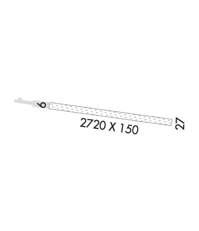
| Lat: N 4619.4 Long: W 09438.3 Elev: 1225 Var: -04 Longest Runway: 2720 | ||
| CTAF: 122.9 | ||
| ||||||||||||||||||||||||||||||||
| ||||||||||||||||||||||||||||||||
| Rwy | Rwy | |||||||
| 2720x150 | 2720' | 2720x150 | 2720' | |||||
| Runway ID | Single Wheel | Double Wheel | Double Tandem Wheel | Dual Double Wheel |
| These numbers are Advisory and are not limits. The Airport Manager should have more accurate Weight Limits | ||||
| FltPlan does not have IFR approaches charts available for K22Y. |
 Airport Diagram might not be current. | |
| Facility Name: | MOREY'S |
| City Name: | MOTLEY |
| County: | MORRISON |
| State abbrev: | MN |
| State Name: | MINNESOTA |
| Ownership: | PRIVATELY OWNED |
| Use: | OPEN TO THE PUBLIC |
| Owner's Name: | LOREN A. MOREY |
| Address: | 38503 30TH AVE |
| MOTLEY, MN 56466 | |
| Owner's Phone: | 218-352-6467 |
| Manager's Name: | LOREN A. MOREY |
| Address: | 38503 30TH AVE |
| MOTLEY, MN 56466 | |
| Phone: | 218-352-6467 |
| FAA Region: | GREAT LAKES |
| FAA Field Office: | DMA |
| Date | Sunrise | Sunset |
|---|---|---|
| 08/10/17 Thursday | 6:11 | 20:36 |
| 08/11/17 Friday | 6:12 | 20:35 |
| 08/12/17 Saturday | 6:13 | 20:33 |
| 08/13/17 Sunday | 6:15 | 20:32 |
| 08/14/17 Monday | 6:16 | 20:30 |
| 08/15/17 Tuesday | 6:17 | 20:28 |
| 08/16/17 Wednesday | 6:18 | 20:27 |
| 08/17/17 Thursday | 6:20 | 20:25 |
| 08/18/17 Friday | 6:21 | 20:23 |
| 08/19/17 Saturday | 6:22 | 20:21 |
| 08/20/17 Sunday | 6:23 | 20:20 |
| 08/21/17 Monday | 6:25 | 20:18 |
| 08/22/17 Tuesday | 6:26 | 20:16 |
| 08/23/17 Wednesday | 6:27 | 20:14 |
| Airport Attendance Schedule | UNATTENDED |
| Airport Status | OPERATIONAL (This Status can change at any time - please check NOTAMS) |
| Airport Lighting Schedule | |
| Airport Storage Available | Tie Downs |
| Extra Services Available | NONE |
| Wind Indicator | YES - (unlit) |
| Control Tower | NO |
| CTAF Frequency | 122.900 |
| Unicom Frequency | |
| Rotating Beacon Color | |
| Segmented Circle | NO |
| Landing Fee | NO |
| Airport Inspected | STATE - performed by STATE AERONAUTICAL PERSONNEL |
| Inspection Date | 06/24/2016 |
| Type of Fuel Available | None |
| Airframe Repair Service | None |
| Power Plant Repair Service | None |
| Latitude | N4619.4 |
| Longitude | W09438.3 (ESTIMATED) |
| Arpt Elevation | 1225ft (ESTIMATED) |
| Magnetic Variation | 04E |
| 1 miles S | of MOTLEY |
| Traffic Pattern Altitude | |
| Sectional Chart | TWIN CITIES |
| Operations (Reported) | Yearly | Avg. Daily |
|---|---|---|
| General Aviation Transient | 1725 | 5 |
| General Aviation Local | 900 | 2 |
| Air Taxi | 0 | 0 |
| Commerical | 0 | 0 |
| Commuter | 0 | 0 |
| Military | 0 | 0 |
| Aircraft based on Field | |
|---|---|
| General Aviation Singles | 1 |
| General Aviation Multi | 0 |
| Jet Aircraft | 0 |
| General Aviation Helicopters | 0 |
| Military Aircraft | 0 |
| Gliders | 0 |
| Ultralights | 0 |
| FSS on field | NO |
| FSS tie-in | PRINCETON |
| FSS Phone | 1-800-WX-BRIEF |
| Who issues Notams | PNM |
| Notam D service at airport | YES |
| ARTCC Name | MINNEAPOLIS |
| Airport Certification | |
| Aircraft Rescue & Firefighting Index | None |
| Airport of Entry | No |
| Custom Landing Rights | No |
| Joint Civil/Military | No |
| Military Landing rights | No |
| LGTD AND MKD 1533' MSL TOWER LCTD 1.3 NM WEST OF ARPT. |
| ARPT CLSD WHEN SNOW COVERED; CONFIRM CONDITIONS WITH AMGR ON 218-352-6467. |
| Runway: 09 | Runway: 27 | ||
| Mag heading: | 97° | Mag heading: | 277° |
| Rwy Slope: | .00% | Rwy Slope: | .00% |
| Approach: | Approach: | ||
| Pattern: | Left Traffic | Pattern: | Left Traffic |
| Markings: | Markings: | ||
| Marking Condition: | RY 09/27 MKD WITH YELLOW CONES. | Marking Condition: | |
| Arresting Dev: | Arresting Dev: | ||
| Lat & Long: | N4619.5 W09438.6 | Lat. & Long.: | N4619.4 W09438.0 |
| Elev: | 1225.0 ft. MSL | Elev: | 1225.0 ft. MSL |
| TCH: | TCH: | ||
| Visual Glide Path: | Visual Glide Path: | ||
| Displaced Threshold: | No | Displaced Threshold: | No |
| Touchdown Zone: | YES | Touchdown Zone: | YES |
| Touchdown Elev.: | 1225.0 feet | Touchdown Elev.: | 1225.0 feet |
| Visual Glide Slope: | Visual Glide Slope: | ||
| RVR Equipment: | RVR Equipment: | ||
| RVV Equipment: | NO | RVV Equipment: | NO |
| Approach Lights: | Approach Lights: | ||
| REIL: | NO | REIL: | NO |
| Centerline Lights: | NO | Centerline Lights: | NO |
| Touchdown lights: | NO | Touchdown lights: | NO |
| Runway Category: | Runway with a Visual Approach | Runway Category: | Runway with a Visual Approach |
| Declared Distances: | Declared Distances: | ||
| Obstructions: | TREE | Obstructions: | |
| Marked: | NOT Marked/Lighted | Marked: | |
| Clearance slope: | 3:1 | Clearance slope: | 20:1 |
| Obstruction height: | 31 feet AGL | Obstruction height: | |
| Dist. from runway: | 95 feet | Dist. from runway: | |
| Centerline offset: | 130 right of centerline | Centerline offset: | |
| Comments: | Comments: |
Thanks for using FltPlan.com
all rights reserved © 1999-2017 by Flight Plan LLC
