| KINGSTON-ULSTER KINGSTON NY |
| |
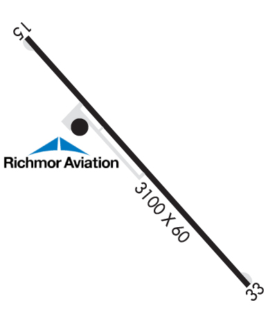
| Lat: N 4159.1 Long: W 07357.9 Elev: 147 Var: +13 Longest Runway: 3100 | ||
| AWOS: 122.8 CTAF: 122.8 | ||
| |||||||||||||||||||||||
| |||||||||||||||||||||||
| |||||||||||||||||||||||
| Rwy | Rwy | |||||||
| 3100x60 | 2865' | 3100x60 | 2791' | |||||
| Runway ID | Single Wheel | Double Wheel | Double Tandem Wheel | Dual Double Wheel |
| 15/33 | 12,500 | N/A | N/A | N/A |
| These numbers are Advisory and are not limits. The Airport Manager should have more accurate Weight Limits | ||||
 Airport Diagram might not be current. | |
| Facility Name: | KINGSTON-ULSTER |
| City Name: | KINGSTON |
| County: | ULSTER |
| State abbrev: | NY |
| State Name: | NEW YORK |
| Ownership: | PRIVATELY OWNED |
| Use: | OPEN TO THE PUBLIC |
| Owner's Name: | KINGSTON-ULSTER ARPT INC. |
| Address: | 1161 FLATBUSH RD |
| KINGSTON, NY 12401 | |
| Owner's Phone: | 845-336-5926 |
| Manager's Name: | TODD COGGESHALL |
| Address: | 1161 FLATBUSH AVE |
| KINGSTON, NY 12401 | |
| Phone: | 845-481-1559 |
| FAA Region: | EASTERN |
| FAA Field Office: | NYC |

| Date | Sunrise | Sunset |
|---|---|---|
| 06/08/26 Monday | 5:20 | 20:29 |
| 06/09/26 Tuesday | 5:20 | 20:30 |
| 06/10/26 Wednesday | 5:20 | 20:31 |
| 06/11/26 Thursday | 5:20 | 20:31 |
| 06/12/26 Friday | 5:20 | 20:32 |
| 06/13/26 Saturday | 5:20 | 20:32 |
| 06/14/26 Sunday | 5:20 | 20:33 |
| 06/15/26 Monday | 5:20 | 20:33 |
| 06/16/26 Tuesday | 5:20 | 20:33 |
| 06/17/26 Wednesday | 5:20 | 20:34 |
| 06/18/26 Thursday | 5:20 | 20:34 |
| 06/19/26 Friday | 5:20 | 20:34 |
| 06/20/26 Saturday | 5:20 | 20:35 |
| 06/21/26 Sunday | 5:20 | 20:35 |
| Airport Attendance Schedule | JAN-DEC 7 Days A Week 0900-1700; UNATNDD THANKSGIVING AND CHRISTMAS. |
| Airport Status | OPERATIONAL (This Status can change at any time - please check NOTAMS) |
| Airport Lighting Schedule | ACTVT PAPI RYS 15 & 33 - 123.3. MIRL RY 15/33; REIL RY 33 & TWY LGTS OPERATE 123.3 DUSK-DAWN. |
| Airport Storage Available | Tie Downs |
| Extra Services Available | Flight Instruction, Aircraft Rental |
| Wind Indicator | YES - (lighted) |
| Control Tower | NO |
| CTAF Frequency | 122.800 |
| Unicom Frequency | 122.800; AUTOMATED UNICOM. |
| Rotating Beacon Color | |
| Segmented Circle | YES |
| Landing Fee | YES |
| Airport Inspected | STATE - performed by STATE AERONAUTICAL PERSONNEL |
| Inspection Date | 07/30/2025 |
| Type of Fuel Available | Grade 100LL, JET A (freeze point -40C) |
| Airframe Repair Service | MAJOR |
| Power Plant Repair Service | MAJOR |
| Latitude | N4159.1 |
| Longitude | W07357.9 (ESTIMATED) |
| Arpt Elevation | 147ft (SURVEYED) |
| Magnetic Variation | 13W |
| 4 miles N | of KINGSTON |
| Traffic Pattern Altitude | |
| Sectional Chart | NEW YORK |
| Operations (Reported) | Yearly | Avg. Daily |
|---|---|---|
| General Aviation Transient | 0 | 0 |
| General Aviation Local | 0 | 0 |
| Air Taxi | 0 | 0 |
| Commerical | 0 | 0 |
| Commuter | 0 | 0 |
| Military | 0 | 0 |
| Aircraft based on Field | |
|---|---|
| General Aviation Singles | 0 |
| General Aviation Multi | 0 |
| Jet Aircraft | 0 |
| General Aviation Helicopters | 0 |
| Military Aircraft | 0 |
| Gliders | 0 |
| Ultralights | 0 |
| FSS on field | NO |
| FSS tie-in | NEW YORK |
| FSS Phone | 1-800-WX-BRIEF |
| Who issues Notams | ISP |
| Notam D service at airport | YES |
| ARTCC Name | NEW YORK |
| Airport Certification | |
| Aircraft Rescue & Firefighting Index | None |
| Airport of Entry | No |
| Custom Landing Rights | No |
| Joint Civil/Military | No |
| Military Landing rights | No |
| NATIONAL PLAN OF INTEGRATED AIRPORT SYSTEMS (NPIAS) |
| GRANT AGREEMENTS UNDER FAAP/ADAP/AIP |
| ASSURANCES PURSUANT TO TITLE VI, CIVIL RIGHTS ACT OF 1964 |
| NO LINE OF SIGHT BTN RY 33 HOLD LINE & ACFT IN FINAL .25 MI OF APCH TO RY 33. |
| RENTAL CAR AVBL - 845-338-6929. |
| FOR CD CTC NEW YORK APCH AT 516-683-2448 |
| PAEW ADJACENT TWY/RWY. |
| VOLUNTARY NOISE ABTMT PROC IN EFCT. AVOID OVERFLIGHT OF HOUSING DEVELOPMENT ADJ TO N END OF RWY. |
| NO RUNUPS AT RY 15 THLD. |
Airport Communications & Frequencies:
| ||||||||||||||
| Runway: 15 | Runway: 33 | ||
| Mag heading: | 153° | Mag heading: | 333° |
| Rwy Slope: | -.45% Down | Rwy Slope: | .45% Up |
| Approach: | Approach: | ||
| Pattern: | Left Traffic | Pattern: | Left Traffic |
| Markings: | NONPRECISION INSTRUMENT | Markings: | NONPRECISION INSTRUMENT |
| Marking Condition: | GOOD | Marking Condition: | GOOD |
| Arresting Dev: | Arresting Dev: | ||
| Lat & Long: | N4159.3 W07358.1 | Lat. & Long.: | N4158.9 W07357.6 |
| Elev: | 147.3 ft. MSL | Elev: | 133.4 ft. MSL |
| TCH: | 50 ft. AGL | TCH: | 53 ft. AGL |
| Visual Glide Path: | 4.50 degrees | Visual Glide Path: | 3.60 degrees |
| Displaced Threshold: | 235 feet | Displaced Threshold: | 309 feet |
| Touchdown Zone: | YES | Touchdown Zone: | YES |
| Touchdown Elev.: | 147.3 feet | Touchdown Elev.: | 147.4 feet |
| Visual Glide Slope: | 2-Light PAPI on LEFT side of Runway; RY 15 PAPI UNUSABLE 5 DEGS LEFT OF COURSE & 8 DEGS RIGHT OF COURSE. | Visual Glide Slope: | 2-Light PAPI on LEFT side of Runway |
| RVR Equipment: | RVR Equipment: | ||
| RVV Equipment: | NO | RVV Equipment: | NO |
| Approach Lights: | Approach Lights: | ||
| REIL: | NO | REIL: | YES |
| Centerline Lights: | NO | Centerline Lights: | NO |
| Touchdown lights: | NO | Touchdown lights: | NO |
| Runway Category: | Runway with a Non-precision Approach | Runway Category: | Runway with a Non-precision Approach |
| Declared Distances: | TORA:3100' TODA:3100' ASDA:3010' LDA:2775' | Declared Distances: | TORA:3100' TODA:3100' ASDA:2939' LDA:2630' |
| Obstructions: | TREE | Obstructions: | POLE |
| Marked: | NOT Marked/Lighted | Marked: | LIGHTED |
| Clearance slope: | CTLNG OBSTN EXCEEDS A 45 DEG SLP. | Clearance slope: | 1:1; RY 33 HAS +73 FT TREES, 742 FT FM RY, 85 FT LT, CLNC SLOPE 14:1 BASED ON DSPLCD THLD. |
| Obstruction height: | 75 feet AGL | Obstruction height: | 33 feet AGL |
| Dist. from runway: | 214 feet | Dist. from runway: | 257 feet |
| Centerline offset: | 183 right of centerline | Centerline offset: | 178 feet left of centerline |
| Comments: | RWY 15: 25 FT LIGHT POLE, 136 FT FM RWY 116 FT LEFT. 12 FENCE, 125 FT FM RWY LEFT & RIGHT. 61 FT TREE 126 FT FM RWY 181 FT LEFT. 15 FT ROAD, 135 FT FM RWY LEFT & RIGHT. | Comments: | RWY 33: 7 FT FENCE, 164 FT FM RWY; 8 FT SHED, 152 FT FM RWY 126 FT LEFT. |
Thanks for using FltPlan.com
all rights reserved © 1999-2026 by Flight Plan LLC