
| ROBBINS FIELD ONEONTA AL |
| |
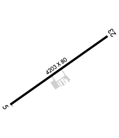
| Lat: N 3358.3 Long: W 08622.8 Elev: 1125 Var: +03 Longest Runway: 4203 | ||
| CTAF: 122.8 | ||
| ||||||||||||||||||||||||||||||||
| ||||||||||||||||||||||||||||||||
| Rwy | Rwy | |||||||
| 4203x80 | 4203' | 4203x80 | 4098' | |||||
| Runway ID | Single Wheel | Double Wheel | Double Tandem Wheel | Dual Double Wheel |
| 06/24 | 20,000 | 35,000 | 55,000 | N/A |
| These numbers are Advisory and are not limits. The Airport Manager should have more accurate Weight Limits | ||||
 Airport Diagram might not be current. | |
| Facility Name: | ROBBINS FLD |
| City Name: | ONEONTA |
| County: | BLOUNT |
| State abbrev: | AL |
| State Name: | ALABAMA |
| Ownership: | PUBLICLY OWNED |
| Use: | OPEN TO THE PUBLIC |
| Owner's Name: | CITY OF ONEONTA & BLOUNT CTY. |
| Address: | 202 3RD AVE EAST |
| ONEONTA, AL 35121 | |
| Owner's Phone: | 205-274-2150 |
| Manager's Name: | BRANDON HORTON |
| Address: | 202 3RD AVE EAST |
| ONEONTA, AL 35121 | |
| Phone: | 205-960-3553 |
| FAA Region: | SOUTHERN |
| FAA Field Office: | JAN |
| Date | Sunrise | Sunset |
|---|---|---|
| 06/08/26 Monday | 5:34 | 19:55 |
| 06/09/26 Tuesday | 5:34 | 19:56 |
| 06/10/26 Wednesday | 5:34 | 19:56 |
| 06/11/26 Thursday | 5:34 | 19:57 |
| 06/12/26 Friday | 5:34 | 19:57 |
| 06/13/26 Saturday | 5:34 | 19:57 |
| 06/14/26 Sunday | 5:34 | 19:58 |
| 06/15/26 Monday | 5:34 | 19:58 |
| 06/16/26 Tuesday | 5:34 | 19:59 |
| 06/17/26 Wednesday | 5:34 | 19:59 |
| 06/18/26 Thursday | 5:34 | 19:59 |
| 06/19/26 Friday | 5:34 | 19:59 |
| 06/20/26 Saturday | 5:34 | 20:00 |
| 06/21/26 Sunday | 5:35 | 20:00 |
| Airport Attendance Schedule | UNATNDD 7 Days A Week ALL |
| Airport Status | OPERATIONAL (This Status can change at any time - please check NOTAMS) |
| Airport Lighting Schedule | ACTVT PAPI RWY 6; MIRL RWY 06/24 - CTAF. |
| Airport Storage Available | Tie Downs |
| Extra Services Available | Flight Instruction |
| Wind Indicator | YES - (lighted) |
| Control Tower | NO |
| CTAF Frequency | 122.800 |
| Unicom Frequency | 122.800 |
| Rotating Beacon Color | WG |
| Segmented Circle | YES |
| Landing Fee | NO |
| Airport Inspected | STATE - performed by STATE AERONAUTICAL PERSONNEL |
| Inspection Date | 12/10/2025 |
| Type of Fuel Available | None |
| Airframe Repair Service | NONE |
| Power Plant Repair Service | NONE |
| Latitude | N3358.3 |
| Longitude | W08622.8 (ESTIMATED) |
| Arpt Elevation | 1124ft (SURVEYED) |
| Magnetic Variation | 03W |
| 5 miles NE | of ONEONTA |
| Traffic Pattern Altitude | |
| Sectional Chart | ATLANTA |
| Operations (Reported) | Yearly | Avg. Daily |
|---|---|---|
| General Aviation Transient | 0 | 0 |
| General Aviation Local | 0 | 0 |
| Air Taxi | 0 | 0 |
| Commerical | 0 | 0 |
| Commuter | 0 | 0 |
| Military | 0 | 0 |
| Aircraft based on Field | |
|---|---|
| General Aviation Singles | 0 |
| General Aviation Multi | 0 |
| Jet Aircraft | 0 |
| General Aviation Helicopters | 0 |
| Military Aircraft | 0 |
| Gliders | 0 |
| Ultralights | 0 |
| FSS on field | NO |
| FSS tie-in | ANNISTON |
| FSS Phone | 1-800-WX-BRIEF |
| Who issues Notams | ANB |
| Notam D service at airport | YES |
| ARTCC Name | ATLANTA |
| Airport Certification | |
| Aircraft Rescue & Firefighting Index | None |
| Airport of Entry | No |
| Custom Landing Rights | No |
| Joint Civil/Military | No |
| Military Landing rights | YES |
| NATIONAL PLAN OF INTEGRATED AIRPORT SYSTEMS (NPIAS) |
| GRANT AGREEMENTS UNDER FAAP/ADAP/AIP |
| ASSURANCES PURSUANT TO TITLE VI, CIVIL RIGHTS ACT OF 1964 |
| DEER ON & INVOF ARPT. |
| FOR CD CTC BIRMINGHAM APCH AT (205) 769-3890. |
Airport Communications & Frequencies:
| ||||||||||||||
| Runway: 06 | Runway: 24 | ||
| Mag heading: | 58° | Mag heading: | 238° |
| Rwy Slope: | .40% Up | Rwy Slope: | -.40% Down |
| Approach: | Approach: | ||
| Pattern: | Left Traffic | Pattern: | Left Traffic |
| Markings: | NONPRECISION INSTRUMENT | Markings: | NONPRECISION INSTRUMENT |
| Marking Condition: | GOOD | Marking Condition: | GOOD |
| Arresting Dev: | Arresting Dev: | ||
| Lat & Long: | N3358.1 W08623.2 | Lat. & Long.: | N3358.5 W08622.5 |
| Elev: | 1108.1 ft. MSL | Elev: | 1124.8 ft. MSL |
| TCH: | 58 ft. AGL | TCH: | 33 ft. AGL |
| Visual Glide Path: | 4.00 degrees | Visual Glide Path: | 3.00 degrees |
| Displaced Threshold: | No | Displaced Threshold: | 105 feet |
| Touchdown Zone: | YES | Touchdown Zone: | YES |
| Touchdown Elev.: | 1120.8 feet | Touchdown Elev.: | 1124.9 feet |
| Visual Glide Slope: | 2-Light PAPI on LEFT side of Runway | Visual Glide Slope: | 2-Light PAPI on LEFT side of Runway |
| RVR Equipment: | RVR Equipment: | ||
| RVV Equipment: | NO | RVV Equipment: | NO |
| Approach Lights: | Approach Lights: | ||
| REIL: | NO | REIL: | NO |
| Centerline Lights: | NO | Centerline Lights: | NO |
| Touchdown lights: | NO | Touchdown lights: | NO |
| Runway Category: | Runway with a Non-precision Approach | Runway Category: | Runway with a Non-precision Approach |
| Declared Distances: | TORA:4098' TODA:4098' ASDA:4098' LDA:4098' | Declared Distances: | TORA:4203' TODA:4203' ASDA:4203' LDA:4098' |
Thanks for using FltPlan.com
all rights reserved © 1999-2026 by Flight Plan LLC
