
| NAVAJO LAKE NAVAJO DAM NM |
| |
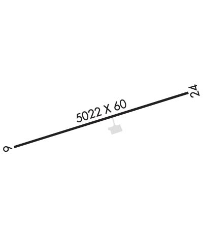
| Lat: N 3648.5 Long: W 10739.2 Elev: 6478 Var: -12 Longest Runway: 5022 | ||
| CTAF: 122.9 | ||
| ||||||||||||||||||||||||||||||||
| ||||||||||||||||||||||||||||||||
| Rwy | Rwy | |||||||
| 5022x60 | 5022' | 5022x60 | 5022' | |||||
| Runway ID | Single Wheel | Double Wheel | Double Tandem Wheel | Dual Double Wheel |
| 06/24 | 12,000 | N/A | N/A | N/A |
| These numbers are Advisory and are not limits. The Airport Manager should have more accurate Weight Limits | ||||
| FltPlan does not have IFR approach charts available for K1V0. |
 Airport Diagram might not be current. | |
| Facility Name: | NAVAJO LAKE |
| City Name: | NAVAJO DAM |
| County: | SAN JUAN |
| State abbrev: | NM |
| State Name: | NEW MEXICO |
| Ownership: | PUBLICLY OWNED |
| Use: | OPEN TO THE PUBLIC |
| Owner's Name: | NM STATE HWY & TRANS DEPT |
| Address: | PO BOX 9830 |
| ALBUQUERQUE, NM 87119 | |
| Owner's Phone: | 505-244-1788 |
| Manager's Name: | JESSI LITZ-ROWDEN |
| Address: | 3501 ACCESS RD C |
| ALBUQUERQUE, NM 87106 | |
| Phone: | 505-618-0301 |
| FAA Region: | SOUTHWEST |
| FAA Field Office: | LNM |
| Date | Sunrise | Sunset |
|---|---|---|
| 06/08/26 Monday | 5:51 | 20:28 |
| 06/09/26 Tuesday | 5:51 | 20:29 |
| 06/10/26 Wednesday | 5:51 | 20:29 |
| 06/11/26 Thursday | 5:51 | 20:30 |
| 06/12/26 Friday | 5:51 | 20:30 |
| 06/13/26 Saturday | 5:51 | 20:30 |
| 06/14/26 Sunday | 5:51 | 20:31 |
| 06/15/26 Monday | 5:51 | 20:31 |
| 06/16/26 Tuesday | 5:51 | 20:32 |
| 06/17/26 Wednesday | 5:51 | 20:32 |
| 06/18/26 Thursday | 5:51 | 20:32 |
| 06/19/26 Friday | 5:51 | 20:32 |
| 06/20/26 Saturday | 5:52 | 20:33 |
| 06/21/26 Sunday | 5:52 | 20:33 |
| Airport Attendance Schedule | UNATTENDED |
| Airport Status | OPERATIONAL (This Status can change at any time - please check NOTAMS) |
| Airport Lighting Schedule | |
| Airport Storage Available | Tie Downs |
| Extra Services Available | NONE |
| Wind Indicator | YES - (unlit) |
| Control Tower | NO |
| CTAF Frequency | 122.900 |
| Unicom Frequency | |
| Rotating Beacon Color | |
| Segmented Circle | YES |
| Landing Fee | NO |
| Airport Inspected | STATE - performed by PRIVATE CONTRACT PERSONNEL |
| Inspection Date | 04/15/2025 |
| Type of Fuel Available | None |
| Airframe Repair Service | NONE |
| Power Plant Repair Service | NONE |
| Latitude | N3648.5 |
| Longitude | W10739.2 (ESTIMATED) |
| Arpt Elevation | 6478ft (ESTIMATED) |
| Magnetic Variation | 12E |
| 3 miles NE | of NAVAJO DAM |
| Traffic Pattern Altitude | |
| Sectional Chart | DENVER |
| Operations (Reported) | Yearly | Avg. Daily |
|---|---|---|
| General Aviation Transient | 0 | 0 |
| General Aviation Local | 0 | 0 |
| Air Taxi | 0 | 0 |
| Commerical | 0 | 0 |
| Commuter | 0 | 0 |
| Military | 0 | 0 |
| Aircraft based on Field | |
|---|---|
| General Aviation Singles | 0 |
| General Aviation Multi | 0 |
| Jet Aircraft | 0 |
| General Aviation Helicopters | 0 |
| Military Aircraft | 0 |
| Gliders | 0 |
| Ultralights | 0 |
| FSS on field | NO |
| FSS tie-in | ALBUQUERQUE |
| FSS Phone | 1-800-WX-BRIEF |
| Who issues Notams | ABQ |
| Notam D service at airport | YES |
| ARTCC Name | DENVER |
| Airport Certification | |
| Aircraft Rescue & Firefighting Index | None |
| Airport of Entry | No |
| Custom Landing Rights | No |
| Joint Civil/Military | No |
| Military Landing rights | YES |
| NATIONAL PLAN OF INTEGRATED AIRPORT SYSTEMS (NPIAS) |
| GRANT AGREEMENTS UNDER FAAP/ADAP/AIP |
| CONVEYANCE UNDER SCETION 16, FEDERAL AIRPORT ACT OF 1946 OR SECTION 23, AIRPORT AND AIRWAY DEVELOPMENT ACT OF 1970 |
| ASSURANCES PURSUANT TO TITLE VI, CIVIL RIGHTS ACT OF 1964 |
| NO SNOW REMOVAL; PPR WHEN SNOW OR ICE ON RWY CALL 505-417-8368. |
| GATE ALWAYS LOCKED; COMBINATION SET TO FIELD ELEVATION LISTED ON ENTRANCE SIGN. |
| LIVESTOCK ON ARPT. |
| ARPT CLSD AT NIGHT. |
| ARPT LCTD ATOP MESA; STRONG DOWNDRAFTS ARE POSSIBLE ON SHORT FINAL TO RWY 06/24. |
| FOR CD CTC DENVER ARTCC AT 303-651-4257. |
| Runway: 06 | Runway: 24 | ||
| Mag heading: | 60° | Mag heading: | 240° |
| Rwy Slope: | .42% Up | Rwy Slope: | -.42% Down |
| Approach: | Approach: | ||
| Pattern: | Left Traffic | Pattern: | Left Traffic |
| Markings: | BASIC | Markings: | BASIC |
| Marking Condition: | GOOD | Marking Condition: | GOOD |
| Arresting Dev: | Arresting Dev: | ||
| Lat & Long: | N3648.4 W10739.6 | Lat. & Long.: | N3648.6 W10738.7 |
| Elev: | 6457.1 ft. MSL | Elev: | 6478.2 ft. MSL |
| TCH: | TCH: | ||
| Visual Glide Path: | Visual Glide Path: | ||
| Displaced Threshold: | No | Displaced Threshold: | No |
| Touchdown Zone: | NO | Touchdown Zone: | NO |
| Touchdown Elev.: | Touchdown Elev.: | ||
| Visual Glide Slope: | Visual Glide Slope: | ||
| RVR Equipment: | RVR Equipment: | ||
| RVV Equipment: | NO | RVV Equipment: | NO |
| Approach Lights: | Approach Lights: | ||
| REIL: | NO | REIL: | NO |
| Centerline Lights: | NO | Centerline Lights: | NO |
| Touchdown lights: | NO | Touchdown lights: | NO |
| Runway Category: | Runway with a Visual Approach | Runway Category: | Runway with a Visual Approach |
| Declared Distances: | Declared Distances: | ||
| Comments: | 2 TO 3 FT BRUSH 50-200 FT FM THR; 6 FT POLE 70 FT FM THR, 65 FT RIGHT. | Comments: |
Thanks for using FltPlan.com
all rights reserved © 1999-2026 by Flight Plan LLC
