
| MUD LAKE/WEST JEFFERSON COUNTY MUD LAKE ID |
| |
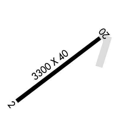
| Lat: N 4351.1 Long: W 11230.1 Elev: 4794 Var: -16 Longest Runway: 3300 | ||
| CTAF: 122.9 | ||
| ||||||||||||||||||||||||||||||||
| ||||||||||||||||||||||||||||||||
| Rwy | Rwy | |||||||
| 3300x40 | 2900' | 3300x40 | 3300' | |||||
| Runway ID | Single Wheel | Double Wheel | Double Tandem Wheel | Dual Double Wheel |
| 02/20 | N/A | N/A | N/A | N/A |
| These numbers are Advisory and are not limits. The Airport Manager should have more accurate Weight Limits | ||||
| FltPlan does not have IFR approach charts available for K1U2. |
 Airport Diagram might not be current. | |
| Facility Name: | MUD LAKE/WEST JEFFERSON COUNTY/ |
| City Name: | MUD LAKE |
| County: | JEFFERSON |
| State abbrev: | ID |
| State Name: | IDAHO |
| Ownership: | PUBLICLY OWNED |
| Use: | OPEN TO THE PUBLIC |
| Owner's Name: | CITY OF MUD LAKE |
| Address: | PO BOX 131 |
| TERRETON, ID 83450 | |
| Owner's Phone: | 208-663-4567 |
| Manager's Name: | SHAWN CALDER |
| Address: | 1583N 1000 E |
| MUD LAKE, ID 83450 | |
| Phone: | 208-681-0418 |
| FAA Region: | NORTHWEST MOUNTAIN |
| FAA Field Office: | HLN |
| Date | Sunrise | Sunset |
|---|---|---|
| 09/24/21 Friday | 7:19 | 19:24 |
| 09/25/21 Saturday | 7:20 | 19:22 |
| 09/26/21 Sunday | 7:22 | 19:20 |
| 09/27/21 Monday | 7:23 | 19:18 |
| 09/28/21 Tuesday | 7:24 | 19:17 |
| 09/29/21 Wednesday | 7:25 | 19:15 |
| 09/30/21 Thursday | 7:26 | 19:13 |
| 10/01/21 Friday | 7:27 | 19:11 |
| 10/02/21 Saturday | 7:29 | 19:09 |
| 10/03/21 Sunday | 7:30 | 19:08 |
| 10/04/21 Monday | 7:31 | 19:06 |
| 10/05/21 Tuesday | 7:32 | 19:04 |
| 10/06/21 Wednesday | 7:33 | 19:02 |
| 10/07/21 Thursday | 7:35 | 19:00 |
| Airport Attendance Schedule | MAY-OCT 7 Days A Week 0800-1700, NOV-APR Irregular Attendance IREG |
| Airport Status | OPERATIONAL (This Status can change at any time - please check NOTAMS) |
| Airport Lighting Schedule | SS-SR |
| Airport Storage Available | Tie Downs |
| Extra Services Available | Crop Dusting |
| Wind Indicator | YES - (unlit) |
| Control Tower | NO |
| CTAF Frequency | 122.900 |
| Unicom Frequency | |
| Rotating Beacon Color | CLEAR-GREEN (Light Land Airport) |
| Segmented Circle | YES |
| Landing Fee | NO |
| Airport Inspected | STATE - performed by STATE AERONAUTICAL PERSONNEL |
| Inspection Date | 07/16/2021 |
| Type of Fuel Available | None |
| Airframe Repair Service | MAJOR |
| Power Plant Repair Service | MAJOR |
| Latitude | N4351.1 |
| Longitude | W11230.1 (ESTIMATED) |
| Arpt Elevation | 4794ft (ESTIMATED) |
| Magnetic Variation | 16E |
| 1 miles NW | of MUD LAKE |
| Traffic Pattern Altitude | |
| Sectional Chart | SALT LAKE CITY |
| Operations (Reported) | Yearly | Avg. Daily |
|---|---|---|
| General Aviation Transient | 1000 | 3 |
| General Aviation Local | 2500 | 7 |
| Air Taxi | 5 | 0 |
| Commerical | 0 | 0 |
| Commuter | 0 | 0 |
| Military | 0 | 0 |
| Aircraft based on Field | |
|---|---|
| General Aviation Singles | 8 |
| General Aviation Multi | 0 |
| Jet Aircraft | 0 |
| General Aviation Helicopters | 0 |
| Military Aircraft | 0 |
| Gliders | 0 |
| Ultralights | 0 |
| FSS on field | NO |
| FSS tie-in | BOISE |
| FSS Phone | 1-800-WX-BRIEF |
| Who issues Notams | BOI |
| Notam D service at airport | YES |
| ARTCC Name | SALT LAKE CITY |
| Airport Certification | |
| Aircraft Rescue & Firefighting Index | None |
| Airport of Entry | No |
| Custom Landing Rights | No |
| Joint Civil/Military | No |
| Military Landing rights | No |
| NGT OPS RECOMMENDED ONLY TO PLTS FAMILIAR WITH ARPT APCHS AND SURROUNDING TERRAIN. |
| LIRL RY 20 & ROTG BCN INOP EA YR 1 NOV - 1 APR. |
| CFM SN RMVL & WINT COND WITH AMGR: 208-681-0418 OR 208-663-4567 . |
| EMERG FUEL SVC ONLY (JET-A & 100LL). CALL AMGR AT 208-681-0418 OR 208-663-4567. |
| FOR CD CTC SALT LAKE ARTCC AT 801-320-2568. |
| RWY 02/2 0 LOW INTST THR LGTS RWY 20; FIRST 600 FT RWY HAS LOW INTST EDGE LGTS; RMNG 2700 FT OF RWY ILLUMINATED WI W SOLAR LGTS. |
| Runway: 02 | Runway: 20 | ||
| Mag heading: | N/A | Mag heading: | N/A |
| Rwy Slope: | .00% | Rwy Slope: | .00% |
| Approach: | Approach: | ||
| Pattern: | Left Traffic | Pattern: | Left Traffic |
| Markings: | BASIC | Markings: | BASIC |
| Marking Condition: | FAIR; RY 02 DSPLCD THR MKD WITH RETROREFLECTIVE REFLECTORS. | Marking Condition: | FAIR |
| Arresting Dev: | Arresting Dev: | ||
| Lat & Long: | N4350.9 W11230.3 | Lat. & Long.: | N4351.3 W11229.8 |
| Elev: | 4794.0 ft. MSL | Elev: | 4794.0 ft. MSL |
| TCH: | TCH: | ||
| Visual Glide Path: | Visual Glide Path: | ||
| Displaced Threshold: | 400 feet | Displaced Threshold: | No |
| Touchdown Zone: | NO | Touchdown Zone: | NO |
| Touchdown Elev.: | Touchdown Elev.: | ||
| Visual Glide Slope: | Visual Glide Slope: | ||
| RVR Equipment: | RVR Equipment: | ||
| RVV Equipment: | NO | RVV Equipment: | NO |
| Approach Lights: | Approach Lights: | ||
| REIL: | NO | REIL: | NO |
| Centerline Lights: | NO | Centerline Lights: | NO |
| Touchdown lights: | NO | Touchdown lights: | NO |
| Runway Category: | Runway with a Visual Approach | Runway Category: | Runway with a Visual Approach |
| Declared Distances: | Declared Distances: | ||
| Obstructions: | FENCE | Obstructions: | ROAD; ADNL OBSTN: +40 FT POLE AT 650 FT, 130 FT R FM DTHR. |
| Marked: | NOT Marked/Lighted | Marked: | NOT Marked/Lighted |
| Clearance slope: | 18:1; RWY 02, DSPLCD FOR 17 FT ROAD AT 580 FT, 33:1 FM DTHR. | Clearance slope: | 8:1; RWY 20, DTHR 450 FT FM 15 FT ROAD. 22:1 SLP FM DTHR. |
| Obstruction height: | 5 feet AGL | Obstruction height: | 12 feet AGL |
| Dist. from runway: | 290 feet | Dist. from runway: | 300 feet |
| Centerline offset: | Centerline offset: | 150 feet left of centerline | |
| Comments: | RWY 02, 17 FT HWY AT 80 FT ON CNTRLN, FM END OF PAVEMENT. | Comments: |
Thanks for using FltPlan.com
all rights reserved © 1999-2021 by Flight Plan LLC
