| BROOKHAVEN-LINCOLN COUNTY BROOKHAVEN MS |
| |
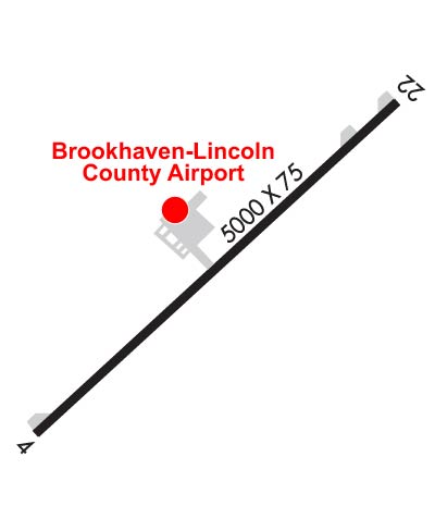
| Lat: N 3136.4 Long: W 09024.6 Elev: 492 Var: -03 Longest Runway: 5000 | ||
| AWOS: 118.12 CTAF: 122.8 | ||
| ||||||||||||||||||||||||||||||
| ||||||||||||||||||||||||||||||
| ||||||||||||||||||||||||||||||
| Rwy | Rwy | |||||||
| 5000x75 | 4365' | 5000x75 | 4006' | |||||
| Runway ID | Single Wheel | Double Wheel | Double Tandem Wheel | Dual Double Wheel |
| 04/22 | 27,000 | N/A | N/A | N/A |
| These numbers are Advisory and are not limits. The Airport Manager should have more accurate Weight Limits | ||||
 Airport Diagram might not be current. | |
| Facility Name: | BROOKHAVEN-LINCOLN COUNTY |
| City Name: | BROOKHAVEN |
| County: | LINCOLN |
| State abbrev: | MS |
| State Name: | MISSISSIPPI |
| Ownership: | PUBLICLY OWNED |
| Use: | OPEN TO THE PUBLIC |
| Owner's Name: | CITY OF BROOKHAVEN |
| Address: | 300 SOUTH 1ST ST |
| BROOKHAVEN, MS 39601 | |
| Owner's Phone: | 601-833-2362 |
| Manager's Name: | JOHN COLEMAN; JOE COX |
| Address: | 1216 HEUCKS RETREAT ROAD |
| BROOKHAVEN, MS 39601 | |
| Phone: | 601-833-0999 |
| FAA Region: | SOUTHERN |
| FAA Field Office: | JAN |

| Date | Sunrise | Sunset |
|---|---|---|
| 09/24/21 Friday | 6:51 | 18:56 |
| 09/25/21 Saturday | 6:52 | 18:55 |
| 09/26/21 Sunday | 6:52 | 18:53 |
| 09/27/21 Monday | 6:53 | 18:52 |
| 09/28/21 Tuesday | 6:53 | 18:51 |
| 09/29/21 Wednesday | 6:54 | 18:49 |
| 09/30/21 Thursday | 6:55 | 18:48 |
| 10/01/21 Friday | 6:55 | 18:47 |
| 10/02/21 Saturday | 6:56 | 18:46 |
| 10/03/21 Sunday | 6:57 | 18:44 |
| 10/04/21 Monday | 6:57 | 18:43 |
| 10/05/21 Tuesday | 6:58 | 18:42 |
| 10/06/21 Wednesday | 6:59 | 18:41 |
| 10/07/21 Thursday | 6:59 | 18:39 |
| Airport Attendance Schedule | MON-FRI 0800-1700; AFT HR - 601-754-6588. |
| Airport Status | OPERATIONAL (This Status can change at any time - please check NOTAMS) |
| Airport Lighting Schedule | ACTVT MIRL RWY 04/22 - CTAF. PAPI RWY 04 OPR DUSK-DAWN. PAPI RWY 22 OPR CONSLY. |
| Airport Storage Available | Tie Downs |
| Extra Services Available | NONE |
| Wind Indicator | YES - (lighted) |
| Control Tower | NO |
| CTAF Frequency | 122.800 |
| Unicom Frequency | 122.800 |
| Rotating Beacon Color | CLEAR-GREEN (Light Land Airport) |
| Segmented Circle | YES |
| Landing Fee | NO |
| Airport Inspected | STATE - performed by STATE AERONAUTICAL PERSONNEL |
| Inspection Date | 03/12/2021 |
| Type of Fuel Available | Grade 100LL, JET A; -10FUEL SVC AVBL H24 WITH CREDIT CARD. |
| Airframe Repair Service | NONE; AVBL - 601-695-9874. |
| Power Plant Repair Service | NONE |
| Latitude | N3136.4 |
| Longitude | W09024.6 (ESTIMATED) |
| Arpt Elevation | 492ft (SURVEYED) |
| Magnetic Variation | 03E |
| 3 miles NE | of BROOKHAVEN |
| Traffic Pattern Altitude | |
| Sectional Chart | NEW ORLEANS |
| Operations (Reported) | Yearly | Avg. Daily |
|---|---|---|
| General Aviation Transient | 6000 | 16 |
| General Aviation Local | 3500 | 10 |
| Air Taxi | 0 | 0 |
| Commerical | 0 | 0 |
| Commuter | 0 | 0 |
| Military | 0 | 0 |
| Aircraft based on Field | |
|---|---|
| General Aviation Singles | 12 |
| General Aviation Multi | 4 |
| Jet Aircraft | 0 |
| General Aviation Helicopters | 0 |
| Military Aircraft | 0 |
| Gliders | 0 |
| Ultralights | 0 |
| FSS on field | NO |
| FSS tie-in | GREENWOOD |
| FSS Phone | 1-800-WX-BRIEF |
| Who issues Notams | GWO |
| Notam D service at airport | YES |
| ARTCC Name | HOUSTON |
| Airport Certification | |
| Aircraft Rescue & Firefighting Index | None |
| Airport of Entry | No |
| Custom Landing Rights | No |
| Joint Civil/Military | No |
| Military Landing rights | YES |
| NATIONAL PLAN OF INTEGRATED AIRPORT SYSTEMS (NPIAS) |
| GRANT AGREEMENTS UNDER FAAP/ADAP/AIP |
| ASSURANCES PURSUANT TO TITLE VI, CIVIL RIGHTS ACT OF 1964 |
| AGREEMENT UNDER DLAND OR DCLA HAS EXPIRED. |
| FOR CD CTC HOUSTON ARTCC AT 281-230-5622. |
| RWY 22 TALL TREES AER. |
Airport Communications & Frequencies:
| |||||||||
| Runway: 04 | Runway: 22 | ||
| Mag heading: | 45° | Mag heading: | 225° |
| Rwy Slope: | -.10% Down | Rwy Slope: | .10% Up |
| Approach: | Approach: | ||
| Pattern: | Left Traffic | Pattern: | Left Traffic |
| Markings: | NONPRECISION INSTRUMENT | Markings: | NONPRECISION INSTRUMENT |
| Marking Condition: | FAIR | Marking Condition: | FAIR |
| Arresting Dev: | Arresting Dev: | ||
| Lat & Long: | N3136.1 W09024.9 | Lat. & Long.: | N3136.6 W09024.2 |
| Elev: | 491.4 ft. MSL | Elev: | 486.2 ft. MSL |
| TCH: | 40 ft. AGL | TCH: | 40 ft. AGL |
| Visual Glide Path: | 3.00 degrees | Visual Glide Path: | 3.00 degrees |
| Displaced Threshold: | 635 feet | Displaced Threshold: | 994 feet |
| Touchdown Zone: | YES | Touchdown Zone: | YES |
| Touchdown Elev.: | 490.6 feet | Touchdown Elev.: | 488.3 feet |
| Visual Glide Slope: | 2-Light PAPI on LEFT side of Runway | Visual Glide Slope: | 2-Light PAPI on LEFT side of Runway |
| RVR Equipment: | RVR Equipment: | ||
| RVV Equipment: | NO | RVV Equipment: | NO |
| Approach Lights: | Approach Lights: | ||
| REIL: | NO | REIL: | NO |
| Centerline Lights: | NO | Centerline Lights: | NO |
| Touchdown lights: | NO | Touchdown lights: | NO |
| Runway Category: | Runway with a Visual Approach | Runway Category: | Runway with a Non-precision Approach |
| Declared Distances: | Declared Distances: | ||
| Obstructions: | TREES | Obstructions: | TREES |
| Marked: | NOT Marked/Lighted | Marked: | NOT Marked/Lighted |
| Clearance slope: | 13:1; APCH RATIO 31:1 FROM DSPLCD THR. | Clearance slope: | 11:1; APCH RATIO 33:1 FROM DSPLCD THR. |
| Obstruction height: | 45 feet AGL | Obstruction height: | 53 feet AGL |
| Dist. from runway: | 800 feet | Dist. from runway: | 800 feet |
| Centerline offset: | 100 left of centerline | Centerline offset: | 50 feet left of centerline |
| Comments: | Comments: |
Thanks for using FltPlan.com
all rights reserved © 1999-2021 by Flight Plan LLC