
| FREDONIA FREDONIA KS |
| |
| Lat: N 3734.8 Long: W 09550.2 Elev: 882 Var: -06 Longest Runway: 4557 | ||
| CTAF: 122.9 | ||
| ||||||||||||||||||||||||||||||||
| ||||||||||||||||||||||||||||||||
| Rwy | Rwy | |||||||
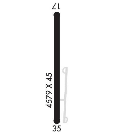
| 4557x60 | 4557' | 4557x60 | 4016' | |||||
| Runway ID | Single Wheel | Double Wheel | Double Tandem Wheel | Dual Double Wheel |
| 17/35 | N/A | N/A | N/A | N/A |
| These numbers are Advisory and are not limits. The Airport Manager should have more accurate Weight Limits | ||||
| FltPlan does not have IFR approach charts available for K1K7. |
 Airport Diagram might not be current. | |
| Facility Name: | FREDONIA |
| City Name: | FREDONIA |
| County: | WILSON |
| State abbrev: | KS |
| State Name: | KANSAS |
| Ownership: | PUBLICLY OWNED |
| Use: | OPEN TO THE PUBLIC |
| Owner's Name: | CITY OF FREDONIA |
| Address: | 100 N. 15TH STREET |
| FREDONIA, KS 66736 | |
| Owner's Phone: | 620-378-2231 |
| Manager's Name: | KELLEY ZELLNER - CITY ADMINISTRATOR; SHANE GLOVER, STREETS SUPERINTENDENT IS CO-MANAGER OF AIRPORT FACILITY. |
| Address: | 100 N. 15TH STREET |
| FREDONIA, KS 66736 | |
| Phone: | 620-378-2231 |
| FAA Region: | CENTRAL |
| FAA Field Office: | NONE |
| Date | Sunrise | Sunset |
|---|---|---|
| 06/07/26 Sunday | 6:02 | 20:43 |
| 06/08/26 Monday | 6:02 | 20:43 |
| 06/09/26 Tuesday | 6:02 | 20:44 |
| 06/10/26 Wednesday | 6:02 | 20:44 |
| 06/11/26 Thursday | 6:01 | 20:45 |
| 06/12/26 Friday | 6:01 | 20:45 |
| 06/13/26 Saturday | 6:01 | 20:45 |
| 06/14/26 Sunday | 6:01 | 20:46 |
| 06/15/26 Monday | 6:01 | 20:46 |
| 06/16/26 Tuesday | 6:01 | 20:47 |
| 06/17/26 Wednesday | 6:02 | 20:47 |
| 06/18/26 Thursday | 6:02 | 20:47 |
| 06/19/26 Friday | 6:02 | 20:48 |
| 06/20/26 Saturday | 6:02 | 20:48 |
| Airport Attendance Schedule | UNATTENDED |
| Airport Status | OPERATIONAL (This Status can change at any time - please check NOTAMS) |
| Airport Lighting Schedule | |
| Airport Storage Available | Tie Downs |
| Extra Services Available | NONE |
| Wind Indicator | YES - (unlit) |
| Control Tower | NO |
| CTAF Frequency | 122.900 |
| Unicom Frequency | |
| Rotating Beacon Color | WG |
| Segmented Circle | NO |
| Landing Fee | NO |
| Airport Inspected | STATE - performed by STATE AERONAUTICAL PERSONNEL |
| Inspection Date | 09/19/2023 |
| Type of Fuel Available | None |
| Airframe Repair Service | NONE |
| Power Plant Repair Service | NONE |
| Latitude | N3734.8 |
| Longitude | W09550.2 (ESTIMATED) |
| Arpt Elevation | 882ft (ESTIMATED) |
| Magnetic Variation | 06E |
| 2 miles N | of FREDONIA |
| Traffic Pattern Altitude | |
| Sectional Chart | KANSAS CITY |
| Operations (Reported) | Yearly | Avg. Daily |
|---|---|---|
| General Aviation Transient | 0 | 0 |
| General Aviation Local | 0 | 0 |
| Air Taxi | 0 | 0 |
| Commerical | 0 | 0 |
| Commuter | 0 | 0 |
| Military | 0 | 0 |
| Aircraft based on Field | |
|---|---|
| General Aviation Singles | 0 |
| General Aviation Multi | 0 |
| Jet Aircraft | 0 |
| General Aviation Helicopters | 0 |
| Military Aircraft | 0 |
| Gliders | 0 |
| Ultralights | 0 |
| FSS on field | NO |
| FSS tie-in | WICHITA |
| FSS Phone | 1-800-WX-BRIEF |
| Who issues Notams | ICT |
| Notam D service at airport | YES |
| ARTCC Name | KANSAS CITY |
| Airport Certification | |
| Aircraft Rescue & Firefighting Index | None |
| Airport of Entry | No |
| Custom Landing Rights | No |
| Joint Civil/Military | No |
| Military Landing rights | No |
| WILDLIFE ON & INVOF ARPT. |
| A DRAINAGE DITCH 70 FT LEFT OF AER 17 RUNS PARL 700 FT. |
| FOR CD CTC KANSAS CITY ARTCC AT 913-254-8508. |
| Runway: 17 | Runway: 35 | ||
| Mag heading: | 174° | Mag heading: | 354° |
| Rwy Slope: | -.11% Down | Rwy Slope: | .11% Up |
| Approach: | Approach: | ||
| Pattern: | Left Traffic | Pattern: | Left Traffic |
| Markings: | NONPRECISION INSTRUMENT | Markings: | BASIC |
| Marking Condition: | FAIR; NSTD NPI MKGS. NO THLD BAR PRESENT. | Marking Condition: | FAIR; NSTD SMALL BSC MARKINGS |
| Arresting Dev: | Arresting Dev: | ||
| Lat & Long: | N3735.2 W09550.2 | Lat. & Long.: | N3734.5 W09550.2 |
| Elev: | 882.0 ft. MSL | Elev: | 877.0 ft. MSL |
| TCH: | TCH: | ||
| Visual Glide Path: | Visual Glide Path: | ||
| Displaced Threshold: | No | Displaced Threshold: | 541 feet |
| Touchdown Zone: | NO | Touchdown Zone: | NO |
| Touchdown Elev.: | Touchdown Elev.: | ||
| Visual Glide Slope: | Visual Glide Slope: | ||
| RVR Equipment: | RVR Equipment: | ||
| RVV Equipment: | NO | RVV Equipment: | NO |
| Approach Lights: | Approach Lights: | ||
| REIL: | NO | REIL: | NO |
| Centerline Lights: | NO | Centerline Lights: | NO |
| Touchdown lights: | NO | Touchdown lights: | NO |
| Runway Category: | Runway with a Visual Approach | Runway Category: | Runway with a Visual Approach |
| Declared Distances: | Declared Distances: | ||
| Obstructions: | POLE | Obstructions: | |
| Marked: | NOT Marked/Lighted | Marked: | |
| Clearance slope: | 9:1 | Clearance slope: | 20:1 |
| Obstruction height: | 35 feet AGL | Obstruction height: | |
| Dist. from runway: | 524 feet | Dist. from runway: | |
| Centerline offset: | 107 left of centerline | Centerline offset: | |
| Comments: | Comments: | +15 FT ROAD 175 FT FM AER 35. |
Thanks for using FltPlan.com
all rights reserved © 1999-2026 by Flight Plan LLC
