
| CLINTON (CLOSED) CLINTON IN |
| |
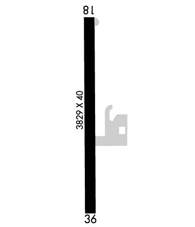
| Lat: N 3942.7 Long: W 08724.0 Elev: 526 Var: +01 Longest Runway: 3829 | ||
| CTAF: 122.8 | ||
| |||||
|
| Rwy | Rwy | |||||||
| 3829x40 | 3684' | 3829x40 | 3449' | |||||
| Runway ID | Single Wheel | Double Wheel | Double Tandem Wheel | Dual Double Wheel |
| These numbers are Advisory and are not limits. The Airport Manager should have more accurate Weight Limits | ||||
| FltPlan does not have IFR approach charts available for K1I7. |
 Airport Diagram might not be current. | |
| Facility Name: | CLINTON |
| City Name: | CLINTON |
| County: | VERMILLION |
| State abbrev: | IN |
| State Name: | INDIANA |
| Ownership: | PRIVATELY OWNED |
| Use: | OPEN TO THE PUBLIC |
| Owner's Name: | H B INVESTMENTS |
| Address: | BOX 366 |
| CLINTON, IN 47842 | |
| Owner's Phone: | (765) 832-1869 |
| Manager's Name: | TRAE WHITE |
| Address: | BOX 366 |
| CLINTON, IN 47842 | |
| Phone: | (765) 832-1869 |
| FAA Region: | GREAT LAKES |
| FAA Field Office: | CHI |
| Date | Sunrise | Sunset |
|---|---|---|
| 03/24/18 Saturday | 7:47 | 20:06 |
| 03/25/18 Sunday | 7:45 | 20:07 |
| 03/26/18 Monday | 7:44 | 20:08 |
| 03/27/18 Tuesday | 7:42 | 20:09 |
| 03/28/18 Wednesday | 7:41 | 20:10 |
| 03/29/18 Thursday | 7:39 | 20:11 |
| 03/30/18 Friday | 7:37 | 20:12 |
| 03/31/18 Saturday | 7:36 | 20:13 |
| 04/01/18 Sunday | 7:34 | 20:14 |
| 04/02/18 Monday | 7:33 | 20:15 |
| 04/03/18 Tuesday | 7:31 | 20:16 |
| 04/04/18 Wednesday | 7:29 | 20:17 |
| 04/05/18 Thursday | 7:28 | 20:18 |
| 04/06/18 Friday | 7:26 | 20:19 |
| Airport Attendance Schedule | UNATTENDED |
| Airport Status | OPERATIONAL (This Status can change at any time - please check NOTAMS) |
| Airport Lighting Schedule | |
| Airport Storage Available | Tie Downs |
| Extra Services Available | Crop Dusting |
| Wind Indicator | YES - (unlit) |
| Control Tower | NO |
| CTAF Frequency | 122.800 |
| Unicom Frequency | 122.800 |
| Rotating Beacon Color | |
| Segmented Circle | NO |
| Landing Fee | NO |
| Airport Inspected | STATE - performed by STATE AERONAUTICAL PERSONNEL |
| Inspection Date | 04/11/2017 |
| Type of Fuel Available | None |
| Airframe Repair Service | NONE |
| Power Plant Repair Service | NONE |
| Latitude | N3942.7 |
| Longitude | W08724.0 (ESTIMATED) |
| Arpt Elevation | 526ft (SURVEYED) |
| Magnetic Variation | 01W |
| 3 miles N | of CLINTON |
| Traffic Pattern Altitude | |
| Sectional Chart | ST LOUIS |
| Operations (Reported) | Yearly | Avg. Daily |
|---|---|---|
| General Aviation Transient | 1875 | 5 |
| General Aviation Local | 3804 | 10 |
| Air Taxi | 0 | 0 |
| Commerical | 0 | 0 |
| Commuter | 0 | 0 |
| Military | 0 | 0 |
| Aircraft based on Field | |
|---|---|
| General Aviation Singles | 12 |
| General Aviation Multi | 0 |
| Jet Aircraft | 0 |
| General Aviation Helicopters | 0 |
| Military Aircraft | 0 |
| Gliders | 0 |
| Ultralights | 0 |
| FSS on field | NO |
| FSS tie-in | TERRE HAUTE |
| FSS Phone | 1-800-WX-BRIEF |
| Who issues Notams | HUF |
| Notam D service at airport | YES |
| ARTCC Name | INDIANAPOLIS |
| Airport Certification | |
| Aircraft Rescue & Firefighting Index | None |
| Airport of Entry | No |
| Custom Landing Rights | No |
| Joint Civil/Military | No |
| Military Landing rights | No |
| SEASONAL CROPS 108 FT W & 118 FT E PENETRATE PRIMARY SFC AREA. |
| Runway: 18 | Runway: 36 | ||
| Mag heading: | N/A | Mag heading: | N/A |
| Rwy Slope: | .00% | Rwy Slope: | .00% |
| Approach: | Approach: | ||
| Pattern: | Left Traffic | Pattern: | Left Traffic |
| Markings: | BASIC | Markings: | BASIC |
| Marking Condition: | GOOD | Marking Condition: | FAIR |
| Arresting Dev: | Arresting Dev: | ||
| Lat & Long: | N3943.0 W08724.0 | Lat. & Long.: | N3942.4 W08724.0 |
| Elev: | 520.0 ft. MSL | Elev: | 520.0 ft. MSL |
| TCH: | TCH: | ||
| Visual Glide Path: | Visual Glide Path: | ||
| Displaced Threshold: | 145 feet | Displaced Threshold: | 380 feet |
| Touchdown Zone: | NO | Touchdown Zone: | NO |
| Touchdown Elev.: | Touchdown Elev.: | ||
| Visual Glide Slope: | Visual Glide Slope: | ||
| RVR Equipment: | RVR Equipment: | ||
| RVV Equipment: | NO | RVV Equipment: | NO |
| Approach Lights: | Approach Lights: | ||
| REIL: | NO | REIL: | NO |
| Centerline Lights: | NO | Centerline Lights: | NO |
| Touchdown lights: | NO | Touchdown lights: | NO |
| Runway Category: | Runway with a Visual Approach | Runway Category: | Runway with a Visual Approach |
| Declared Distances: | Declared Distances: | ||
| Obstructions: | TREE | Obstructions: | CROPS |
| Marked: | NOT Marked/Lighted | Marked: | NOT Marked/Lighted |
| Clearance slope: | 10:1; APCH RATIO 20:1 TO DTHR. | Clearance slope: | 6:1 |
| Obstruction height: | 30 feet AGL | Obstruction height: | 10 feet AGL |
| Dist. from runway: | 520 feet | Dist. from runway: | 260 feet |
| Centerline offset: | 105 left of centerline | Centerline offset: | |
| Comments: | 10 FT CROPS 115 FT FROM RWY END ON CNTRLN. | Comments: |
Thanks for using FltPlan.com
all rights reserved © 1999-2018 by Flight Plan LLC
