
| BROOKNEAL/CAMPBELL COUNTY BROOKNEAL VA |
| |
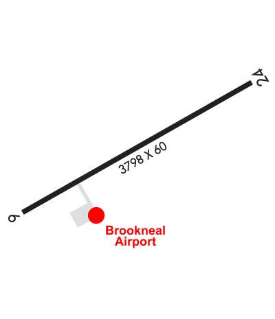
| Lat: N 3708.5 Long: W 07901.0 Elev: 597 Var: +09 Longest Runway: 3798 | ||
| AWOS: 120.57 CTAF: 122.7 | ||
| ||||||||||||||||||||||||||||||||||||||||||||||||||||||||||||
| ||||||||||||||||||||||||||||||||||||||||||||||||||||||||||||
| ||||||||||||||||||||||||||||||||||||||||||||||||||||||||||||
| Rwy | Rwy | |||||||
| 3798x60 | 3798' | 3798x60 | 3798' | |||||
| Runway ID | Single Wheel | Double Wheel | Double Tandem Wheel | Dual Double Wheel |
| 06/24 | 12,500 | N/A | N/A | N/A |
| These numbers are Advisory and are not limits. The Airport Manager should have more accurate Weight Limits | ||||
 Airport Diagram might not be current. | |
| Facility Name: | BROOKNEAL/CAMPBELL COUNTY |
| City Name: | BROOKNEAL |
| County: | CAMPBELL |
| State abbrev: | VA |
| State Name: | VIRGINIA |
| Ownership: | PUBLICLY OWNED |
| Use: | OPEN TO THE PUBLIC |
| Owner's Name: | BROOKNEAL/CAMPBELL CO. AUTH |
| Address: | PO BOX 100, 133 RUNWAY ROAD |
| RUSTBURG, VA 24528 | |
| Owner's Phone: | 434-592-9595 |
| Manager's Name: | MARY WESTLING |
| Address: | 985 JUNIPER CLIFF ROAD |
| BROOKNEAL, VA 24528 | |
| Phone: | 434-444-2806 |
| FAA Region: | EASTERN |
| FAA Field Office: | DCA |
| Date | Sunrise | Sunset |
|---|---|---|
| 09/24/21 Friday | 7:05 | 19:10 |
| 09/25/21 Saturday | 7:06 | 19:09 |
| 09/26/21 Sunday | 7:07 | 19:07 |
| 09/27/21 Monday | 7:08 | 19:06 |
| 09/28/21 Tuesday | 7:09 | 19:04 |
| 09/29/21 Wednesday | 7:10 | 19:03 |
| 09/30/21 Thursday | 7:10 | 19:01 |
| 10/01/21 Friday | 7:11 | 19:00 |
| 10/02/21 Saturday | 7:12 | 18:58 |
| 10/03/21 Sunday | 7:13 | 18:57 |
| 10/04/21 Monday | 7:14 | 18:55 |
| 10/05/21 Tuesday | 7:15 | 18:54 |
| 10/06/21 Wednesday | 7:16 | 18:52 |
| 10/07/21 Thursday | 7:16 | 18:51 |
| Airport Attendance Schedule | UNATTENDED |
| Airport Status | OPERATIONAL (This Status can change at any time - please check NOTAMS) |
| Airport Lighting Schedule | DUSK-DAWN. MIRL RWY 06/24 PRESET LOW, TO INCR INTST AND ACTVT REIL RWY 06 AND 24 - CTAF. |
| Airport Storage Available | Tie Downs |
| Extra Services Available | NONE |
| Wind Indicator | YES - (lighted) |
| Control Tower | NO |
| CTAF Frequency | 122.700 |
| Unicom Frequency | 122.700 |
| Rotating Beacon Color | CLEAR-GREEN (Light Land Airport) |
| Segmented Circle | YES |
| Landing Fee | NO |
| Airport Inspected | STATE - performed by STATE AERONAUTICAL PERSONNEL |
| Inspection Date | 04/20/2021 |
| Type of Fuel Available | Grade 100LL; -1024 HR SELF SVC FUEL AVBL WITH CREDIT CARD. |
| Airframe Repair Service | None |
| Power Plant Repair Service | None |
| Latitude | N3708.5 |
| Longitude | W07901.0 (ESTIMATED) |
| Arpt Elevation | 596ft (SURVEYED) |
| Magnetic Variation | 09W |
| 6 miles NW | of BROOKNEAL |
| Traffic Pattern Altitude | |
| Sectional Chart | CINCINNATI |
| Operations (Reported) | Yearly | Avg. Daily |
|---|---|---|
| General Aviation Transient | 32 | 0 |
| General Aviation Local | 1134 | 3 |
| Air Taxi | 8 | 0 |
| Commerical | 0 | 0 |
| Commuter | 0 | 0 |
| Military | 8 | 0 |
| Aircraft based on Field | |
|---|---|
| General Aviation Singles | 2 |
| General Aviation Multi | 0 |
| Jet Aircraft | 0 |
| General Aviation Helicopters | 0 |
| Military Aircraft | 0 |
| Gliders | 0 |
| Ultralights | 0 |
| FSS on field | NO |
| FSS tie-in | LEESBURG |
| FSS Phone | 1-800-WX-BRIEF |
| Who issues Notams | DCA |
| Notam D service at airport | YES |
| ARTCC Name | WASHINGTON |
| Airport Certification | |
| Aircraft Rescue & Firefighting Index | None |
| Airport of Entry | No |
| Custom Landing Rights | No |
| Joint Civil/Military | No |
| Military Landing rights | YES |
| NATIONAL PLAN OF INTEGRATED AIRPORT SYSTEMS (NPIAS) |
| GRANT AGREEMENTS UNDER FAAP/ADAP/AIP |
| ASSURANCES PURSUANT TO TITLE VI, CIVIL RIGHTS ACT OF 1964 |
| ULTRALGT ACTIVITY ON & INVOF ARPT. |
| DEER ON & INVOF ARPT. |
| ROA TWR SVCS AVBL AT 540-563-1307. |
| FOR CD CTC ROANOKE APCH AT 540-563-1307. |
Airport Communications & Frequencies:
| ||||||||||||||||||
| Runway: 06 | Runway: 24 | ||
| Mag heading: | 62° | Mag heading: | 242° |
| Rwy Slope: | -.19% Down | Rwy Slope: | .19% Up |
| Approach: | Approach: | ||
| Pattern: | Left Traffic | Pattern: | Left Traffic |
| Markings: | NONPRECISION INSTRUMENT | Markings: | NONPRECISION INSTRUMENT |
| Marking Condition: | GOOD | Marking Condition: | GOOD |
| Arresting Dev: | Arresting Dev: | ||
| Lat & Long: | N3708.3 W07901.3 | Lat. & Long.: | N3708.7 W07900.7 |
| Elev: | 596.0 ft. MSL | Elev: | 588.9 ft. MSL |
| TCH: | 43 ft. AGL | TCH: | 46 ft. AGL |
| Visual Glide Path: | 3.00 degrees | Visual Glide Path: | 3.00 degrees |
| Displaced Threshold: | No | Displaced Threshold: | No |
| Touchdown Zone: | YES | Touchdown Zone: | YES |
| Touchdown Elev.: | 596.4 feet | Touchdown Elev.: | 596.4 feet |
| Visual Glide Slope: | 2-Light PAPI on RIGHT side of Runway | Visual Glide Slope: | 2-Light PAPI on LEFT side of Runway |
| RVR Equipment: | RVR Equipment: | ||
| RVV Equipment: | NO | RVV Equipment: | NO |
| Approach Lights: | Approach Lights: | ||
| REIL: | YES | REIL: | YES |
| Centerline Lights: | NO | Centerline Lights: | NO |
| Touchdown lights: | NO | Touchdown lights: | NO |
| Runway Category: | Runway with a Non-precision Approach | Runway Category: | Runway with a Non-precision Approach |
| Declared Distances: | Declared Distances: | ||
| Obstructions: | TREE | Obstructions: | TREE |
| Marked: | NOT Marked/Lighted | Marked: | NOT Marked/Lighted |
| Clearance slope: | 32:1 | Clearance slope: | 15:1 |
| Obstruction height: | 69 feet AGL | Obstruction height: | 45 feet AGL |
| Dist. from runway: | 2472 feet | Dist. from runway: | 892 feet |
| Centerline offset: | 491 right of centerline | Centerline offset: | 302 feet left of centerline |
| Comments: | Comments: |
Thanks for using FltPlan.com
all rights reserved © 1999-2021 by Flight Plan LLC

