
| CYNTHIANA-HARRISON COUNTY CYNTHIANA KY |
| |
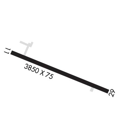
| Lat: N 3822.0 Long: W 08417.0 Elev: 721 Var: +06 Longest Runway: 3850 | ||
| CTAF: 122.8 | ||
| ||||||||||||||||||||||||||||||||||||||||||||
| ||||||||||||||||||||||||||||||||||||||||||||
| Rwy | Rwy | |||||||
| 3850x75 | 3850' | 3850x75 | 2756' | |||||
| Runway ID | Single Wheel | Double Wheel | Double Tandem Wheel | Dual Double Wheel |
| 11/29 | 16,000 | 25,000 | N/A | N/A |
| These numbers are Advisory and are not limits. The Airport Manager should have more accurate Weight Limits | ||||
 Airport Diagram might not be current. | |
| Facility Name: | CYNTHIANA-HARRISON COUNTY |
| City Name: | CYNTHIANA |
| County: | HARRISON |
| State abbrev: | KY |
| State Name: | KENTUCKY |
| Ownership: | PUBLICLY OWNED |
| Use: | OPEN TO THE PUBLIC |
| Owner's Name: | CYNTHIANA-HARRISON COUNTY ARPT BD |
| Address: | P.O. BOX 395 |
| CYNTHIANA, KY 41031 | |
| Owner's Phone: | 859-234-5533 |
| Manager's Name: | ROBERT CRAFT |
| Address: | 40 AIRFIELD LANE |
| CYNTHIANA, KY 41031 | |
| Phone: | 859-234-8477 |
| FAA Region: | SOUTHERN |
| FAA Field Office: | MEM |
| Date | Sunrise | Sunset |
|---|---|---|
| 09/24/21 Friday | 7:26 | 19:31 |
| 09/25/21 Saturday | 7:27 | 19:30 |
| 09/26/21 Sunday | 7:28 | 19:28 |
| 09/27/21 Monday | 7:29 | 19:27 |
| 09/28/21 Tuesday | 7:30 | 19:25 |
| 09/29/21 Wednesday | 7:31 | 19:23 |
| 09/30/21 Thursday | 7:32 | 19:22 |
| 10/01/21 Friday | 7:33 | 19:20 |
| 10/02/21 Saturday | 7:34 | 19:19 |
| 10/03/21 Sunday | 7:34 | 19:17 |
| 10/04/21 Monday | 7:35 | 19:16 |
| 10/05/21 Tuesday | 7:36 | 19:14 |
| 10/06/21 Wednesday | 7:37 | 19:13 |
| 10/07/21 Thursday | 7:38 | 19:11 |
| Airport Attendance Schedule | 7 Days A Week 0800-DUSK |
| Airport Status | OPERATIONAL (This Status can change at any time - please check NOTAMS) |
| Airport Lighting Schedule | ACTVT REIL RWY 11 & 29; PAPI RWY 11 & 29; MIRL RWY 11/29 - CTAF. |
| Airport Storage Available | Tie Downs, Hanger |
| Extra Services Available | Flight Instruction |
| Wind Indicator | YES - (lighted) |
| Control Tower | NO |
| CTAF Frequency | 122.800 |
| Unicom Frequency | 122.800 |
| Rotating Beacon Color | CLEAR-GREEN (Light Land Airport) |
| Segmented Circle | YES |
| Landing Fee | NO |
| Airport Inspected | STATE - performed by STATE AERONAUTICAL PERSONNEL |
| Inspection Date | 04/26/2021 |
| Type of Fuel Available | Grade 100LL; -10FUEL AVBL 24/7 WITH CC. |
| Airframe Repair Service | MINOR |
| Power Plant Repair Service | MINOR |
| Latitude | N3822.0 |
| Longitude | W08417.0 (ESTIMATED) |
| Arpt Elevation | 720ft (SURVEYED) |
| Magnetic Variation | 06W |
| 2 miles S | of CYNTHIANA |
| Traffic Pattern Altitude | |
| Sectional Chart | CINCINNATI |
| Operations (Reported) | Yearly | Avg. Daily |
|---|---|---|
| General Aviation Transient | 6405 | 18 |
| General Aviation Local | 6500 | 18 |
| Air Taxi | 386 | 1 |
| Commerical | 0 | 0 |
| Commuter | 0 | 0 |
| Military | 263 | 1 |
| Aircraft based on Field | |
|---|---|
| General Aviation Singles | 24 |
| General Aviation Multi | 0 |
| Jet Aircraft | 0 |
| General Aviation Helicopters | 0 |
| Military Aircraft | 0 |
| Gliders | 0 |
| Ultralights | 0 |
| FSS on field | NO |
| FSS tie-in | LOUISVILLE |
| FSS Phone | 1-800-WX-BRIEF |
| Who issues Notams | LOU |
| Notam D service at airport | YES |
| ARTCC Name | INDIANAPOLIS |
| Airport Certification | |
| Aircraft Rescue & Firefighting Index | None |
| Airport of Entry | No |
| Custom Landing Rights | No |
| Joint Civil/Military | No |
| Military Landing rights | YES |
| NATIONAL PLAN OF INTEGRATED AIRPORT SYSTEMS (NPIAS) |
| ASSURANCES PURSUANT TO TITLE VI, CIVIL RIGHTS ACT OF 1964 |
| GRANT AGREEMENT HAS EXPIRED; HOWEVER, AGREEMENT REMAINS IN EFFECT FOR THIS FACILITY AS LONG AS IT IS PUBLIC USE. |
| FOR CD CTC LEXINGTON APCH AT 859-514-7890. |
Airport Communications & Frequencies:
| ||||||||||||||||||||||
| Runway: 11 | Runway: 29 | ||
| Mag heading: | 112° | Mag heading: | 292° |
| Rwy Slope: | -.02% Down | Rwy Slope: | .02% Up |
| Approach: | Approach: | ||
| Pattern: | Left Traffic | Pattern: | Left Traffic |
| Markings: | NONPRECISION INSTRUMENT | Markings: | NONPRECISION INSTRUMENT |
| Marking Condition: | FAIR | Marking Condition: | FAIR |
| Arresting Dev: | Arresting Dev: | ||
| Lat & Long: | N3822.1 W08417.4 | Lat. & Long.: | N3821.9 W08416.6 |
| Elev: | 720.9 ft. MSL | Elev: | 720.0 ft. MSL |
| TCH: | 41 ft. AGL | TCH: | 50 ft. AGL |
| Visual Glide Path: | 4.00 degrees | Visual Glide Path: | 4.00 degrees |
| Displaced Threshold: | No | Displaced Threshold: | 1094 feet |
| Touchdown Zone: | YES | Touchdown Zone: | YES |
| Touchdown Elev.: | 720.9 feet | Touchdown Elev.: | 720.9 feet |
| Visual Glide Slope: | 2-Light PAPI on LEFT side of Runway | Visual Glide Slope: | 2-Light PAPI on LEFT side of Runway |
| RVR Equipment: | RVR Equipment: | ||
| RVV Equipment: | NO | RVV Equipment: | NO |
| Approach Lights: | Approach Lights: | ||
| REIL: | YES | REIL: | YES |
| Centerline Lights: | NO | Centerline Lights: | NO |
| Touchdown lights: | NO | Touchdown lights: | NO |
| Runway Category: | Runway with a Non-precision Approach having visibility minimums greater than 3/4 mile | Runway Category: | Runway with a Non-precision Approach having visibility minimums greater than 3/4 mile |
| Declared Distances: | TORA:2757' TODA:3852' ASDA:3852' LDA:3852' | Declared Distances: | TORA:3852' TODA:3852' ASDA:3852' LDA:2757' |
| Obstructions: | RR | Obstructions: | TREES |
| Marked: | NOT Marked/Lighted | Marked: | NOT Marked/Lighted |
| Clearance slope: | 14:1 | Clearance slope: | APCH RATIO 19:1 TO DSPLCD THR. |
| Obstruction height: | 36 feet AGL | Obstruction height: | 55 feet AGL |
| Dist. from runway: | 716 feet | Dist. from runway: | 5 feet |
| Centerline offset: | 319 right of centerline | Centerline offset: | 211 feet right of centerline |
| Comments: | Comments: | +55 FT TREES 5 FT FM RWY END 211 FT R OF CNTRLN. |
Thanks for using FltPlan.com
all rights reserved © 1999-2021 by Flight Plan LLC
