
| JOHNSON CITY JOHNSON CITY TN |
| |
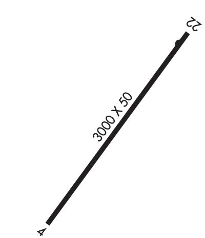
| Lat: N 3621.8 Long: W 08218.5 Elev: 1550 Var: +04 Longest Runway: 3000 | ||
| CTAF: 122.9 | ||
| ||||||||||||||||||||||||||||||||
| ||||||||||||||||||||||||||||||||
| Rwy | Rwy | |||||||
| 3000x50 | 2200' | 3000x50 | 3000' | |||||
| Runway ID | Single Wheel | Double Wheel | Double Tandem Wheel | Dual Double Wheel |
| 04/22 | 15,000 | N/A | N/A | N/A |
| These numbers are Advisory and are not limits. The Airport Manager should have more accurate Weight Limits | ||||
| FltPlan does not have IFR approach charts available for K0A4. |
 Airport Diagram might not be current. | |
| Facility Name: | JOHNSON CITY |
| City Name: | JOHNSON CITY |
| County: | WASHINGTON |
| State abbrev: | TN |
| State Name: | TENNESSEE |
| Ownership: | PRIVATELY OWNED |
| Use: | OPEN TO THE PUBLIC |
| Owner's Name: | GEORGE W ST JOHN, HEIRS |
| Address: | RT 1 BOX 122 |
| WATAUGA, TN 37694 | |
| Owner's Phone: | (423) 928-4500 |
| Manager's Name: | PRESTON ELDRED |
| Address: | 209 CRESTWOOD DRIVE |
| JOHNSON CITY, TN 37601 | |
| Phone: | 423-928-4500 |
| FAA Region: | SOUTHERN |
| FAA Field Office: | MEM |
| Date | Sunrise | Sunset |
|---|---|---|
| 06/12/26 Friday | 6:11 | 20:47 |
| 06/13/26 Saturday | 6:11 | 20:48 |
| 06/14/26 Sunday | 6:11 | 20:48 |
| 06/15/26 Monday | 6:11 | 20:49 |
| 06/16/26 Tuesday | 6:11 | 20:49 |
| 06/17/26 Wednesday | 6:11 | 20:49 |
| 06/18/26 Thursday | 6:11 | 20:50 |
| 06/19/26 Friday | 6:11 | 20:50 |
| 06/20/26 Saturday | 6:11 | 20:50 |
| 06/21/26 Sunday | 6:12 | 20:50 |
| 06/22/26 Monday | 6:12 | 20:50 |
| 06/23/26 Tuesday | 6:12 | 20:51 |
| 06/24/26 Wednesday | 6:12 | 20:51 |
| 06/25/26 Thursday | 6:13 | 20:51 |
| Airport Attendance Schedule | 7 Days A Week 0900-1700; SEASON VRBL - AMGR. |
| Airport Status | OPERATIONAL (This Status can change at any time - please check NOTAMS) |
| Airport Lighting Schedule | |
| Airport Storage Available | Tie Downs |
| Extra Services Available | NONE |
| Wind Indicator | YES - (unlit) |
| Control Tower | NO |
| CTAF Frequency | 122.900 |
| Unicom Frequency | |
| Rotating Beacon Color | |
| Segmented Circle | NO |
| Landing Fee | NO |
| Airport Inspected | STATE - performed by STATE AERONAUTICAL PERSONNEL |
| Inspection Date | 05/19/2025 |
| Type of Fuel Available | None |
| Airframe Repair Service | None |
| Power Plant Repair Service | None |
| Latitude | N3621.8 |
| Longitude | W08218.5 (ESTIMATED) |
| Arpt Elevation | 1550ft (ESTIMATED) |
| Magnetic Variation | 04W |
| 3 miles NE | of JOHNSON CITY |
| Traffic Pattern Altitude | |
| Sectional Chart | CINCINNATI |
| Operations (Reported) | Yearly | Avg. Daily |
|---|---|---|
| General Aviation Transient | 0 | 0 |
| General Aviation Local | 0 | 0 |
| Air Taxi | 0 | 0 |
| Commerical | 0 | 0 |
| Commuter | 0 | 0 |
| Military | 0 | 0 |
| Aircraft based on Field | |
|---|---|
| General Aviation Singles | 0 |
| General Aviation Multi | 0 |
| Jet Aircraft | 0 |
| General Aviation Helicopters | 0 |
| Military Aircraft | 0 |
| Gliders | 0 |
| Ultralights | 0 |
| FSS on field | NO |
| FSS tie-in | NASHVILLE |
| FSS Phone | 1-800-WX-BRIEF |
| Who issues Notams | BNA |
| Notam D service at airport | YES |
| ARTCC Name | ATLANTA |
| Airport Certification | |
| Aircraft Rescue & Firefighting Index | None |
| Airport of Entry | No |
| Custom Landing Rights | No |
| Joint Civil/Military | No |
| Military Landing rights | No |
| FOR CD CTC ATLANTA ARTCC AT 770-210-7692. |
| RWY 04/2 2 DEP RWY 04; ARR RWY 22 RCMDD. |
| RWY 04/2 2 GRASS, CRACKING & OXIDIZED PAVEMENT. |
| Runway: 04 | Runway: 22 | ||
| Mag heading: | N/A | Mag heading: | N/A |
| Approach: | Approach: | ||
| Pattern: | Left Traffic | Pattern: | Left Traffic |
| Markings: | BASIC | Markings: | BASIC |
| Marking Condition: | GOOD | Marking Condition: | GOOD |
| Arresting Dev: | Arresting Dev: | ||
| Lat & Long: | Lat. & Long.: | ||
| Elev: | N/A | Elev: | N/A |
| TCH: | TCH: | ||
| Visual Glide Path: | Visual Glide Path: | ||
| Displaced Threshold: | 800 feet | Displaced Threshold: | No |
| Touchdown Zone: | NO | Touchdown Zone: | NO |
| Touchdown Elev.: | Touchdown Elev.: | ||
| Visual Glide Slope: | Visual Glide Slope: | ||
| RVR Equipment: | RVR Equipment: | ||
| RVV Equipment: | NO | RVV Equipment: | NO |
| Approach Lights: | Approach Lights: | ||
| REIL: | NO | REIL: | NO |
| Centerline Lights: | NO | Centerline Lights: | NO |
| Touchdown lights: | NO | Touchdown lights: | NO |
| Runway Category: | Runway with a Visual Approach | Runway Category: | Runway with a Visual Approach |
| Declared Distances: | Declared Distances: | ||
| Obstructions: | Obstructions: | 4390 FT MTN RIDGES E WI 9 MI. | |
| Marked: | Marked: | NOT Marked/Lighted | |
| Clearance slope: | 20:1; APCH RATIO 15:1 TO DTHR. | Clearance slope: | 20:1 |
| Obstruction height: | Obstruction height: | ||
| Dist. from runway: | Dist. from runway: | ||
| Centerline offset: | Centerline offset: | ||
| Comments: | Comments: |
Thanks for using FltPlan.com
all rights reserved © 1999-2026 by Flight Plan LLC
