
| SCHAUMBURG RGNL CHICAGO/SCHAUMBURG IL |
| |
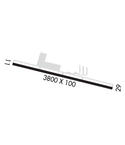
| Lat: N 4159.4 Long: W 08806.1 Elev: 801 Var: +01 Longest Runway: 3800 | ||
| CTAF: 123.0 | ||
| ||||||||||||||||||||||||||||||||||||||||||||
| ||||||||||||||||||||||||||||||||||||||||||||
| Rwy | Rwy | |||||||
| 3800x100 | 3800' | 3800x100 | 3800' | |||||
| Runway ID | Single Wheel | Double Wheel | Double Tandem Wheel | Dual Double Wheel |
| 11/29 | 12,500 | 12,500 | N/A | N/A |
| These numbers are Advisory and are not limits. The Airport Manager should have more accurate Weight Limits | ||||
| FltPlan does not have IFR approach charts available for K06C. |
 Airport Diagram might not be current. | |
| Facility Name: | SCHAUMBURG RGNL |
| City Name: | CHICAGO/SCHAUMBURG |
| County: | DU PAGE; AND COOK COUNTY. |
| State abbrev: | IL |
| State Name: | ILLINOIS |
| Ownership: | PUBLICLY OWNED |
| Use: | OPEN TO THE PUBLIC |
| Owner's Name: | VILLAGE OF SCHAUMBURG |
| Address: | 101 SCHAUMBURG CT |
| SCHAUMBURG, IL 60193-1899 | |
| Owner's Phone: | 847-895-0007 |
| Manager's Name: | ERIK TRYDAL; ARPT ADMINISTRATOR. |
| Address: | 101 SCHAUMBURG COURT; EMAIL ADDRESS: ETRYDAL@SCHAUMBURG.COM (ALL LWR CASE) |
| SCHAUMBURG, IL 60193 | |
| Phone: | 847-923-3859; EMERG CTC: 630-600-1439. |
| FAA Region: | GREAT LAKES |
| FAA Field Office: | CHI |

| Date | Sunrise | Sunset |
|---|---|---|
| 06/08/26 Monday | 5:17 | 20:26 |
| 06/09/26 Tuesday | 5:17 | 20:27 |
| 06/10/26 Wednesday | 5:17 | 20:27 |
| 06/11/26 Thursday | 5:16 | 20:28 |
| 06/12/26 Friday | 5:16 | 20:28 |
| 06/13/26 Saturday | 5:16 | 20:29 |
| 06/14/26 Sunday | 5:16 | 20:29 |
| 06/15/26 Monday | 5:16 | 20:30 |
| 06/16/26 Tuesday | 5:16 | 20:30 |
| 06/17/26 Wednesday | 5:16 | 20:30 |
| 06/18/26 Thursday | 5:16 | 20:31 |
| 06/19/26 Friday | 5:17 | 20:31 |
| 06/20/26 Saturday | 5:17 | 20:31 |
| 06/21/26 Sunday | 5:17 | 20:31 |
| Airport Attendance Schedule | OCT-APR 7 Days A Week 0700-1900, MAY-SEP 7 Days A Week 0700-2000 |
| Airport Status | OPERATIONAL (This Status can change at any time - please check NOTAMS) |
| Airport Lighting Schedule | MIRL RY 11/29 PRESET LOW INTST; TO INCR INTST & ACTVT TWY LGTS & REILS RY 11 & RY 29 - CTAF. |
| Airport Storage Available | Tie Downs, Hanger |
| Extra Services Available | Air Freight, Air Ambulance, Charter, Flight Instruction, Aircraft Rental, Aircraft Sales |
| Wind Indicator | YES - (lighted) |
| Control Tower | NO |
| CTAF Frequency | 123.000 |
| Unicom Frequency | 123.000 |
| Rotating Beacon Color | WG |
| Segmented Circle | NO |
| Landing Fee | NO |
| Airport Inspected | STATE - performed by STATE AERONAUTICAL PERSONNEL |
| Inspection Date | 08/13/2025 |
| Type of Fuel Available | Grade 100LL, JET A (freeze point -40C); -10100LL SELF SRVC FUEL AVAILABLE AFTER HRS. |
| Airframe Repair Service | MAJOR |
| Power Plant Repair Service | MAJOR |
| Latitude | N4159.4 |
| Longitude | W08806.1 (ESTIMATED) |
| Arpt Elevation | 801ft (ESTIMATED) |
| Magnetic Variation | 01W |
| 22 miles NW | of CHICAGO/SCHAUMBURG |
| Traffic Pattern Altitude | 800 |
| Sectional Chart | CHICAGO |
| Operations (Reported) | Yearly | Avg. Daily |
|---|---|---|
| General Aviation Transient | 0 | 0 |
| General Aviation Local | 0 | 0 |
| Air Taxi | 0 | 0 |
| Commerical | 0 | 0 |
| Commuter | 0 | 0 |
| Military | 0 | 0 |
| Aircraft based on Field | |
|---|---|
| General Aviation Singles | 0 |
| General Aviation Multi | 0 |
| Jet Aircraft | 0 |
| General Aviation Helicopters | 0 |
| Military Aircraft | 0 |
| Gliders | 0 |
| Ultralights | 0 |
| FSS on field | NO |
| FSS tie-in | KANKAKEE |
| FSS Phone | 1-800-WX-BRIEF |
| Who issues Notams | IKK |
| Notam D service at airport | YES |
| ARTCC Name | CHICAGO |
| Airport Certification | |
| Aircraft Rescue & Firefighting Index | None |
| Airport of Entry | No |
| Custom Landing Rights | No |
| Joint Civil/Military | No |
| Military Landing rights | No |
| NATIONAL PLAN OF INTEGRATED AIRPORT SYSTEMS (NPIAS) |
| FOR NOISE ABATEMENT PROCEDURES CTC AMGR 847-923-3778. |
| WATER FOWL ON & INVOF RY 11/29. |
| RY 29 PREFERED RY IN CALM & DIRECT CROSSWINDS. DEP ACFT FLY RY HEADING TO 1400 FT MSL BEFORE STARTING CROSSWIND TURN. |
| BANNER TOWING PROHIBITED WITH IN 2 NM RADIUS OF ARPT. |
| FOR CD CTC CHICAGO APCH AT 847-289-0926. |
| RWY 11/2 9 HAS 100 FT STWY ON EACH END. |
| Runway: 11 | Runway: 29 | ||
| Mag heading: | N/A | Mag heading: | N/A |
| Rwy Slope: | .00% | Rwy Slope: | .00% |
| Approach: | Approach: | ||
| Pattern: | Left Traffic | Pattern: | Left Traffic |
| Markings: | BASIC | Markings: | BASIC |
| Marking Condition: | GOOD | Marking Condition: | GOOD |
| Arresting Dev: | Arresting Dev: | ||
| Lat & Long: | N4159.4 W08806.5 | Lat. & Long.: | N4159.3 W08805.7 |
| Elev: | 801.0 ft. MSL | Elev: | 801.0 ft. MSL |
| TCH: | 44 ft. AGL | TCH: | 40 ft. AGL |
| Visual Glide Path: | 3.25 degrees | Visual Glide Path: | 3.00 degrees |
| Displaced Threshold: | No | Displaced Threshold: | No |
| Touchdown Zone: | YES | Touchdown Zone: | YES |
| Touchdown Elev.: | 801.0 feet | Touchdown Elev.: | 801.0 feet |
| Visual Glide Slope: | 2-Light PAPI on RIGHT side of Runway | Visual Glide Slope: | 2-Light PAPI on LEFT side of Runway |
| RVR Equipment: | RVR Equipment: | ||
| RVV Equipment: | NO | RVV Equipment: | NO |
| Approach Lights: | Approach Lights: | ||
| REIL: | YES | REIL: | YES |
| Centerline Lights: | NO | Centerline Lights: | NO |
| Touchdown lights: | NO | Touchdown lights: | NO |
| Runway Category: | Runway with a Visual Approach | Runway Category: | Runway with a Visual Approach |
| Declared Distances: | Declared Distances: | ||
| Obstructions: | BRUSH | Obstructions: | |
| Marked: | NOT Marked/Lighted | Marked: | |
| Clearance slope: | 2:1 | Clearance slope: | 20:1 |
| Obstruction height: | 22 feet AGL | Obstruction height: | |
| Dist. from runway: | 251 feet | Dist. from runway: | |
| Centerline offset: | 32 right of centerline | Centerline offset: | |
| Comments: | Comments: |
Thanks for using FltPlan.com
all rights reserved © 1999-2026 by Flight Plan LLC