| GRAGG-WADE FIELD CLANTON AL |
| |
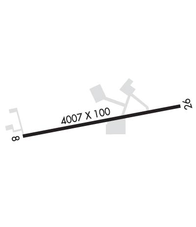
| Lat: N 3251.0 Long: W 08636.7 Elev: 585 Var: +04 Longest Runway: 4007 | ||
| CTAF: 122.8 | ||
| ||||||||||||||||||||||||||||||
| ||||||||||||||||||||||||||||||
| Rwy | Rwy | |||||||
| 4007x100 | 4007' | 4007x100 | 4007' | |||||
| Runway ID | Single Wheel | Double Wheel | Double Tandem Wheel | Dual Double Wheel |
| 08/26 | 16,000 | N/A | N/A | N/A |
| These numbers are Advisory and are not limits. The Airport Manager should have more accurate Weight Limits | ||||
 Airport Diagram might not be current. | |
| Facility Name: | CHILTON COUNTY |
| City Name: | CLANTON |
| County: | CHILTON |
| State abbrev: | AL |
| State Name: | ALABAMA |
| Ownership: | PUBLICLY OWNED |
| Use: | OPEN TO THE PUBLIC |
| Owner's Name: | CHILTON COUNTY AIRPORT AUTHORITY |
| Address: | 700 AIRPORT ROAD |
| CLANTON, AL 35045 | |
| Owner's Phone: | 205-280-3800 |
| Manager's Name: | CHILTON COUNTY AIRPORT AUTHORITY |
| Address: | 700 AIRPORT ROAD |
| CLANTON, AL 35045 | |
| Phone: | 205-280-3800 |
| FAA Region: | SOUTHERN |
| FAA Field Office: | JAN |
| Date | Sunrise | Sunset |
|---|---|---|
| 06/07/26 Sunday | 5:38 | 19:53 |
| 06/08/26 Monday | 5:38 | 19:53 |
| 06/09/26 Tuesday | 5:38 | 19:54 |
| 06/10/26 Wednesday | 5:38 | 19:54 |
| 06/11/26 Thursday | 5:38 | 19:55 |
| 06/12/26 Friday | 5:38 | 19:55 |
| 06/13/26 Saturday | 5:38 | 19:55 |
| 06/14/26 Sunday | 5:38 | 19:56 |
| 06/15/26 Monday | 5:38 | 19:56 |
| 06/16/26 Tuesday | 5:38 | 19:56 |
| 06/17/26 Wednesday | 5:38 | 19:57 |
| 06/18/26 Thursday | 5:38 | 19:57 |
| 06/19/26 Friday | 5:38 | 19:57 |
| 06/20/26 Saturday | 5:38 | 19:58 |
| Airport Attendance Schedule | MON-FRI 0800-1700; AFT HRS 205-755-8913 |
| Airport Status | OPERATIONAL (This Status can change at any time - please check NOTAMS) |
| Airport Lighting Schedule | ACTVT MIRL RWY 08/26 - CTAF. |
| Airport Storage Available | Tie Downs, Hanger |
| Extra Services Available | NONE |
| Wind Indicator | YES - (lighted) |
| Control Tower | NO |
| CTAF Frequency | 122.800 |
| Unicom Frequency | 122.800 |
| Rotating Beacon Color | WG |
| Segmented Circle | YES |
| Landing Fee | NO |
| Airport Inspected | STATE - performed by STATE AERONAUTICAL PERSONNEL |
| Inspection Date | 02/01/2024 |
| Type of Fuel Available | Grade 100LL, JET A (freeze point -40C); -10SELF SERVE FUEL AVBL H24 N SIDE OF ARPT.; -A JET-A SELF SERVE NORTH SIDE OF FIELD 24/7. |
| Airframe Repair Service | MAJOR |
| Power Plant Repair Service | MAJOR |
| Latitude | N3251.0 |
| Longitude | W08636.7 (ESTIMATED) |
| Arpt Elevation | 584ft (SURVEYED) |
| Magnetic Variation | 04W |
| 1 miles E | of CLANTON |
| Traffic Pattern Altitude | |
| Sectional Chart | ATLANTA |
| Operations (Reported) | Yearly | Avg. Daily |
|---|---|---|
| General Aviation Transient | 0 | 0 |
| General Aviation Local | 0 | 0 |
| Air Taxi | 0 | 0 |
| Commerical | 0 | 0 |
| Commuter | 0 | 0 |
| Military | 0 | 0 |
| Aircraft based on Field | |
|---|---|
| General Aviation Singles | 0 |
| General Aviation Multi | 0 |
| Jet Aircraft | 0 |
| General Aviation Helicopters | 0 |
| Military Aircraft | 0 |
| Gliders | 0 |
| Ultralights | 0 |
| FSS on field | NO |
| FSS tie-in | ANNISTON |
| FSS Phone | 1-800-WX-BRIEF |
| Who issues Notams | ANB |
| Notam D service at airport | YES |
| ARTCC Name | ATLANTA |
| Airport Certification | |
| Aircraft Rescue & Firefighting Index | None |
| Airport of Entry | No |
| Custom Landing Rights | No |
| Joint Civil/Military | No |
| Military Landing rights | No |
| NATIONAL PLAN OF INTEGRATED AIRPORT SYSTEMS (NPIAS) |
| FOR CD CTC MONTGOMERY APCH AT 334-284-4575, WHEN APCH CLSD FOR CD CTC ATLANTA ARTCC AT 770-210-7692. |
Airport Communications & Frequencies:
| |||||||||||||||||
| Runway: 08 | Runway: 26 | ||
| Mag heading: | 82° | Mag heading: | 262° |
| Rwy Slope: | -.45% Down | Rwy Slope: | .45% Up |
| Approach: | Approach: | ||
| Pattern: | Left Traffic | Pattern: | Left Traffic |
| Markings: | NONPRECISION INSTRUMENT | Markings: | NONPRECISION INSTRUMENT |
| Marking Condition: | GOOD | Marking Condition: | GOOD |
| Arresting Dev: | Arresting Dev: | ||
| Lat & Long: | N3251.0 W08637.1 | Lat. & Long.: | N3251.1 W08636.3 |
| Elev: | 584.7 ft. MSL | Elev: | 566.6 ft. MSL |
| TCH: | 38 ft. AGL | TCH: | 51 ft. AGL |
| Visual Glide Path: | 4.00 degrees | Visual Glide Path: | 4.00 degrees |
| Displaced Threshold: | No | Displaced Threshold: | No |
| Touchdown Zone: | YES | Touchdown Zone: | YES |
| Touchdown Elev.: | 584.7 feet | Touchdown Elev.: | 574.8 feet |
| Visual Glide Slope: | 2-Light PAPI on LEFT side of Runway | Visual Glide Slope: | 2-Light PAPI on LEFT side of Runway |
| RVR Equipment: | RVR Equipment: | ||
| RVV Equipment: | NO | RVV Equipment: | NO |
| Approach Lights: | Approach Lights: | ||
| REIL: | YES | REIL: | YES |
| Centerline Lights: | NO | Centerline Lights: | NO |
| Touchdown lights: | NO | Touchdown lights: | NO |
| Runway Category: | Runway with a Visual Approach | Runway Category: | Runway with a Non-precision Approach having visibility minimums greater than 3/4 mile |
| Declared Distances: | Declared Distances: | ||
| Obstructions: | Obstructions: | TREE | |
| Marked: | Marked: | NOT Marked/Lighted | |
| Clearance slope: | 20:1 | Clearance slope: | 17:1 |
| Obstruction height: | Obstruction height: | 35 feet AGL | |
| Dist. from runway: | Dist. from runway: | 800 feet | |
| Centerline offset: | Centerline offset: | 133 feet right of centerline | |
| Comments: | Comments: |
Thanks for using FltPlan.com
all rights reserved © 1999-2026 by Flight Plan LLC