
| FIELD OF DREAMS HINCKLEY MN |
| |
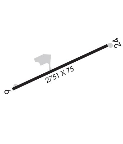
| Lat: N 4601.4 Long: W 09253.7 Elev: 1021 Var: -00 Longest Runway: 2751 | ||
| AWOS: 118.22 CTAF: 122.9 | ||
| ||||||||||||||||||||||||||||||||||||||||||||
| ||||||||||||||||||||||||||||||||||||||||||||
| ||||||||||||||||||||||||||||||||||||||||||||
| Rwy | Rwy | |||||||
| 2751x75 | 2561' | 2751x75 | 2357' | |||||
| Runway ID | Single Wheel | Double Wheel | Double Tandem Wheel | Dual Double Wheel |
| 06/24 | N/A | N/A | N/A | N/A |
| These numbers are Advisory and are not limits. The Airport Manager should have more accurate Weight Limits | ||||
 Airport Diagram might not be current. | |
| Facility Name: | FIELD OF DREAMS |
| City Name: | HINCKLEY |
| County: | PINE |
| State abbrev: | MN |
| State Name: | MINNESOTA |
| Ownership: | PRIVATELY OWNED |
| Use: | OPEN TO THE PUBLIC |
| Owner's Name: | BRIAN WEIDENDORF |
| Address: | 24226 LONE PINE ROAD |
| HINCKLEY, MN 55051 | |
| Owner's Phone: | 320-384-6667 |
| Manager's Name: | BRIAN WEIDENDORF |
| Address: | 24226 LONE PINE ROAD |
| HINKLEY, MN 55051 | |
| Phone: | 218-370-9704 |
| FAA Region: | GREAT LAKES |
| FAA Field Office: | DMA |
| Date | Sunrise | Sunset |
|---|---|---|
| 04/18/24 Thursday | 6:19 | 20:04 |
| 04/19/24 Friday | 6:17 | 20:05 |
| 04/20/24 Saturday | 6:15 | 20:06 |
| 04/21/24 Sunday | 6:13 | 20:08 |
| 04/22/24 Monday | 6:12 | 20:09 |
| 04/23/24 Tuesday | 6:10 | 20:10 |
| 04/24/24 Wednesday | 6:08 | 20:12 |
| 04/25/24 Thursday | 6:07 | 20:13 |
| 04/26/24 Friday | 6:05 | 20:14 |
| 04/27/24 Saturday | 6:03 | 20:15 |
| 04/28/24 Sunday | 6:02 | 20:17 |
| 04/29/24 Monday | 6:00 | 20:18 |
| 04/30/24 Tuesday | 5:59 | 20:19 |
| 05/01/24 Wednesday | 5:57 | 20:21 |
| Airport Attendance Schedule | UNATTENDED |
| Airport Status | OPERATIONAL (This Status can change at any time - please check NOTAMS) |
| Airport Lighting Schedule | MIRL PRESET TO LOW, INCR INTSTY - CTAF. |
| Airport Storage Available | Tie Downs, Hanger |
| Extra Services Available | Aircraft Sales |
| Wind Indicator | YES - (lighted) |
| Control Tower | NO |
| CTAF Frequency | 122.900 |
| Unicom Frequency | |
| Rotating Beacon Color | WG |
| Segmented Circle | NO |
| Landing Fee | YES |
| Airport Inspected | No Inspection Data Available performed by STATE AERONAUTICAL PERSONNEL |
| Inspection Date | 07/10/2023 |
| Type of Fuel Available | Grade 100LL; -10SELF SERVE FUEL AVAIL 24 HRS WITH CREDIT CARD. |
| Airframe Repair Service | NONE |
| Power Plant Repair Service | NONE |
| Latitude | N4601.4 |
| Longitude | W09253.7 (ESTIMATED) |
| Arpt Elevation | 1021ft () |
| Magnetic Variation | 00E |
| 1 miles E | of HINCKLEY |
| Traffic Pattern Altitude | |
| Sectional Chart | GREEN BAY |
| Operations (Reported) | Yearly | Avg. Daily |
|---|---|---|
| General Aviation Transient | 3000 | 8 |
| General Aviation Local | 3000 | 8 |
| Air Taxi | 20 | 0 |
| Commerical | 0 | 0 |
| Commuter | 0 | 0 |
| Military | 6 | 0 |
| Aircraft based on Field | |
|---|---|
| General Aviation Singles | 6 |
| General Aviation Multi | 0 |
| Jet Aircraft | 1 |
| General Aviation Helicopters | 0 |
| Military Aircraft | 0 |
| Gliders | 0 |
| Ultralights | 0 |
| FSS on field | NO |
| FSS tie-in | PRINCETON |
| FSS Phone | 1-800-WX-BRIEF |
| Who issues Notams | PNM |
| Notam D service at airport | YES |
| ARTCC Name | MINNEAPOLIS |
| Airport Certification | |
| Aircraft Rescue & Firefighting Index | None |
| Airport of Entry | No |
| Custom Landing Rights | No |
| Joint Civil/Military | No |
| Military Landing rights | No |
| FOR CD CTC MINNEAPOLIS ARTCC AT 651-463-5588. |
| RWY 06/2 4 MARKINGS FADED. |
| RWY 06/2 4 IN PAVEMENT FLUSH END LGTS OBSCURED BY DEBRIS. |
Airport Communications & Frequencies:
| |||||||
| Runway: 06 | Runway: 24 | ||
| Mag heading: | 66° | Mag heading: | 246° |
| Rwy Slope: | -.42% Down | Rwy Slope: | .42% Up |
| Approach: | Approach: | ||
| Pattern: | Left Traffic | Pattern: | Left Traffic |
| Markings: | NONPRECISION INSTRUMENT | Markings: | NONPRECISION INSTRUMENT |
| Marking Condition: | POOR | Marking Condition: | POOR |
| Arresting Dev: | Arresting Dev: | ||
| Lat & Long: | N4601.3 W09254.0 | Lat. & Long.: | N4601.5 W09253.4 |
| Elev: | 1020.6 ft. MSL | Elev: | 1009.1 ft. MSL |
| TCH: | TCH: | ||
| Visual Glide Path: | Visual Glide Path: | ||
| Displaced Threshold: | 190 feet | Displaced Threshold: | 394 feet |
| Touchdown Zone: | YES | Touchdown Zone: | YES |
| Touchdown Elev.: | 1020.6 feet | Touchdown Elev.: | 1020.6 feet |
| Visual Glide Slope: | Visual Glide Slope: | ||
| RVR Equipment: | RVR Equipment: | ||
| RVV Equipment: | NO | RVV Equipment: | NO |
| Approach Lights: | Approach Lights: | ||
| REIL: | NO | REIL: | NO |
| Centerline Lights: | NO | Centerline Lights: | NO |
| Touchdown lights: | NO | Touchdown lights: | NO |
| Runway Category: | Runway with a Non-precision Approach | Runway Category: | Runway with a Visual Approach |
| Declared Distances: | Declared Distances: | ||
| Obstructions: | Obstructions: | TREE | |
| Marked: | Marked: | NOT Marked/Lighted | |
| Clearance slope: | 20:1 | Clearance slope: | 6:1 |
| Obstruction height: | Obstruction height: | 65 feet AGL | |
| Dist. from runway: | Dist. from runway: | 616 feet | |
| Centerline offset: | Centerline offset: | 233 feet left of centerline | |
| Comments: | +8 FT ROAD 35 FT FM RWY END L/R; +4 FT FENCE 63 FT FM RWY END L/R. | Comments: |
Thanks for using FltPlan.com
all rights reserved © 1999-2024 by Flight Plan LLC
