| SHOSHONE COUNTY KELLOGG ID |
| |
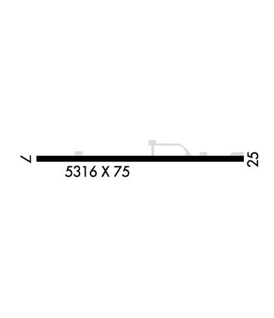
| Lat: N 4732.8 Long: W 11611.3 Elev: 2227 Var: -19 Longest Runway: 5316 | ||
| CTAF: 122.8 | ||
| |||||||||||||||||||||||
| |||||||||||||||||||||||
| Rwy | Rwy | |||||||
| 5316x75 | 5316' | 5316x75 | 4981' | |||||
| Runway ID | Single Wheel | Double Wheel | Double Tandem Wheel | Dual Double Wheel |
| 07/25 | 14,000 | N/A | N/A | N/A |
| These numbers are Advisory and are not limits. The Airport Manager should have more accurate Weight Limits | ||||
| FltPlan does not have IFR approach charts available for KS83. |
 Airport Diagram might not be current. | |
| Facility Name: | SHOSHONE COUNTY |
| City Name: | KELLOGG |
| County: | SHOSHONE |
| State abbrev: | ID |
| State Name: | IDAHO |
| Ownership: | PUBLICLY OWNED |
| Use: | OPEN TO THE PUBLIC |
| Owner's Name: | SHOSHONE COUNTY |
| Address: | 700 BANK STREET |
| WALLACE, ID 83873-2348 | |
| Owner's Phone: | 208-752-3331 |
| Manager's Name: | JOHN HANSEN |
| Address: | 700 BANK ST, SUITE 120 |
| WALLACE 83873 | |
| Phone: | 208-512-0532 |
| FAA Region: | NORTHWEST MOUNTAIN |
| FAA Field Office: | HLN |
| Date | Sunrise | Sunset |
|---|---|---|
| 04/25/24 Thursday | 5:36 | 19:50 |
| 04/26/24 Friday | 5:35 | 19:51 |
| 04/27/24 Saturday | 5:33 | 19:52 |
| 04/28/24 Sunday | 5:31 | 19:54 |
| 04/29/24 Monday | 5:30 | 19:55 |
| 04/30/24 Tuesday | 5:28 | 19:57 |
| 05/01/24 Wednesday | 5:26 | 19:58 |
| 05/02/24 Thursday | 5:25 | 19:59 |
| 05/03/24 Friday | 5:23 | 20:01 |
| 05/04/24 Saturday | 5:22 | 20:02 |
| 05/05/24 Sunday | 5:20 | 20:03 |
| 05/06/24 Monday | 5:19 | 20:05 |
| 05/07/24 Tuesday | 5:17 | 20:06 |
| 05/08/24 Wednesday | 5:16 | 20:07 |
| Airport Attendance Schedule | 7 Days A Week DALGT |
| Airport Status | OPERATIONAL (This Status can change at any time - please check NOTAMS) |
| Airport Lighting Schedule | ACVT MIRL RY 07/25 - CTAF. |
| Airport Storage Available | Tie Downs |
| Extra Services Available | NONE |
| Wind Indicator | YES - (lighted) |
| Control Tower | NO |
| CTAF Frequency | 122.800 |
| Unicom Frequency | 122.800 |
| Rotating Beacon Color | WG |
| Segmented Circle | YES |
| Landing Fee | NO |
| Airport Inspected | STATE - performed by STATE AERONAUTICAL PERSONNEL |
| Inspection Date | 09/03/2021 |
| Type of Fuel Available | Grade 100LL |
| Airframe Repair Service | NONE |
| Power Plant Repair Service | NONE |
| Latitude | N4732.8 |
| Longitude | W11611.3 (ESTIMATED) |
| Arpt Elevation | 2227ft (ESTIMATED) |
| Magnetic Variation | 19E |
| 3 miles W | of KELLOGG |
| Traffic Pattern Altitude | |
| Sectional Chart | GREAT FALLS |
| Operations (Reported) | Yearly | Avg. Daily |
|---|---|---|
| General Aviation Transient | 5500 | 15 |
| General Aviation Local | 1200 | 3 |
| Air Taxi | 750 | 2 |
| Commerical | 0 | 0 |
| Commuter | 0 | 0 |
| Military | 50 | 0 |
| Aircraft based on Field | |
|---|---|
| General Aviation Singles | 12 |
| General Aviation Multi | 1 |
| Jet Aircraft | 0 |
| General Aviation Helicopters | 1 |
| Military Aircraft | 0 |
| Gliders | 0 |
| Ultralights | 1 |
| FSS on field | NO |
| FSS tie-in | BOISE |
| FSS Phone | 1-800-WX-BRIEF |
| Who issues Notams | BOI |
| Notam D service at airport | YES |
| ARTCC Name | SEATTLE |
| Airport Certification | |
| Aircraft Rescue & Firefighting Index | None |
| Airport of Entry | No |
| Custom Landing Rights | No |
| Joint Civil/Military | No |
| Military Landing rights | YES |
| NATIONAL PLAN OF INTEGRATED AIRPORT SYSTEMS (NPIAS) |
| GRANT AGREEMENTS UNDER FAAP/ADAP/AIP |
| CONVEYANCE UNDER SCETION 16, FEDERAL AIRPORT ACT OF 1946 OR SECTION 23, AIRPORT AND AIRWAY DEVELOPMENT ACT OF 1970 |
| ASSURANCES PURSUANT TO TITLE VI, CIVIL RIGHTS ACT OF 1964 |
| FOR CD CTC SEATTLE ARTCC AT 253-351-3694. |
| Runway: 07 | Runway: 25 | ||
| Mag heading: | N/A | Mag heading: | N/A |
| Rwy Slope: | .36% Up | Rwy Slope: | -.36% Down |
| Approach: | Approach: | ||
| Pattern: | Right Traffic | Pattern: | Left Traffic |
| Markings: | BASIC | Markings: | BASIC |
| Marking Condition: | GOOD | Marking Condition: | GOOD |
| Arresting Dev: | Arresting Dev: | ||
| Lat & Long: | N4732.8 W11612.0 | Lat. & Long.: | N4732.8 W11610.7 |
| Elev: | 2208.0 ft. MSL | Elev: | 2227.0 ft. MSL |
| TCH: | TCH: | ||
| Visual Glide Path: | Visual Glide Path: | ||
| Displaced Threshold: | No | Displaced Threshold: | 335 feet |
| Touchdown Zone: | NO | Touchdown Zone: | NO |
| Touchdown Elev.: | Touchdown Elev.: | ||
| Visual Glide Slope: | Visual Glide Slope: | ||
| RVR Equipment: | RVR Equipment: | ||
| RVV Equipment: | NO | RVV Equipment: | NO |
| Approach Lights: | Approach Lights: | ||
| REIL: | NO | REIL: | NO |
| Centerline Lights: | NO | Centerline Lights: | NO |
| Touchdown lights: | NO | Touchdown lights: | NO |
| Runway Category: | Runway with a Visual Approach | Runway Category: | Runway with a Visual Approach |
| Declared Distances: | Declared Distances: | ||
| Obstructions: | TREE | Obstructions: | TREE; RY 25 +80 FT TREES AT 1700 FT ON CNTRLN; +40 FT POLE & TRRN ON CNTRLN 700 FT FM RY END; +63 FT SIGN AT 1900 FT ON CNTRLN. |
| Marked: | NOT Marked/Lighted | Marked: | NOT Marked/Lighted |
| Clearance slope: | 2:1 | Clearance slope: | 5:1; RWY 25 APPROACH SLOPE 16:1 TO DISPLACED THRESHOLD. |
| Obstruction height: | 50 feet AGL | Obstruction height: | 55 feet AGL |
| Dist. from runway: | 345 feet | Dist. from runway: | 500 feet |
| Centerline offset: | 125 right of centerline | Centerline offset: | 100 feet left of centerline |
| Comments: | Comments: |
Thanks for using FltPlan.com
all rights reserved © 1999-2024 by Flight Plan LLC