
| ST MARIES MUNI ST MARIES ID |
| |
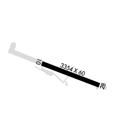
| Lat: N 4719.5 Long: W 11634.6 Elev: 2131 Var: -15 Longest Runway: 3354 | ||
| CTAF: 122.8 | ||
| ||||||
|
| Rwy | Rwy | |||||||
| 3354x60 | 3354' | 3354x60 | 3354' | |||||
| Runway ID | Single Wheel | Double Wheel | Double Tandem Wheel | Dual Double Wheel |
| 10/28 | 12,500 | N/A | N/A | N/A |
| These numbers are Advisory and are not limits. The Airport Manager should have more accurate Weight Limits | ||||
| FltPlan does not have IFR approach charts available for KS72. |
 Airport Diagram might not be current. | |
| Facility Name: | JACK A BUELL |
| City Name: | ST MARIES |
| County: | BENEWAH |
| State abbrev: | ID |
| State Name: | IDAHO |
| Ownership: | PUBLICLY OWNED |
| Use: | OPEN TO THE PUBLIC |
| Owner's Name: | BENEWAH COUNTY |
| Address: | BENEWAH COUNTY COURTHOUSE |
| ST MARIES, ID 83861 | |
| Owner's Phone: | 208-245-2234 |
| Manager's Name: | JIM ROLETTO |
| Address: | 701 COLLEGE AVE |
| ST MARIES, ID 83861 | |
| Phone: | 208-967-4232 |
| FAA Region: | NORTHWEST MOUNTAIN |
| FAA Field Office: | HLN |
| Date | Sunrise | Sunset |
|---|---|---|
| 04/24/24 Wednesday | 5:40 | 19:49 |
| 04/25/24 Thursday | 5:38 | 19:51 |
| 04/26/24 Friday | 5:37 | 19:52 |
| 04/27/24 Saturday | 5:35 | 19:53 |
| 04/28/24 Sunday | 5:33 | 19:55 |
| 04/29/24 Monday | 5:32 | 19:56 |
| 04/30/24 Tuesday | 5:30 | 19:57 |
| 05/01/24 Wednesday | 5:29 | 19:59 |
| 05/02/24 Thursday | 5:27 | 20:00 |
| 05/03/24 Friday | 5:25 | 20:02 |
| 05/04/24 Saturday | 5:24 | 20:03 |
| 05/05/24 Sunday | 5:22 | 20:04 |
| 05/06/24 Monday | 5:21 | 20:06 |
| 05/07/24 Tuesday | 5:19 | 20:07 |
| Airport Attendance Schedule | UNATTENDED |
| Airport Status | OPERATIONAL (This Status can change at any time - please check NOTAMS) |
| Airport Lighting Schedule | ACTVT MIRL RWY 10/28 - CTAF. |
| Airport Storage Available | Tie Downs |
| Extra Services Available | Flight Instruction |
| Wind Indicator | YES - (lighted) |
| Control Tower | NO |
| CTAF Frequency | 122.800 |
| Unicom Frequency | 122.800 |
| Rotating Beacon Color | WG |
| Segmented Circle | YES |
| Landing Fee | NO |
| Airport Inspected | STATE - performed by STATE AERONAUTICAL PERSONNEL |
| Inspection Date | 08/16/2022 |
| Type of Fuel Available | Grade 100LL |
| Airframe Repair Service | MINOR |
| Power Plant Repair Service | MINOR |
| Latitude | N4719.5 |
| Longitude | W11634.6 (ESTIMATED) |
| Arpt Elevation | 2131ft (SURVEYED) |
| Magnetic Variation | 15E |
| 1 miles NW | of ST MARIES |
| Traffic Pattern Altitude | |
| Sectional Chart | GREAT FALLS |
| Operations (Reported) | Yearly | Avg. Daily |
|---|---|---|
| General Aviation Transient | 8400 | 23 |
| General Aviation Local | 4700 | 13 |
| Air Taxi | 0 | 0 |
| Commerical | 0 | 0 |
| Commuter | 0 | 0 |
| Military | 0 | 0 |
| Aircraft based on Field | |
|---|---|
| General Aviation Singles | 13 |
| General Aviation Multi | 2 |
| Jet Aircraft | 0 |
| General Aviation Helicopters | 0 |
| Military Aircraft | 0 |
| Gliders | 0 |
| Ultralights | 0 |
| FSS on field | NO |
| FSS tie-in | BOISE |
| FSS Phone | 1-800-WX-BRIEF |
| Who issues Notams | BOI |
| Notam D service at airport | YES |
| ARTCC Name | SEATTLE |
| Airport Certification | |
| Aircraft Rescue & Firefighting Index | None |
| Airport of Entry | No |
| Custom Landing Rights | No |
| Joint Civil/Military | No |
| Military Landing rights | YES |
| NATIONAL PLAN OF INTEGRATED AIRPORT SYSTEMS (NPIAS) |
| GRANT AGREEMENTS UNDER FAAP/ADAP/AIP |
| ASSURANCES PURSUANT TO TITLE VI, CIVIL RIGHTS ACT OF 1964 |
| RY 28 HAS 200 FT STOPWAY. |
| FOR CD CTC SEATTLE ARTCC AT 253-351-3694. |
| RWY 10/2 8 FIRST 715 FT RWY 10 NOT LGTD. |
| Runway: 10 | Runway: 28 | ||
| Mag heading: | 100° | Mag heading: | 280° |
| Rwy Slope: | -.15% Down | Rwy Slope: | .15% Up |
| Approach: | Approach: | ||
| Pattern: | Right Traffic | Pattern: | Left Traffic |
| Markings: | BASIC | Markings: | BASIC |
| Marking Condition: | GOOD; NSTD DSPLCD THLD MARKING YELLOW CHEVRONS. | Marking Condition: | GOOD |
| Arresting Dev: | Arresting Dev: | ||
| Lat & Long: | N4719.7 W11635.0 | Lat. & Long.: | N4719.4 W11634.2 |
| Elev: | 2131.3 ft. MSL | Elev: | 2126.3 ft. MSL |
| TCH: | TCH: | ||
| Visual Glide Path: | Visual Glide Path: | ||
| Displaced Threshold: | No | Displaced Threshold: | No |
| Touchdown Zone: | YES | Touchdown Zone: | YES |
| Touchdown Elev.: | 2131.3 feet | Touchdown Elev.: | 2130.7 feet |
| Visual Glide Slope: | Visual Glide Slope: | ||
| RVR Equipment: | RVR Equipment: | ||
| RVV Equipment: | NO | RVV Equipment: | NO |
| Approach Lights: | Approach Lights: | ||
| REIL: | NO | REIL: | NO |
| Centerline Lights: | NO | Centerline Lights: | NO |
| Touchdown lights: | NO | Touchdown lights: | NO |
| Runway Category: | Runway with a Visual Approach | Runway Category: | Runway with a Visual Approach |
| Declared Distances: | Declared Distances: | ||
| Obstructions: | ROAD | Obstructions: | TREES; ADDNL OBSTNS +50' PLINE AT 2000', ON CNTRLN +4' FENCE AT 275' ON CNTRLN, +1000' RIDGE AT 1 1/2 MILES, ON CNTRLN. |
| Marked: | NOT Marked/Lighted | Marked: | NOT Marked/Lighted |
| Clearance slope: | 8:1; DSPLCD FOR 45' ROAD AT 0';30 FT R; 23:1 FM DSPLCD THLD. | Clearance slope: | 33:1 |
| Obstruction height: | 45 feet AGL | Obstruction height: | 45 feet AGL |
| Dist. from runway: | 600 feet | Dist. from runway: | 1700 feet |
| Centerline offset: | 165 right of centerline | Centerline offset: | |
| Comments: | Comments: |
Thanks for using FltPlan.com
all rights reserved © 1999-2024 by Flight Plan LLC
