
| OTHELLO MUNI OTHELLO WA |
| |
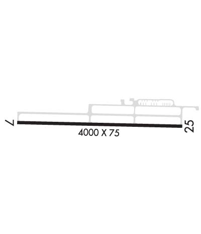
| Lat: N 4647.7 Long: W 11904.8 Elev: 1149 Var: -19 Longest Runway: 4000 | ||
| CTAF: 122.9 | ||
| ||||||
|
| Rwy | Rwy | |||||||
| 4000x75 | 4000' | 4000x75 | 4000' | |||||
| Runway ID | Single Wheel | Double Wheel | Double Tandem Wheel | Dual Double Wheel |
| 07/25 | 16,000 | N/A | N/A | N/A |
| These numbers are Advisory and are not limits. The Airport Manager should have more accurate Weight Limits | ||||
| FltPlan does not have IFR approach charts available for KS70. |
 Airport Diagram might not be current. | |
| Facility Name: | OTHELLO MUNI |
| City Name: | OTHELLO |
| County: | ADAMS |
| State abbrev: | WA |
| State Name: | WASHINGTON |
| Ownership: | PUBLICLY OWNED |
| Use: | OPEN TO THE PUBLIC |
| Owner's Name: | PORT OF OTHELLO |
| Address: | 705 EAST HEMLOCK |
| OTHELLO, WA 99344 | |
| Owner's Phone: | 509-488-2544 |
| Manager's Name: | CHRIS FAIX |
| Address: | 705 EAST HEMLOCK |
| OTHELLO, WA 99344 | |
| Phone: | (509) 761-1004 |
| FAA Region: | NORTHWEST MOUNTAIN |
| FAA Field Office: | SEA |
| Date | Sunrise | Sunset |
|---|---|---|
| 04/25/24 Thursday | 5:50 | 19:59 |
| 04/26/24 Friday | 5:48 | 20:01 |
| 04/27/24 Saturday | 5:46 | 20:02 |
| 04/28/24 Sunday | 5:45 | 20:03 |
| 04/29/24 Monday | 5:43 | 20:05 |
| 04/30/24 Tuesday | 5:41 | 20:06 |
| 05/01/24 Wednesday | 5:40 | 20:07 |
| 05/02/24 Thursday | 5:38 | 20:09 |
| 05/03/24 Friday | 5:37 | 20:10 |
| 05/04/24 Saturday | 5:35 | 20:11 |
| 05/05/24 Sunday | 5:34 | 20:13 |
| 05/06/24 Monday | 5:32 | 20:14 |
| 05/07/24 Tuesday | 5:31 | 20:15 |
| 05/08/24 Wednesday | 5:30 | 20:17 |
| Airport Attendance Schedule | UNATTENDED |
| Airport Status | OPERATIONAL (This Status can change at any time - please check NOTAMS) |
| Airport Lighting Schedule | ACTVT REIL RWY 07 & RWY 25; PAPI RWY 25; MIRL RWY 07/25 - CTAF. |
| Airport Storage Available | Tie Downs |
| Extra Services Available | Crop Dusting |
| Wind Indicator | YES - (lighted) |
| Control Tower | NO |
| CTAF Frequency | 122.900 |
| Unicom Frequency | |
| Rotating Beacon Color | WG |
| Segmented Circle | YES |
| Landing Fee | NO |
| Airport Inspected | STATE - performed by STATE AERONAUTICAL PERSONNEL |
| Inspection Date | 08/22/2022 |
| Type of Fuel Available | Grade 100LL; -10FUEL AVBL 24 HRS. |
| Airframe Repair Service | NONE |
| Power Plant Repair Service | NONE |
| Latitude | N4647.7 |
| Longitude | W11904.8 (ESTIMATED) |
| Arpt Elevation | 1148ft (SURVEYED) |
| Magnetic Variation | 19E |
| 4 miles SE | of OTHELLO |
| Traffic Pattern Altitude | |
| Sectional Chart | SEATTLE |
| Operations (Reported) | Yearly | Avg. Daily |
|---|---|---|
| General Aviation Transient | 5740 | 16 |
| General Aviation Local | 28750 | 79 |
| Air Taxi | 0 | 0 |
| Commerical | 0 | 0 |
| Commuter | 0 | 0 |
| Military | 0 | 0 |
| Aircraft based on Field | |
|---|---|
| General Aviation Singles | 23 |
| General Aviation Multi | 1 |
| Jet Aircraft | 0 |
| General Aviation Helicopters | 2 |
| Military Aircraft | 0 |
| Gliders | 0 |
| Ultralights | 0 |
| FSS on field | NO |
| FSS tie-in | SEATTLE |
| FSS Phone | 1-800-WX-BRIEF |
| Who issues Notams | SEA |
| Notam D service at airport | YES |
| ARTCC Name | SEATTLE |
| Airport Certification | |
| Aircraft Rescue & Firefighting Index | None |
| Airport of Entry | No |
| Custom Landing Rights | No |
| Joint Civil/Military | No |
| Military Landing rights | No |
| NATIONAL PLAN OF INTEGRATED AIRPORT SYSTEMS (NPIAS) |
| GRANT AGREEMENTS UNDER FAAP/ADAP/AIP |
| IRRIGATION PIVOT OCCASIONALLY OPRS ACROSS EXTENDED CTRLN OF RY 25, APPROXIMATELY 750 FT BYD RY END, DURING GROWING SEASON. |
| FOR CD CTC GRANT COUNTY APCH AT 509-762-2842, WHEN APCH CLSD CTC SEATTLE ARTCC AT 253-351-3694. |
| Runway: 07 | Runway: 25 | ||
| Mag heading: | 72° | Mag heading: | 252° |
| Rwy Slope: | .28% Up | Rwy Slope: | -.28% Down |
| Approach: | Approach: | ||
| Pattern: | Left Traffic | Pattern: | Left Traffic |
| Markings: | BASIC | Markings: | BASIC |
| Marking Condition: | GOOD | Marking Condition: | GOOD |
| Arresting Dev: | Arresting Dev: | ||
| Lat & Long: | N4647.7 W11905.3 | Lat. & Long.: | N4647.6 W11904.3 |
| Elev: | 1137.6 ft. MSL | Elev: | 1148.6 ft. MSL |
| TCH: | TCH: | 32 ft. AGL | |
| Visual Glide Path: | Visual Glide Path: | 3.00 degrees | |
| Displaced Threshold: | No | Displaced Threshold: | No |
| Touchdown Zone: | YES | Touchdown Zone: | YES |
| Touchdown Elev.: | 1146.6 feet | Touchdown Elev.: | 1148.6 feet |
| Visual Glide Slope: | Visual Glide Slope: | 2-Light PAPI on LEFT side of Runway | |
| RVR Equipment: | RVR Equipment: | ||
| RVV Equipment: | NO | RVV Equipment: | NO |
| Approach Lights: | Approach Lights: | ||
| REIL: | YES | REIL: | YES |
| Centerline Lights: | NO | Centerline Lights: | NO |
| Touchdown lights: | NO | Touchdown lights: | NO |
| Runway Category: | Runway with a Visual Approach | Runway Category: | Runway with a Visual Approach |
| Declared Distances: | Declared Distances: | ||
| Obstructions: | ROAD | Obstructions: | ROAD |
| Marked: | NOT Marked/Lighted | Marked: | NOT Marked/Lighted |
| Clearance slope: | 32:1 | Clearance slope: | 32:1 |
| Obstruction height: | 15 feet AGL | Obstruction height: | 15 feet AGL |
| Dist. from runway: | 691 feet | Dist. from runway: | 687 feet |
| Centerline offset: | Centerline offset: | ||
| Comments: | Comments: |
Thanks for using FltPlan.com
all rights reserved © 1999-2024 by Flight Plan LLC
