
| ALBANY MUNI ALBANY OR |
| |
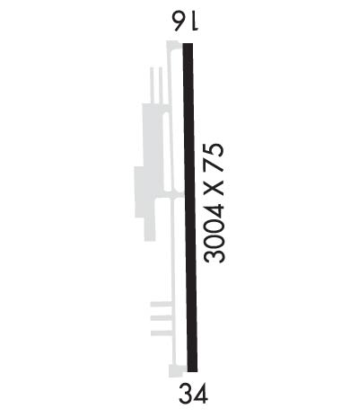
| Lat: N 4438.3 Long: W 12303.6 Elev: 227 Var: -15 Longest Runway: 3004 | ||
| AWOS: 119.93 CTAF: 122.72 | ||
| ||||||||||||||||||||||||||||||
| ||||||||||||||||||||||||||||||
| Rwy | Rwy | |||||||
| 3004x75 | 3004' | 3004x75 | 3004' | |||||
| Runway ID | Single Wheel | Double Wheel | Double Tandem Wheel | Dual Double Wheel |
| 16/34 | 30,000 | 43,000 | 71,000 | N/A |
| These numbers are Advisory and are not limits. The Airport Manager should have more accurate Weight Limits | ||||
 Airport Diagram might not be current. | |
| Facility Name: | ALBANY MUNI |
| City Name: | ALBANY |
| County: | LINN |
| State abbrev: | OR |
| State Name: | OREGON |
| Ownership: | PUBLICLY OWNED |
| Use: | OPEN TO THE PUBLIC |
| Owner's Name: | CITY OF ALBANY |
| Address: | P O BOX 490 |
| ALBANY, OR 97321 | |
| Owner's Phone: | 541-917-7600 |
| Manager's Name: | ROBB ROMEO |
| Address: | 310 NE WAVERLY DRIVE |
| ALBANY, OR 97321 | |
| Phone: | 541-917-7605 |
| FAA Region: | NORTHWEST MOUNTAIN |
| FAA Field Office: | SEA |
| Date | Sunrise | Sunset |
|---|---|---|
| 04/24/24 Wednesday | 6:12 | 20:09 |
| 04/25/24 Thursday | 6:10 | 20:11 |
| 04/26/24 Friday | 6:09 | 20:12 |
| 04/27/24 Saturday | 6:07 | 20:13 |
| 04/28/24 Sunday | 6:06 | 20:14 |
| 04/29/24 Monday | 6:04 | 20:16 |
| 04/30/24 Tuesday | 6:03 | 20:17 |
| 05/01/24 Wednesday | 6:01 | 20:18 |
| 05/02/24 Thursday | 6:00 | 20:19 |
| 05/03/24 Friday | 5:58 | 20:20 |
| 05/04/24 Saturday | 5:57 | 20:22 |
| 05/05/24 Sunday | 5:56 | 20:23 |
| 05/06/24 Monday | 5:54 | 20:24 |
| 05/07/24 Tuesday | 5:53 | 20:25 |
| Airport Attendance Schedule | 7 Days A Week 0800-1700 |
| Airport Status | OPERATIONAL (This Status can change at any time - please check NOTAMS) |
| Airport Lighting Schedule | ACTVT MIRL RY 16/34, REIL RY 16 & 34 AND VASI RY 16 - CTAF. |
| Airport Storage Available | Tie Downs |
| Extra Services Available | Flight Instruction, Aircraft Rental, Aircraft Sales |
| Wind Indicator | YES - (lighted) |
| Control Tower | NO |
| CTAF Frequency | 122.725 |
| Unicom Frequency | 122.725 |
| Rotating Beacon Color | WG |
| Segmented Circle | YES |
| Landing Fee | NO |
| Airport Inspected | STATE - performed by STATE AERONAUTICAL PERSONNEL |
| Inspection Date | 08/23/2023 |
| Type of Fuel Available | Grade 100LL, JET A (freeze point -40C) |
| Airframe Repair Service | NONE |
| Power Plant Repair Service | NONE |
| Latitude | N4438.3 |
| Longitude | W12303.6 (ESTIMATED) |
| Arpt Elevation | 226ft (SURVEYED) |
| Magnetic Variation | 15E |
| 3 miles E | of ALBANY |
| Traffic Pattern Altitude | |
| Sectional Chart | SEATTLE |
| Operations (Reported) | Yearly | Avg. Daily |
|---|---|---|
| General Aviation Transient | 12650 | 35 |
| General Aviation Local | 10000 | 27 |
| Air Taxi | 650 | 2 |
| Commerical | 0 | 0 |
| Commuter | 0 | 0 |
| Military | 0 | 0 |
| Aircraft based on Field | |
|---|---|
| General Aviation Singles | 64 |
| General Aviation Multi | 3 |
| Jet Aircraft | 1 |
| General Aviation Helicopters | 0 |
| Military Aircraft | 0 |
| Gliders | 0 |
| Ultralights | 0 |
| FSS on field | NO |
| FSS tie-in | MC MINNVILLE |
| FSS Phone | 1-800-WX-BRIEF |
| Who issues Notams | MMV |
| Notam D service at airport | YES |
| ARTCC Name | SEATTLE |
| Airport Certification | |
| Aircraft Rescue & Firefighting Index | None |
| Airport of Entry | No |
| Custom Landing Rights | No |
| Joint Civil/Military | No |
| Military Landing rights | YES |
| NATIONAL PLAN OF INTEGRATED AIRPORT SYSTEMS (NPIAS) |
| GRANT AGREEMENTS UNDER FAAP/ADAP/AIP |
| ASSURANCES PURSUANT TO TITLE VI, CIVIL RIGHTS ACT OF 1964 |
| TWY MKD BY REFLECTORS. NON STD COLOR ON NORTH AND SOUTH ENDS. |
| RY 34 HAS A 160 FT OVERRUN. |
| RY 16 HAS A 497 FT OVERRUN. |
| FOR CD CTC CASCADE APCH AT 541-607-4674/4675, WHEN APCH CLSD CTC SEATTLE ARTCC AT 253-351-3694. |
Airport Communications & Frequencies:
| |||||||||||||||||
| Runway: 16 | Runway: 34 | ||
| Mag heading: | 165° | Mag heading: | 345° |
| Rwy Slope: | .02% Up | Rwy Slope: | -.02% Down |
| Approach: | Approach: | ||
| Pattern: | Left Traffic | Pattern: | Left Traffic |
| Markings: | BASIC | Markings: | BASIC |
| Marking Condition: | GOOD | Marking Condition: | GOOD |
| Arresting Dev: | Arresting Dev: | ||
| Lat & Long: | N4438.5 W12303.6 | Lat. & Long.: | N4438.0 W12303.6 |
| Elev: | 225.8 ft. MSL | Elev: | 226.3 ft. MSL |
| TCH: | 29 ft. AGL | TCH: | 25 ft. AGL |
| Visual Glide Path: | 4.00 degrees | Visual Glide Path: | 4.00 degrees |
| Displaced Threshold: | No | Displaced Threshold: | No |
| Touchdown Zone: | YES | Touchdown Zone: | YES |
| Touchdown Elev.: | 226.5 feet | Touchdown Elev.: | 226.5 feet |
| Visual Glide Slope: | 4-BOX VASI ON LEFT SIDE OF RUNWAY | Visual Glide Slope: | 2-Box VASI on LEFT side of Runway |
| RVR Equipment: | RVR Equipment: | ||
| RVV Equipment: | NO | RVV Equipment: | NO |
| Approach Lights: | Approach Lights: | ||
| REIL: | YES | REIL: | YES |
| Centerline Lights: | NO | Centerline Lights: | NO |
| Touchdown lights: | NO | Touchdown lights: | NO |
| Runway Category: | Runway with a Visual Approach | Runway Category: | Runway with a Visual Approach |
| Declared Distances: | Declared Distances: | ||
| Obstructions: | ROAD; RY 16 80 FT UNMARKED TREE AT 1530 FT ON CNTRLN AT 18:1. | Obstructions: | TREES; 65 FT MKD PLINE AT 1575 FT ON CNTRLN AT 20:1. |
| Marked: | NOT Marked/Lighted | Marked: | NOT Marked/Lighted |
| Clearance slope: | 17:1 | Clearance slope: | 16:1 |
| Obstruction height: | 13 feet AGL | Obstruction height: | 80 feet AGL |
| Dist. from runway: | 427 feet | Dist. from runway: | 1520 feet |
| Centerline offset: | 148 right of centerline | Centerline offset: | |
| Comments: | Comments: |
Thanks for using FltPlan.com
all rights reserved © 1999-2024 by Flight Plan LLC


