| SOUTHWEST FLORIDA INTL FORT MYERS FL |
| |
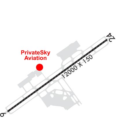
| Lat: N 2632.2 Long: W 08145.3 Elev: 30 Var: +04 Longest Runway: 12000 | ||
| Clr Del: 132.07 Dept. ATIS: 124.65 Arr. ATIS: 124.65 AWOS: 124.65 Ground: 121.9 Tower: 128.75 | ||
| |||||||||||||||||||||||||||||||||||||||||||||||||||||||||||||||||||||
| |||||||||||||||||||||||||||||||||||||||||||||||||||||||||||||||||||||
| |||||||||||||||||||||||||||||||||||||||||||||||||||||||||||||||||||||
| Rwy | Rwy | |||||||
| 12000x150 | 12000' | 111.50 - 058° | 12000x150 | 12000' | ||||
| Runway ID | Single Wheel | Double Wheel | Double Tandem Wheel | Dual Double Wheel |
| 06/24 | 120,000 | 250,000 | 538,000 | 1,045,000 |
| These numbers are Advisory and are not limits. The Airport Manager should have more accurate Weight Limits | ||||
 Airport Diagram might not be current. | |
| Facility Name: | SOUTHWEST FLORIDA INTL |
| City Name: | FORT MYERS |
| County: | LEE |
| State abbrev: | FL |
| State Name: | FLORIDA |
| Ownership: | PUBLICLY OWNED |
| Use: | OPEN TO THE PUBLIC |
| Owner's Name: | BOARD OF COM LEE CO PORT AUTH |
| Address: | PO BOX 398 |
| FORT MYERS, FL 33902 | |
| Owner's Phone: | 239-590-4800 |
| Manager's Name: | BEN SIEGEL |
| Address: | 11000 TERMINAL ACCESS RD. |
| FORT MYERS, FL 33913 | |
| Phone: | 239-590-4400 |
| FAA Region: | SOUTHERN |
| FAA Field Office: | ORL |
| Date | Sunrise | Sunset |
|---|---|---|
| 04/25/24 Thursday | 6:54 | 19:57 |
| 04/26/24 Friday | 6:53 | 19:57 |
| 04/27/24 Saturday | 6:52 | 19:58 |
| 04/28/24 Sunday | 6:51 | 19:58 |
| 04/29/24 Monday | 6:50 | 19:59 |
| 04/30/24 Tuesday | 6:49 | 19:59 |
| 05/01/24 Wednesday | 6:49 | 20:00 |
| 05/02/24 Thursday | 6:48 | 20:00 |
| 05/03/24 Friday | 6:47 | 20:01 |
| 05/04/24 Saturday | 6:46 | 20:01 |
| 05/05/24 Sunday | 6:46 | 20:02 |
| 05/06/24 Monday | 6:45 | 20:03 |
| 05/07/24 Tuesday | 6:44 | 20:03 |
| 05/08/24 Wednesday | 6:44 | 20:04 |
| Airport Attendance Schedule | 7 Days A Week 0700-0100 |
| Airport Status | OPERATIONAL (This Status can change at any time - please check NOTAMS) |
| Airport Lighting Schedule | ACTVT MALSR RWY 06 - CTAF. ALL OTHER LGTS OPR CONSLY. |
| Airport Storage Available | Tie Downs, Hanger |
| Extra Services Available | Cargo Handling |
| Wind Indicator | YES - (lighted) |
| Control Tower | YES |
| CTAF Frequency | 128.750 |
| Unicom Frequency | 122.950 |
| Rotating Beacon Color | WG |
| Segmented Circle | YES |
| Landing Fee | YES; FEES FOR CHARTER, TRAVEL CLUBS & REVENUE PRODUCING ACFT. |
| Airport Inspected | FEDERAL - performed by FAA AIRPORTS FIELD PERSONNEL |
| Inspection Date | 05/05/2023 |
| Type of Fuel Available | Grade 100LL, JET A (freeze point -40C), JET A |
| Airframe Repair Service | MAJOR |
| Power Plant Repair Service | MAJOR |
| Latitude | N2632.2 |
| Longitude | W08145.3 (ESTIMATED) |
| Arpt Elevation | 29ft (SURVEYED) |
| Magnetic Variation | 04W |
| 10 miles SE | of FORT MYERS |
| Traffic Pattern Altitude | |
| Sectional Chart | MIAMI |
| Operations (Reported) | Yearly | Avg. Daily |
|---|---|---|
| General Aviation Transient | 8523 | 23 |
| General Aviation Local | 158 | 0 |
| Air Taxi | 5979 | 16 |
| Commerical | 68128 | 187 |
| Commuter | 0 | 0 |
| Military | 1378 | 4 |
| Aircraft based on Field | |
|---|---|
| General Aviation Singles | 0 |
| General Aviation Multi | 0 |
| Jet Aircraft | 5 |
| General Aviation Helicopters | 0 |
| Military Aircraft | 0 |
| Gliders | 0 |
| Ultralights | 0 |
| FSS on field | NO |
| FSS tie-in | MIAMI |
| FSS Phone | 1-800-WX-BRIEF |
| Who issues Notams | RSW |
| Notam D service at airport | YES |
| ARTCC Name | MIAMI |
| Airport Certification | AIRPORT RECEIVING SCHEDULED AIR CARRIER SERVICE FROM CARRIERS CERTIFICATED BY THE CIVIL AERONAUTICS BOARD |
| Aircraft Rescue & Firefighting Index | AIRPORT HAS A CERTIFICATE UNDER CFR PART 139 |
| Airport of Entry | No |
| Custom Landing Rights | YES; US CUSTOMS USER FEE ARPT. |
| Joint Civil/Military | No |
| Military Landing rights | YES |
| NATIONAL PLAN OF INTEGRATED AIRPORT SYSTEMS (NPIAS) |
| GRANT AGREEMENTS UNDER FAAP/ADAP/AIP |
| ASSURANCES PURSUANT TO TITLE VI, CIVIL RIGHTS ACT OF 1964 |
| CAUTION: OPEN BAGGAGE BAYS & CONST WITHIN TERMINAL RAMP AREA. AIRCREWS USE MINIMUM THRUST SETTINGS IN THESE AREAS, SPCLY DURG SINGLE ENG TAXI. CROSS-BLEED STARTS ONLY ALLOWED AFT REACHING THE TUG RELEASE POINT. |
| ALL ACFT ON RAMP EXP CLOCKWISE FLOW. OUTBOUND TRAFFIC FROM GATES D2, D4, D6, D8 & D10 PROCEED TO CALL SPOT 1; OUTBOUND TRAFFIC FROM GATES C2, C4, C6, D1, D3, D5 & D7 PROCEED TO CALL SPOT 3; OUTBOUND TRAFFIC FROM GATES B2, B4, B6, B8, C1, C3, C5 & C7 PROCEED TO CALL SPOT 5; OUTBOUND TRAFFIC FROM GATES B1, B3 & B5 PROCEED TO CALL SPOT 9; ALL OUTBOUND TRAFFIC REQUEST TAXI INSTRUCTIONS. |
| ACR USE RAMP PROC PRESCRIBED BY ARPT OPS. |
| TFC PROCD DRCTLY TO GATE UNLESS DRCTD BY ATC; ADVISE ATC IF GATE IS NOT AVBL. |
| DEP ACFT OBTAIN APVL FM GND CTL PRIOR TO PUSHBACK FM GATES B7, B9, C8, C9 & D10A. PILOTS ADVISE TUG OPR OF OBTAINED CLNC FM GND CTL PRIOR TO ENTERING TWY G. DEP CTC GND CTL PRIOR TO LEAVING THE COMMUTER RAMP FROM GATES D9A & D9B. |
| GATES B7 & B9 EXP CALL SPOT #7. GATES C8 & C9 EXP CALL SPOT #4. GATE D10A EXP CALL SPOT #2. |
| FOR CD IFUN TO CTC ON MIAMI CTR FREQ, CTC MIAMI ARTCC AT 305-716-1731 (0100-0700). |
| TWY A5 BTN FBO RAMP AND TWY A CLSD TO ACFT WINGSPAN MORE THAN 118 FT. |
| CAUTION: GS ANT 130 FT SW OF TWY A CNTRLN BTN TWY A1 & TWY A2. |
| OPERATE TRANSPONDERS WITH ALTITUDE REPORTING MODE AND ADS-B (IF EQUIPPED) ENABLED ON ALL AIRPORT SURFACES. |
| NO HELI OPS PERMITTED ON TRML APRON. |
| LGTS ON PARALLEL ROAD & PARKING LOT NW OF RWY 06/24 CAN BE MISTAKEN FOR RWY & APCH ENVIRONMENT. |
| GND CLNC RQRD PRIOR TO ENTERING TWY G. |
| RWY USE PROGRAM IN EFFECT; USE DISTANT NOISE ABATEMENT DEP PROFILE. VISUAL APCH TO RWY 06 W OF FORT MYERS BEACH MAINTAIN 3000 FT UNTIL CROSSING SHORELINE 12 NM SW OF ARPT. RWY 24 PREFERRED BTN 2200-0600. FOR NOISE ABATEMENT PROC CTC AMGR. |
Airport Communications & Frequencies:
| |||||||||||||||||||||||||||||||||||||||||||||||||||||||||||||||||
| Runway: 06 | Runway: 24 | ||
| Mag heading: | 58° | Mag heading: | 238° |
| Rwy Slope: | .03% Up | Rwy Slope: | -.03% Down |
| Approach: | ILS/DME | Approach: | |
| Pattern: | Right Traffic | Pattern: | Left Traffic |
| Markings: | PRECISION INSTRUMENT | Markings: | PRECISION INSTRUMENT |
| Marking Condition: | GOOD | Marking Condition: | GOOD |
| Arresting Dev: | Arresting Dev: | ||
| Lat & Long: | N2631.6 W08146.2 | Lat. & Long.: | N2632.8 W08144.4 |
| Elev: | 26.6 ft. MSL | Elev: | 29.8 ft. MSL |
| TCH: | 69 ft. AGL | TCH: | 72 ft. AGL |
| Visual Glide Path: | 3.00 degrees | Visual Glide Path: | 3.00 degrees |
| Displaced Threshold: | No | Displaced Threshold: | No |
| Touchdown Zone: | YES | Touchdown Zone: | YES |
| Touchdown Elev.: | 27.0 feet | Touchdown Elev.: | 29.9 feet |
| Visual Glide Slope: | 4-Light PAPI on LEFT side of Runway | Visual Glide Slope: | 4-Light PAPI on LEFT side of Runway |
| RVR Equipment: | TOUCHDOWN | RVR Equipment: | ROLLOUT |
| RVV Equipment: | YES | RVV Equipment: | NO |
| Approach Lights: | MALSR - 1,400 foot medium intensity approach lighting system with runway alignment indicator lights | Approach Lights: | |
| REIL: | NO | REIL: | YES |
| Centerline Lights: | YES | Centerline Lights: | YES |
| Touchdown lights: | YES | Touchdown lights: | NO |
| Runway Category: | Precision Instrument Runway | Runway Category: | D |
| Declared Distances: | Declared Distances: |
Thanks for using FltPlan.com
all rights reserved © 1999-2024 by Flight Plan LLC