
| PUNXSUTAWNEY MUNI PUNXSUTAWNEY PA |
| |
| Lat: N 4058.0 Long: W 07855.8 Elev: 1445 Var: +10 Longest Runway: 3003 | ||
| CTAF: 123.0 | ||
| ||||||
|
| Rwy | Rwy | |||||||
| 2200x100 | 2200' | 2200x100 | 2200' | |||||
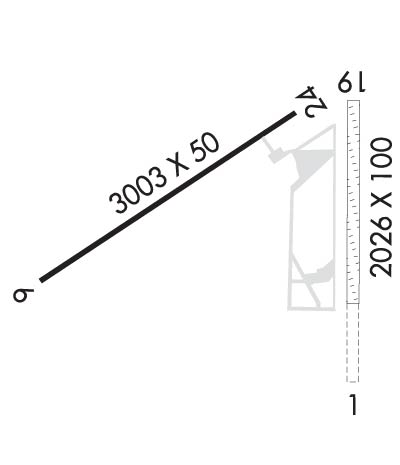
| 3003x50 | 3003' | 3003x50 | 3003' | |||||
| Runway ID | Single Wheel | Double Wheel | Double Tandem Wheel | Dual Double Wheel |
| 01/19 | N/A | N/A | N/A | N/A |
| 06/24 | 12,500 | N/A | N/A | N/A |
| These numbers are Advisory and are not limits. The Airport Manager should have more accurate Weight Limits | ||||
 Airport Diagram might not be current. | |
| Facility Name: | PUNXSUTAWNEY MUNI |
| City Name: | PUNXSUTAWNEY |
| County: | JEFFERSON |
| State abbrev: | PA |
| State Name: | PENNSYLVANIA |
| Ownership: | PUBLICLY OWNED |
| Use: | OPEN TO THE PUBLIC |
| Owner's Name: | PUNXSUTAWNEY AIRPORT AUTH |
| Address: | PO BOX 365 |
| PUNXSUTAWNEY, PA 15767 | |
| Owner's Phone: | (814) 590-1137 |
| Manager's Name: | RICK YOUNG |
| Address: | PO BOX 365 |
| PUNXSUTAWNEY, PA 15767 | |
| Phone: | (814) 590-1137 |
| FAA Region: | EASTERN |
| FAA Field Office: | HAR |
| Date | Sunrise | Sunset |
|---|---|---|
| 04/24/24 Wednesday | 6:22 | 20:06 |
| 04/25/24 Thursday | 6:21 | 20:07 |
| 04/26/24 Friday | 6:19 | 20:08 |
| 04/27/24 Saturday | 6:18 | 20:09 |
| 04/28/24 Sunday | 6:17 | 20:10 |
| 04/29/24 Monday | 6:15 | 20:11 |
| 04/30/24 Tuesday | 6:14 | 20:12 |
| 05/01/24 Wednesday | 6:13 | 20:13 |
| 05/02/24 Thursday | 6:12 | 20:14 |
| 05/03/24 Friday | 6:10 | 20:15 |
| 05/04/24 Saturday | 6:09 | 20:16 |
| 05/05/24 Sunday | 6:08 | 20:17 |
| 05/06/24 Monday | 6:07 | 20:18 |
| 05/07/24 Tuesday | 6:06 | 20:19 |
| Airport Attendance Schedule | UNATTENDED; FOR SVC AFTER HRS CTC 814-590-1137. |
| Airport Status | OPERATIONAL (This Status can change at any time - please check NOTAMS) |
| Airport Lighting Schedule | ACTVT REIL RWY 1 & 19, 06 & 24; PAPI RWY 06 & 24; MIRL RWY 01/19 & 06/24 - CTAF. |
| Airport Storage Available | Tie Downs, Hanger |
| Extra Services Available | Flight Instruction |
| Wind Indicator | YES - (lighted) |
| Control Tower | NO |
| CTAF Frequency | 123.000 |
| Unicom Frequency | 123.000 |
| Rotating Beacon Color | WG |
| Segmented Circle | YES |
| Landing Fee | NO |
| Airport Inspected | STATE - performed by STATE AERONAUTICAL PERSONNEL |
| Inspection Date | 06/13/2023 |
| Type of Fuel Available | Grade 100LL; -10FUEL SELF-SERVE WITH CREDIT CARD. |
| Airframe Repair Service | NONE |
| Power Plant Repair Service | NONE |
| Latitude | N4058.0 |
| Longitude | W07855.8 (ESTIMATED) |
| Arpt Elevation | 1444ft (ESTIMATED) |
| Magnetic Variation | 10W |
| 3 miles NE | of PUNXSUTAWNEY |
| Traffic Pattern Altitude | |
| Sectional Chart | DETROIT |
| Operations (Reported) | Yearly | Avg. Daily |
|---|---|---|
| General Aviation Transient | 1000 | 3 |
| General Aviation Local | 4000 | 11 |
| Air Taxi | 0 | 0 |
| Commerical | 0 | 0 |
| Commuter | 0 | 0 |
| Military | 200 | 1 |
| Aircraft based on Field | |
|---|---|
| General Aviation Singles | 11 |
| General Aviation Multi | 1 |
| Jet Aircraft | 0 |
| General Aviation Helicopters | 0 |
| Military Aircraft | 0 |
| Gliders | 0 |
| Ultralights | 0 |
| FSS on field | NO |
| FSS tie-in | ALTOONA |
| FSS Phone | 1-800-WX-BRIEF |
| Who issues Notams | AOO |
| Notam D service at airport | YES |
| ARTCC Name | CLEVELAND |
| Airport Certification | |
| Aircraft Rescue & Firefighting Index | None |
| Airport of Entry | No |
| Custom Landing Rights | No |
| Joint Civil/Military | No |
| Military Landing rights | YES |
| NATIONAL PLAN OF INTEGRATED AIRPORT SYSTEMS (NPIAS) |
| GRANT AGREEMENTS UNDER FAAP/ADAP/AIP |
| ASSURANCES PURSUANT TO TITLE VI, CIVIL RIGHTS ACT OF 1964 |
| TURF SOFT AND WET DRG SPRING THAW. |
| RWY 24 REIL IS ON A DAY SENSOR, OPER DURG HRS OF DARKNESS ONLY. |
| 56 FT STACK E OF RWY 01 |
| RWY 01/19 CLSD DEC-APR. |
| BIRDS; DEER & WOODCHUCK ON & INVOF ARPT. |
| RWY 19 22 FT ROAD 146 FT FM RWY END ACRS CNTRLN. |
| FOR CD CTC CLEVELAND ARTCC AT 440-774-0234. |
Airport Communications & Frequencies:
| |||||||||
| Runway: 01 | Runway: 19 | ||
| Mag heading: | 10° | Mag heading: | 190° |
| Rwy Slope: | .40% Up | Rwy Slope: | -.40% Down |
| Approach: | Approach: | ||
| Pattern: | Left Traffic | Pattern: | Left Traffic |
| Markings: | NONSTANDARD | Markings: | NONSTANDARD |
| Marking Condition: | GOOD; RWY MARKED WITH ORANGE CONES. | Marking Condition: | GOOD; RWY MARKED WITH ORANGE CONES. |
| Arresting Dev: | Arresting Dev: | ||
| Lat & Long: | N4057.8 W07855.6 | Lat. & Long.: | N4058.2 W07855.6 |
| Elev: | 1436.0 ft. MSL | Elev: | 1444.8 ft. MSL |
| TCH: | TCH: | ||
| Visual Glide Path: | Visual Glide Path: | ||
| Displaced Threshold: | No | Displaced Threshold: | No |
| Touchdown Zone: | YES | Touchdown Zone: | YES |
| Touchdown Elev.: | 1439.0 feet | Touchdown Elev.: | 1439.0 feet |
| Visual Glide Slope: | Visual Glide Slope: | ||
| RVR Equipment: | RVR Equipment: | ||
| RVV Equipment: | NO | RVV Equipment: | NO |
| Approach Lights: | Approach Lights: | ||
| REIL: | YES | REIL: | YES |
| Centerline Lights: | NO | Centerline Lights: | NO |
| Touchdown lights: | NO | Touchdown lights: | NO |
| Runway Category: | Runway with a Visual Approach | Runway Category: | Runway with a Visual Approach |
| Declared Distances: | Declared Distances: | ||
| Obstructions: | TREES | Obstructions: | ROAD |
| Marked: | NOT Marked/Lighted | Marked: | NOT Marked/Lighted |
| Clearance slope: | 16:1 | Clearance slope: | 17:1 |
| Obstruction height: | 59 feet AGL | Obstruction height: | 21 feet AGL |
| Dist. from runway: | 975 feet | Dist. from runway: | 360 feet |
| Centerline offset: | 167 left of centerline | Centerline offset: | |
| Comments: | Comments: |
| Runway: 06 | Runway: 24 | ||
| Mag heading: | 67° | Mag heading: | 247° |
| Rwy Slope: | .90% Up | Rwy Slope: | -.90% Down |
| Approach: | Approach: | ||
| Pattern: | Left Traffic | Pattern: | Left Traffic |
| Markings: | NONPRECISION INSTRUMENT | Markings: | NONPRECISION INSTRUMENT |
| Marking Condition: | GOOD | Marking Condition: | GOOD |
| Arresting Dev: | Arresting Dev: | ||
| Lat & Long: | N4057.9 W07856.2 | Lat. & Long.: | N4058.1 W07855.7 |
| Elev: | 1410.0 ft. MSL | Elev: | 1437.0 ft. MSL |
| TCH: | 45 ft. AGL | TCH: | 40 ft. AGL |
| Visual Glide Path: | 4.00 degrees | Visual Glide Path: | 4.00 degrees |
| Displaced Threshold: | No | Displaced Threshold: | No |
| Touchdown Zone: | YES | Touchdown Zone: | YES |
| Touchdown Elev.: | 1439.0 feet | Touchdown Elev.: | 1439.0 feet |
| Visual Glide Slope: | 2-Light PAPI on LEFT side of Runway | Visual Glide Slope: | 2-Light PAPI on LEFT side of Runway |
| RVR Equipment: | RVR Equipment: | ||
| RVV Equipment: | NO | RVV Equipment: | NO |
| Approach Lights: | Approach Lights: | ||
| REIL: | YES | REIL: | YES |
| Centerline Lights: | NO | Centerline Lights: | NO |
| Touchdown lights: | NO | Touchdown lights: | NO |
| Runway Category: | Runway with a Visual Approach | Runway Category: | Runway with a Non-precision Approach |
| Declared Distances: | Declared Distances: | ||
| Obstructions: | TREES | Obstructions: | ROAD |
| Marked: | NOT Marked/Lighted | Marked: | NOT Marked/Lighted |
| Clearance slope: | 3:1 | Clearance slope: | 15:1 |
| Obstruction height: | 26 feet AGL | Obstruction height: | 28 feet AGL |
| Dist. from runway: | 296 feet | Dist. from runway: | 634 feet |
| Centerline offset: | 252 right of centerline | Centerline offset: | |
| Comments: | RWY 06 30 FT POLE, 103 FT FM RWY END, 227 FT RIGHT. | Comments: |
Thanks for using FltPlan.com
all rights reserved © 1999-2024 by Flight Plan LLC
