| GREENBRIER VALLEY LEWISBURG WV |
| |
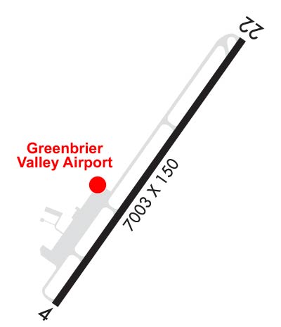
| Lat: N 3751.5 Long: W 08024.0 Elev: 2302 Var: +08 Longest Runway: 7003 | ||
| Clr Del: 120.85 TW CLD Dept. ATIS: 121.4 Arr. ATIS: 121.4 AWOS: 121.4 Ground: 121.9 Tower: 118.9 | ||
| |||||||||||||||||||||||||||||||||||||||||||||||||||||||||||||||||||||
| |||||||||||||||||||||||||||||||||||||||||||||||||||||||||||||||||||||
| |||||||||||||||||||||||||||||||||||||||||||||||||||||||||||||||||||||
| |||||||||||||||||||||||||||||||||||||||||||||||||||||||||||||||||||||
| Rwy | Rwy | |||||||
| 7003x150 | 7003' | 110.35 - 045° | 7003x150 | 7003' | ||||
| Runway ID | Single Wheel | Double Wheel | Double Tandem Wheel | Dual Double Wheel |
| 04/22 | 90,000 | 120,000 | 160,000 | N/A |
| These numbers are Advisory and are not limits. The Airport Manager should have more accurate Weight Limits | ||||
 Airport Diagram might not be current. | |
| Facility Name: | GREENBRIER VALLEY |
| City Name: | LEWISBURG |
| County: | GREENBRIER |
| State abbrev: | WV |
| State Name: | WEST VIRGINIA |
| Ownership: | PUBLICLY OWNED |
| Use: | OPEN TO THE PUBLIC |
| Owner's Name: | GREENBRIER CO ARPT AUTH |
| Address: | 584 AIRPORT RD BOX 1 |
| LEWISBURG, WV 24901 | |
| Owner's Phone: | 304-645-3961 |
| Manager's Name: | MARTHA LIVESAY |
| Address: | 584 AIRPORT RD BOX 1 |
| LEWISBURG, WV 24901 | |
| Phone: | 304-646-7382; MGR CELL: 304-992-4204 |
| FAA Region: | EASTERN |
| FAA Field Office: | BKW |

| Date | Sunrise | Sunset |
|---|---|---|
| 04/25/24 Thursday | 6:32 | 20:07 |
| 04/26/24 Friday | 6:31 | 20:08 |
| 04/27/24 Saturday | 6:30 | 20:09 |
| 04/28/24 Sunday | 6:28 | 20:10 |
| 04/29/24 Monday | 6:27 | 20:11 |
| 04/30/24 Tuesday | 6:26 | 20:12 |
| 05/01/24 Wednesday | 6:25 | 20:13 |
| 05/02/24 Thursday | 6:24 | 20:14 |
| 05/03/24 Friday | 6:23 | 20:15 |
| 05/04/24 Saturday | 6:21 | 20:16 |
| 05/05/24 Sunday | 6:20 | 20:17 |
| 05/06/24 Monday | 6:19 | 20:17 |
| 05/07/24 Tuesday | 6:18 | 20:18 |
| 05/08/24 Wednesday | 6:17 | 20:19 |
| Airport Attendance Schedule | CONTINUOUS |
| Airport Status | OPERATIONAL (This Status can change at any time - please check NOTAMS) |
| Airport Lighting Schedule | ACTVT MALSR RWY 04; REIL RWY 22; HIRL RWY 04/22; TWY LGTS - CTAF. VASI RWY 22 OPR CONSLY. |
| Airport Storage Available | Tie Downs, Hanger |
| Extra Services Available | Cargo Handling, Charter, Flight Instruction, Aircraft Rental, Aircraft Sales |
| Wind Indicator | YES - (lighted) |
| Control Tower | YES |
| CTAF Frequency | 118.900 |
| Unicom Frequency | 122.950 |
| Rotating Beacon Color | WG |
| Segmented Circle | NO |
| Landing Fee | YES; MULTI ENG ONLY, FEE WAIVED IF PURCHASE FUEL. |
| Airport Inspected | FEDERAL - performed by FAA AIRPORTS FIELD PERSONNEL |
| Inspection Date | 07/18/2023 |
| Type of Fuel Available | Grade 100LL, JET A (freeze point -40C) |
| Airframe Repair Service | MINOR |
| Power Plant Repair Service | MINOR |
| Latitude | N3751.5 |
| Longitude | W08024.0 (ESTIMATED) |
| Arpt Elevation | 2301ft (SURVEYED) |
| Magnetic Variation | 08W |
| 3 miles N | of LEWISBURG |
| Traffic Pattern Altitude | |
| Sectional Chart | CINCINNATI |
| Operations (Reported) | Yearly | Avg. Daily |
|---|---|---|
| General Aviation Transient | 2919 | 8 |
| General Aviation Local | 2511 | 7 |
| Air Taxi | 1374 | 4 |
| Commerical | 1003 | 3 |
| Commuter | 0 | 0 |
| Military | 330 | 1 |
| Aircraft based on Field | |
|---|---|
| General Aviation Singles | 15 |
| General Aviation Multi | 2 |
| Jet Aircraft | 1 |
| General Aviation Helicopters | 0 |
| Military Aircraft | 0 |
| Gliders | 0 |
| Ultralights | 0 |
| FSS on field | NO |
| FSS tie-in | ELKINS |
| FSS Phone | 1-800-WX-BRIEF |
| Who issues Notams | LWB |
| Notam D service at airport | YES |
| ARTCC Name | WASHINGTON |
| Airport Certification | AIRPORT RECEIVING SCHEDULED AIR CARRIER SERVICE FROM CARRIERS CERTIFICATED BY THE CIVIL AERONAUTICS BOARD; PPR 24 HRS FOR UNSKED ACR OPNS WITH MORE THAN 30 PSGR SEATS CALL AMGR 304-645-3961. ARFF INDEX C EQPT AVBL UPON REQ. |
| Aircraft Rescue & Firefighting Index | AIRPORT HAS A CERTIFICATE UNDER CFR PART 139 |
| Airport of Entry | No |
| Custom Landing Rights | No |
| Joint Civil/Military | No |
| Military Landing rights | YES |
| NATIONAL PLAN OF INTEGRATED AIRPORT SYSTEMS (NPIAS) |
| GRANT AGREEMENTS UNDER FAAP/ADAP/AIP |
| ASSURANCES PURSUANT TO TITLE VI, CIVIL RIGHTS ACT OF 1964 |
| COMPLIANCE WITH ACCESSIBILITY TO THE HANDICAPPED |
| BIRDS & DEER ON & INVOF ARPT. |
| USE CTAF 118.9 WHEN TWR CLSD. FREQ 121.5 NOT AVBL AT TWR. |
| RWY 04/2 2 USBL PAINTED RWY WIDTH IS 100 FT WITH 25 FT PAVED SHOULDERS. |
| RWY 04/2 2 RWY EDGE LGTS ARE 35 FT FM PAINTED RWY EDGE MRKG. |
Airport Communications & Frequencies:
| |||||||||||||||
| Runway: 04 | Runway: 22 | ||
| Mag heading: | 43° | Mag heading: | 223° |
| Rwy Slope: | .07% Up | Rwy Slope: | -.07% Down |
| Approach: | ILS | Approach: | |
| Pattern: | Left Traffic | Pattern: | Left Traffic |
| Markings: | PRECISION INSTRUMENT | Markings: | NONPRECISION INSTRUMENT |
| Marking Condition: | GOOD | Marking Condition: | GOOD |
| Arresting Dev: | Arresting Dev: | ||
| Lat & Long: | N3751.0 W08024.4 | Lat. & Long.: | N3752.0 W08023.5 |
| Elev: | 2287.3 ft. MSL | Elev: | 2292.5 ft. MSL |
| TCH: | TCH: | ||
| Visual Glide Path: | Visual Glide Path: | ||
| Displaced Threshold: | No | Displaced Threshold: | No |
| Touchdown Zone: | YES | Touchdown Zone: | YES |
| Touchdown Elev.: | 2287.5 feet | Touchdown Elev.: | 2301.6 feet |
| Visual Glide Slope: | Visual Glide Slope: | ||
| RVR Equipment: | RVR Equipment: | ||
| RVV Equipment: | NO | RVV Equipment: | NO |
| Approach Lights: | MALSR - 1,400 foot medium intensity approach lighting system with runway alignment indicator lights | Approach Lights: | |
| REIL: | NO | REIL: | YES |
| Centerline Lights: | NO | Centerline Lights: | NO |
| Touchdown lights: | NO | Touchdown lights: | NO |
| Runway Category: | Precision Instrument Runway | Runway Category: | Runway with a Non-precision Approach having visibility minimums greater than 3/4 mile |
| Declared Distances: | TORA:7003' TODA:7003' ASDA:7003' LDA:7003' | Declared Distances: | TORA:7003' TODA:7003' ASDA:7003' LDA:7003' |
Thanks for using FltPlan.com
all rights reserved © 1999-2024 by Flight Plan LLC