
| LAKEFIELD CELINA OH |
| |
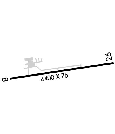
| Lat: N 4029.1 Long: W 08433.5 Elev: 894 Var: +04 Longest Runway: 4400 | ||
| CTAF: 122.8 | ||
| |||||||||||||||||||||||||||||||||||||||||||||||||||||||||||||
| |||||||||||||||||||||||||||||||||||||||||||||||||||||||||||||
| Rwy | Rwy | |||||||
| 4400x75 | 4400' | 4400x75 | 4400' | |||||
| Runway ID | Single Wheel | Double Wheel | Double Tandem Wheel | Dual Double Wheel |
| 08/26 | 30,000 | N/A | N/A | N/A |
| These numbers are Advisory and are not limits. The Airport Manager should have more accurate Weight Limits | ||||
 Airport Diagram might not be current. | |
| Facility Name: | LAKEFIELD |
| City Name: | CELINA |
| County: | MERCER |
| State abbrev: | OH |
| State Name: | OHIO |
| Ownership: | PUBLICLY OWNED |
| Use: | OPEN TO THE PUBLIC |
| Owner's Name: | LAKEFIELD ARPT AUTH |
| Address: | MERCER CO COMMISSIONERS OFC, 220 W LIVINGSTON ST STE A201 |
| CELINA, OH 45822-1673 | |
| Owner's Phone: | 419-586-3178 |
| Manager's Name: | JONATHAN JEFFERIES; LAKEFIELD.CQA@GMAIL.COM. |
| Address: | 6177 STATE ROUTE 219 |
| CELINA, OH 45822-9512 | |
| Phone: | 419-586-2190; OR 419-268-2190. |
| FAA Region: | GREAT LAKES |
| FAA Field Office: | DET |
| Date | Sunrise | Sunset |
|---|---|---|
| 04/25/24 Thursday | 6:44 | 20:29 |
| 04/26/24 Friday | 6:43 | 20:30 |
| 04/27/24 Saturday | 6:42 | 20:31 |
| 04/28/24 Sunday | 6:40 | 20:32 |
| 04/29/24 Monday | 6:39 | 20:33 |
| 04/30/24 Tuesday | 6:38 | 20:34 |
| 05/01/24 Wednesday | 6:36 | 20:35 |
| 05/02/24 Thursday | 6:35 | 20:36 |
| 05/03/24 Friday | 6:34 | 20:37 |
| 05/04/24 Saturday | 6:33 | 20:38 |
| 05/05/24 Sunday | 6:31 | 20:39 |
| 05/06/24 Monday | 6:30 | 20:40 |
| 05/07/24 Tuesday | 6:29 | 20:41 |
| 05/08/24 Wednesday | 6:28 | 20:42 |
| Airport Attendance Schedule | SAT-SUN IREG, MON-FRI 0800-1700 |
| Airport Status | OPERATIONAL (This Status can change at any time - please check NOTAMS) |
| Airport Lighting Schedule | ACTVT REIL RWY 08 & 26; MIRL RWY 08/26 - 123.3. |
| Airport Storage Available | Tie Downs, Hanger |
| Extra Services Available | NONE |
| Wind Indicator | YES - (unlit) |
| Control Tower | NO |
| CTAF Frequency | 122.800 |
| Unicom Frequency | 122.800 |
| Rotating Beacon Color | WG |
| Segmented Circle | NO |
| Landing Fee | NO |
| Airport Inspected | STATE - performed by STATE AERONAUTICAL PERSONNEL |
| Inspection Date | 08/24/2023 |
| Type of Fuel Available | Grade 100LL, JET A (freeze point -40C); -10100LL & JET A AVBL H24 SELF SVC VIA CREDIT CARD. |
| Airframe Repair Service | NONE |
| Power Plant Repair Service | NONE |
| Latitude | N4029.1 |
| Longitude | W08433.5 (ESTIMATED) |
| Arpt Elevation | 894ft (SURVEYED) |
| Magnetic Variation | 04W |
| 4 miles S | of CELINA |
| Traffic Pattern Altitude | |
| Sectional Chart | DETROIT |
| Operations (Reported) | Yearly | Avg. Daily |
|---|---|---|
| General Aviation Transient | 3000 | 8 |
| General Aviation Local | 9000 | 25 |
| Air Taxi | 150 | 0 |
| Commerical | 0 | 0 |
| Commuter | 0 | 0 |
| Military | 0 | 0 |
| Aircraft based on Field | |
|---|---|
| General Aviation Singles | 20 |
| General Aviation Multi | 0 |
| Jet Aircraft | 0 |
| General Aviation Helicopters | 0 |
| Military Aircraft | 0 |
| Gliders | 0 |
| Ultralights | 0 |
| FSS on field | NO |
| FSS tie-in | DAYTON |
| FSS Phone | 1-800-WX-BRIEF |
| Who issues Notams | DAY |
| Notam D service at airport | YES |
| ARTCC Name | INDIANAPOLIS |
| Airport Certification | |
| Aircraft Rescue & Firefighting Index | None |
| Airport of Entry | No |
| Custom Landing Rights | No |
| Joint Civil/Military | No |
| Military Landing rights | YES |
| NATIONAL PLAN OF INTEGRATED AIRPORT SYSTEMS (NPIAS) |
| GRANT AGREEMENTS UNDER FAAP/ADAP/AIP |
| ASSURANCES PURSUANT TO TITLE VI, CIVIL RIGHTS ACT OF 1964 |
| FOR CD CTC COLUMBUS APCH AT 614-338-8537. |
| BIRDS & WILDLIFE ON & INVOF ARPT. |
Airport Communications & Frequencies:
| ||||||||||||||
| Runway: 08 | Runway: 26 | ||
| Mag heading: | 87° | Mag heading: | 267° |
| Rwy Slope: | -.18% Down | Rwy Slope: | .18% Up |
| Approach: | Approach: | ||
| Pattern: | Left Traffic | Pattern: | Left Traffic |
| Markings: | NONPRECISION INSTRUMENT | Markings: | NONPRECISION INSTRUMENT |
| Marking Condition: | FAIR | Marking Condition: | FAIR |
| Arresting Dev: | Arresting Dev: | ||
| Lat & Long: | N4029.0 W08434.0 | Lat. & Long.: | N4029.1 W08433.0 |
| Elev: | 894.2 ft. MSL | Elev: | 886.5 ft. MSL |
| TCH: | 20 ft. AGL | TCH: | 29 ft. AGL |
| Visual Glide Path: | 3.00 degrees | Visual Glide Path: | 3.00 degrees |
| Displaced Threshold: | No | Displaced Threshold: | No |
| Touchdown Zone: | YES | Touchdown Zone: | YES |
| Touchdown Elev.: | 894.3 feet | Touchdown Elev.: | 892.9 feet |
| Visual Glide Slope: | 4-Light PAPI on LEFT side of Runway | Visual Glide Slope: | 4-Light PAPI on LEFT side of Runway |
| RVR Equipment: | RVR Equipment: | ||
| RVV Equipment: | NO | RVV Equipment: | NO |
| Approach Lights: | Approach Lights: | ||
| REIL: | YES | REIL: | YES |
| Centerline Lights: | NO | Centerline Lights: | NO |
| Touchdown lights: | NO | Touchdown lights: | NO |
| Runway Category: | Runway with a Non-precision Approach | Runway Category: | Runway with a Non-precision Approach |
| Declared Distances: | Declared Distances: | ||
| Comments: | Comments: | 10-12 FT BRUSH, 75 FT DIST, 175 FT R. |
Thanks for using FltPlan.com
all rights reserved © 1999-2024 by Flight Plan LLC

