
| EADS MUNI EADS CO |
| |
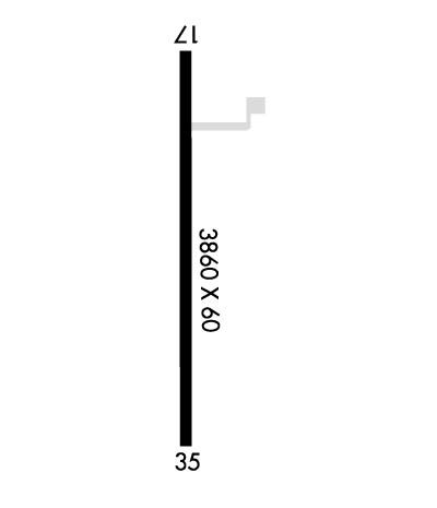
| Lat: N 3828.5 Long: W 10248.7 Elev: 4245 Var: -10 Longest Runway: 3860 | ||
| CTAF: 122.9 | ||
| ||||||||||||||||||||||||||||||||
| ||||||||||||||||||||||||||||||||
| Rwy | Rwy | |||||||
| 3860x60 | 3860' | 3860x60 | 3860' | |||||
| Runway ID | Single Wheel | Double Wheel | Double Tandem Wheel | Dual Double Wheel |
| 17/35 | N/A | N/A | N/A | N/A |
| These numbers are Advisory and are not limits. The Airport Manager should have more accurate Weight Limits | ||||
| FltPlan does not have IFR approach charts available for K9V7. |
 Airport Diagram might not be current. | |
| Facility Name: | EADS MUNI |
| City Name: | EADS |
| County: | KIOWA |
| State abbrev: | CO |
| State Name: | COLORADO |
| Ownership: | PUBLICLY OWNED |
| Use: | OPEN TO THE PUBLIC |
| Owner's Name: | TOWN OF EADS |
| Address: | CITY HALL BOX 8 |
| EADS, CO 81036 | |
| Owner's Phone: | 719-438-5590 |
| Manager's Name: | VAN BROWN JR |
| Address: | CITY HALL BOX 8 |
| EADS, CO 81036 | |
| Phone: | 719-438-5590 |
| FAA Region: | NORTHWEST MOUNTAIN |
| FAA Field Office: | DEN |
| Date | Sunrise | Sunset |
|---|---|---|
| 04/24/24 Wednesday | 6:02 | 19:37 |
| 04/25/24 Thursday | 6:01 | 19:38 |
| 04/26/24 Friday | 5:59 | 19:39 |
| 04/27/24 Saturday | 5:58 | 19:40 |
| 04/28/24 Sunday | 5:57 | 19:41 |
| 04/29/24 Monday | 5:56 | 19:42 |
| 04/30/24 Tuesday | 5:54 | 19:43 |
| 05/01/24 Wednesday | 5:53 | 19:44 |
| 05/02/24 Thursday | 5:52 | 19:45 |
| 05/03/24 Friday | 5:51 | 19:46 |
| 05/04/24 Saturday | 5:50 | 19:47 |
| 05/05/24 Sunday | 5:49 | 19:48 |
| 05/06/24 Monday | 5:48 | 19:48 |
| 05/07/24 Tuesday | 5:47 | 19:49 |
| Airport Attendance Schedule | UNATTENDED |
| Airport Status | OPERATIONAL (This Status can change at any time - please check NOTAMS) |
| Airport Lighting Schedule | SS-SR |
| Airport Storage Available | Tie Downs |
| Extra Services Available | Crop Dusting |
| Wind Indicator | YES - (unlit) |
| Control Tower | NO |
| CTAF Frequency | 122.900 |
| Unicom Frequency | |
| Rotating Beacon Color | |
| Segmented Circle | NO |
| Landing Fee | NO |
| Airport Inspected | STATE - performed by STATE AERONAUTICAL PERSONNEL |
| Inspection Date | 09/29/2020 |
| Type of Fuel Available | None |
| Airframe Repair Service | NONE |
| Power Plant Repair Service | NONE |
| Latitude | N3828.5 |
| Longitude | W10248.7 (ESTIMATED) |
| Arpt Elevation | 4245ft (ESTIMATED) |
| Magnetic Variation | 10E |
| 1 miles W | of EADS |
| Traffic Pattern Altitude | |
| Sectional Chart | WICHITA |
| Operations (Reported) | Yearly | Avg. Daily |
|---|---|---|
| General Aviation Transient | 250 | 1 |
| General Aviation Local | 1000 | 3 |
| Air Taxi | 0 | 0 |
| Commerical | 0 | 0 |
| Commuter | 0 | 0 |
| Military | 0 | 0 |
| Aircraft based on Field | |
|---|---|
| General Aviation Singles | 9 |
| General Aviation Multi | 0 |
| Jet Aircraft | 0 |
| General Aviation Helicopters | 0 |
| Military Aircraft | 0 |
| Gliders | 0 |
| Ultralights | 0 |
| FSS on field | NO |
| FSS tie-in | DENVER |
| FSS Phone | 1-800-WX-BRIEF |
| Who issues Notams | DEN |
| Notam D service at airport | YES |
| ARTCC Name | DENVER |
| Airport Certification | |
| Aircraft Rescue & Firefighting Index | None |
| Airport of Entry | No |
| Custom Landing Rights | No |
| Joint Civil/Military | No |
| Military Landing rights | No |
| APRON AREA IS ASPH. |
| UNCONTROLLED VEHICLE ACCESS TO OPNS AREA & RYS. |
| RY 17 HAS +25 FT RAILROAD 530 FT FM THLD CNTRLN. |
| TWY AND RY HAVE NO MARKINGS. |
| BE ALERT; INTENSIVE USAF STUDENT TRAINING IN VICINITY OF COLORADO SPRINGS & PUEBLO COLORADO. |
| RY 17 +25 FT BLDGS 300 FT RIGHT OF CNTRLN 108 FT FM RY END. |
| FOR CD CTC DENVER ARTCC AT 303-651-4257. |
| Runway: 17 | Runway: 35 | ||
| Mag heading: | 170° | Mag heading: | 350° |
| Rwy Slope: | -.08% Down | Rwy Slope: | .08% Up |
| Approach: | Approach: | ||
| Pattern: | Left Traffic | Pattern: | Left Traffic |
| Markings: | NONE | Markings: | NONE |
| Marking Condition: | Marking Condition: | ||
| Arresting Dev: | Arresting Dev: | ||
| Lat & Long: | N3828.8 W10248.7 | Lat. & Long.: | N3828.2 W10248.6 |
| Elev: | 4245.0 ft. MSL | Elev: | 4242.0 ft. MSL |
| TCH: | TCH: | ||
| Visual Glide Path: | Visual Glide Path: | ||
| Displaced Threshold: | No | Displaced Threshold: | No |
| Touchdown Zone: | NO | Touchdown Zone: | NO |
| Touchdown Elev.: | Touchdown Elev.: | ||
| Visual Glide Slope: | Visual Glide Slope: | ||
| RVR Equipment: | RVR Equipment: | ||
| RVV Equipment: | NO | RVV Equipment: | NO |
| Approach Lights: | Approach Lights: | ||
| REIL: | NO | REIL: | NO |
| Centerline Lights: | NO | Centerline Lights: | NO |
| Touchdown lights: | NO | Touchdown lights: | NO |
| Runway Category: | Runway with a Visual Approach | Runway Category: | Runway with a Visual Approach |
| Declared Distances: | Declared Distances: | ||
| Obstructions: | ROAD | Obstructions: | ROAD |
| Marked: | NOT Marked/Lighted | Marked: | NOT Marked/Lighted |
| Clearance slope: | 11:1 | Clearance slope: | |
| Obstruction height: | 18 feet AGL | Obstruction height: | 16 feet AGL |
| Dist. from runway: | 400 feet | Dist. from runway: | 210 feet |
| Centerline offset: | Centerline offset: | ||
| Comments: | RUNWAY 17 HAS +10' ROAD 40' RIGHT OF CENTERLINE 5' FROM RUNWAY END. | Comments: |
Thanks for using FltPlan.com
all rights reserved © 1999-2024 by Flight Plan LLC
