
| LOCKHART MUNI LOCKHART TX |
| |
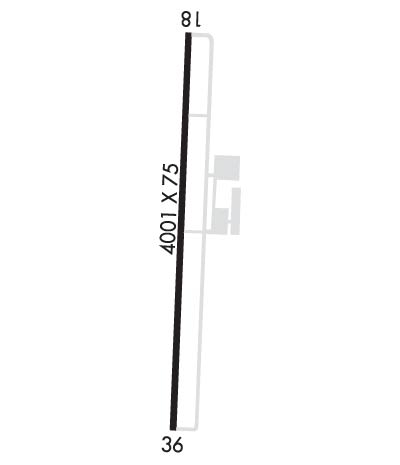
| Lat: N 2951.0 Long: W 09740.3 Elev: 532 Var: -07 Longest Runway: 4001 | ||
| CTAF: 122.8 | ||
| ||||||||||||||||||||||||||||||||||||||||||||
| ||||||||||||||||||||||||||||||||||||||||||||
| Rwy | Rwy | |||||||
| 4001x75 | 4001' | 4001x75 | 4001' | |||||
| Runway ID | Single Wheel | Double Wheel | Double Tandem Wheel | Dual Double Wheel |
| 18/36 | 12,500 | N/A | N/A | N/A |
| These numbers are Advisory and are not limits. The Airport Manager should have more accurate Weight Limits | ||||
 Airport Diagram might not be current. | |
| Facility Name: | LOCKHART MUNI |
| City Name: | LOCKHART |
| County: | CALDWELL |
| State abbrev: | TX |
| State Name: | TEXAS |
| Ownership: | PUBLICLY OWNED |
| Use: | OPEN TO THE PUBLIC |
| Owner's Name: | CITY OF LOCKHART |
| Address: | PO BOX 239 |
| LOCKHART, TX 78644 | |
| Owner's Phone: | 512-398-3461 |
| Manager's Name: | SEAN KELLEY; PUBLIC WORKS |
| Address: | PO BOX 239 |
| LOCKHART, TX 78644 | |
| Phone: | 512-398-6452 |
| FAA Region: | SOUTHWEST |
| FAA Field Office: | TEX |
| Date | Sunrise | Sunset |
|---|---|---|
| 04/25/24 Thursday | 6:53 | 20:05 |
| 04/26/24 Friday | 6:52 | 20:05 |
| 04/27/24 Saturday | 6:51 | 20:06 |
| 04/28/24 Sunday | 6:50 | 20:06 |
| 04/29/24 Monday | 6:49 | 20:07 |
| 04/30/24 Tuesday | 6:48 | 20:08 |
| 05/01/24 Wednesday | 6:47 | 20:08 |
| 05/02/24 Thursday | 6:47 | 20:09 |
| 05/03/24 Friday | 6:46 | 20:10 |
| 05/04/24 Saturday | 6:45 | 20:10 |
| 05/05/24 Sunday | 6:44 | 20:11 |
| 05/06/24 Monday | 6:43 | 20:12 |
| 05/07/24 Tuesday | 6:42 | 20:12 |
| 05/08/24 Wednesday | 6:42 | 20:13 |
| Airport Attendance Schedule | 7 Days A Week 0800-1700; EXCP MAJOR HOL. |
| Airport Status | OPERATIONAL (This Status can change at any time - please check NOTAMS) |
| Airport Lighting Schedule | DUSK-DAWN. MIRL RWY 18/36 PRESET LOW INTST; TO INCR INTST ACTVT - CTAF. |
| Airport Storage Available | Tie Downs, Hanger |
| Extra Services Available | Flight Instruction, Aircraft Rental |
| Wind Indicator | YES - (lighted) |
| Control Tower | NO |
| CTAF Frequency | 122.800 |
| Unicom Frequency | 122.800 |
| Rotating Beacon Color | WG |
| Segmented Circle | YES |
| Landing Fee | NO |
| Airport Inspected | STATE - performed by PRIVATE CONTRACT PERSONNEL |
| Inspection Date | 05/30/2023 |
| Type of Fuel Available | Grade 100LL |
| Airframe Repair Service | MAJOR |
| Power Plant Repair Service | MAJOR |
| Latitude | N2951.0 |
| Longitude | W09740.3 (ESTIMATED) |
| Arpt Elevation | 531ft (SURVEYED) |
| Magnetic Variation | 07E |
| 2 miles S | of LOCKHART |
| Traffic Pattern Altitude | |
| Sectional Chart | SAN ANTONIO |
| Operations (Reported) | Yearly | Avg. Daily |
|---|---|---|
| General Aviation Transient | 3800 | 10 |
| General Aviation Local | 11800 | 32 |
| Air Taxi | 76 | 0 |
| Commerical | 0 | 0 |
| Commuter | 0 | 0 |
| Military | 2500 | 7 |
| Aircraft based on Field | |
|---|---|
| General Aviation Singles | 33 |
| General Aviation Multi | 1 |
| Jet Aircraft | 0 |
| General Aviation Helicopters | 0 |
| Military Aircraft | 0 |
| Gliders | 0 |
| Ultralights | 0 |
| FSS on field | NO |
| FSS tie-in | SAN ANGELO |
| FSS Phone | 1-800-WX-BRIEF |
| Who issues Notams | SJT |
| Notam D service at airport | YES |
| ARTCC Name | HOUSTON |
| Airport Certification | |
| Aircraft Rescue & Firefighting Index | None |
| Airport of Entry | No |
| Custom Landing Rights | No |
| Joint Civil/Military | No |
| Military Landing rights | No |
| NATIONAL PLAN OF INTEGRATED AIRPORT SYSTEMS (NPIAS) |
| GRANT AGREEMENTS UNDER FAAP/ADAP/AIP |
| ASSURANCES PURSUANT TO TITLE VI, CIVIL RIGHTS ACT OF 1964 |
| THIS AIRPORT HAS BEEN SURVEYED BY THE NATIONAL GEODETIC SURVEY. |
| +280 FT LGTD WATER TWR 2.1 MI S OF RWY 36. |
| PARL TWY GREEN REFLECTORS ON CL. |
| WILDLIFE INVOF ARPT. |
| FOR CD CTC AUSTIN APCH AT 512-369-7865. |
Airport Communications & Frequencies:
| ||||||||||||||
| Runway: 18 | Runway: 36 | ||
| Mag heading: | 175° | Mag heading: | 355° |
| Rwy Slope: | -.19% Down | Rwy Slope: | .19% Up |
| Approach: | Approach: | ||
| Pattern: | Left Traffic | Pattern: | Left Traffic |
| Markings: | NONPRECISION INSTRUMENT | Markings: | NONPRECISION INSTRUMENT |
| Marking Condition: | POOR; MKGS DISCOLORED, PEELING. | Marking Condition: | POOR; MKGS DISCOLORED, PEELING. |
| Arresting Dev: | Arresting Dev: | ||
| Lat & Long: | N2951.3 W09740.3 | Lat. & Long.: | N2950.7 W09740.4 |
| Elev: | 531.5 ft. MSL | Elev: | 524.0 ft. MSL |
| TCH: | 24 ft. AGL | TCH: | 25 ft. AGL |
| Visual Glide Path: | 3.50 degrees | Visual Glide Path: | 3.00 degrees |
| Displaced Threshold: | No | Displaced Threshold: | No |
| Touchdown Zone: | YES | Touchdown Zone: | YES |
| Touchdown Elev.: | 531.6 feet | Touchdown Elev.: | 530.0 feet |
| Visual Glide Slope: | 2-Light PAPI on LEFT side of Runway | Visual Glide Slope: | 2-Light PAPI on LEFT side of Runway |
| RVR Equipment: | RVR Equipment: | ||
| RVV Equipment: | NO | RVV Equipment: | NO |
| Approach Lights: | Approach Lights: | ||
| REIL: | NO | REIL: | NO |
| Centerline Lights: | NO | Centerline Lights: | NO |
| Touchdown lights: | NO | Touchdown lights: | NO |
| Runway Category: | Runway with a Non-precision Approach | Runway Category: | Runway with a Non-precision Approach |
| Declared Distances: | Declared Distances: | ||
| Obstructions: | TREE | Obstructions: | TREE |
| Marked: | NOT Marked/Lighted | Marked: | NOT Marked/Lighted |
| Clearance slope: | 18:1 | Clearance slope: | 1:1 |
| Obstruction height: | 8 feet AGL | Obstruction height: | 16 feet AGL |
| Dist. from runway: | 348 feet | Dist. from runway: | 221 feet |
| Centerline offset: | 215 left of centerline | Centerline offset: | 2149 feet left of centerline |
| Comments: | Comments: | 12 FT TREE, 10 FT DSTC 174 FT L. |
Thanks for using FltPlan.com
all rights reserved © 1999-2024 by Flight Plan LLC
