
| HAMPTON COUNTY AIRPORT HAMPTON SC |
| |
| Lat: N 3252.0 Long: W 08104.9 Elev: 112 Var: +04 Longest Runway: 3601 | ||
| CTAF: 122.9 | ||
| ||||||||||||||||||||||||||||||||||||||||||||
| ||||||||||||||||||||||||||||||||||||||||||||
| Rwy | Rwy | |||||||
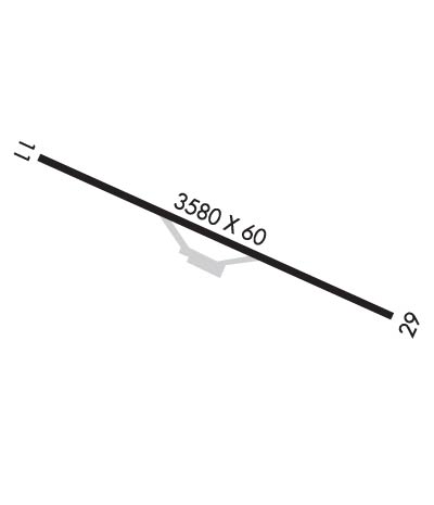
| 3601x60 | 3601' | 3601x60 | 3601' | |||||
| Runway ID | Single Wheel | Double Wheel | Double Tandem Wheel | Dual Double Wheel |
| 11/29 | 8,000 | N/A | N/A | N/A |
| These numbers are Advisory and are not limits. The Airport Manager should have more accurate Weight Limits | ||||
| FltPlan does not have IFR approach charts available for K3J0. |
 Airport Diagram might not be current. | |
| Facility Name: | HAMPTON COUNTY |
| City Name: | HAMPTON |
| County: | HAMPTON |
| State abbrev: | SC |
| State Name: | SOUTH CAROLINA |
| Ownership: | PUBLICLY OWNED |
| Use: | OPEN TO THE PUBLIC |
| Owner's Name: | HAMPTON COUNTY |
| Address: | 201 JACKSON AVENUE WEST |
| HAMPTON, SC 29924 | |
| Owner's Phone: | 803-914-2100 |
| Manager's Name: | DOBIE HIERS; DOBIE HIERS 803-942-2702 |
| Address: | 201 JACKSON AVENUE W |
| HAMPTON, SC 29924 | |
| Phone: | (803) 942-2702 |
| FAA Region: | SOUTHERN |
| FAA Field Office: | ATL |
| Date | Sunrise | Sunset |
|---|---|---|
| 05/07/24 Tuesday | 6:31 | 20:11 |
| 05/08/24 Wednesday | 6:30 | 20:12 |
| 05/09/24 Thursday | 6:29 | 20:13 |
| 05/10/24 Friday | 6:28 | 20:13 |
| 05/11/24 Saturday | 6:28 | 20:14 |
| 05/12/24 Sunday | 6:27 | 20:15 |
| 05/13/24 Monday | 6:26 | 20:16 |
| 05/14/24 Tuesday | 6:25 | 20:16 |
| 05/15/24 Wednesday | 6:25 | 20:17 |
| 05/16/24 Thursday | 6:24 | 20:18 |
| 05/17/24 Friday | 6:23 | 20:18 |
| 05/18/24 Saturday | 6:23 | 20:19 |
| 05/19/24 Sunday | 6:22 | 20:20 |
| 05/20/24 Monday | 6:22 | 20:21 |
| Airport Attendance Schedule | MON-FRI 0800-1700, SAT 0830-1700, SUN 1200-1700 |
| Airport Status | OPERATIONAL (This Status can change at any time - please check NOTAMS) |
| Airport Lighting Schedule | |
| Airport Storage Available | Tie Downs |
| Extra Services Available | NONE |
| Wind Indicator | YES - (lighted) |
| Control Tower | NO |
| CTAF Frequency | 122.900 |
| Unicom Frequency | |
| Rotating Beacon Color | |
| Segmented Circle | NO |
| Landing Fee | NO |
| Airport Inspected | STATE - performed by STATE AERONAUTICAL PERSONNEL |
| Inspection Date | 05/26/2023 |
| Type of Fuel Available | Grade 100LL, JET A (freeze point -40C); -10100LL & JET A FUEL ABL 24 HRS SELF SVC WITH CREDIT CARD. |
| Airframe Repair Service | NONE |
| Power Plant Repair Service | NONE |
| Latitude | N3252.0 |
| Longitude | W08104.9 (ESTIMATED) |
| Arpt Elevation | 112ft (SURVEYED) |
| Magnetic Variation | 04W |
| 1 miles E | of HAMPTON |
| Traffic Pattern Altitude | |
| Sectional Chart | CHARLOTTE |
| Operations (Reported) | Yearly | Avg. Daily |
|---|---|---|
| General Aviation Transient | 343 | 1 |
| General Aviation Local | 57 | 0 |
| Air Taxi | 0 | 0 |
| Commerical | 0 | 0 |
| Commuter | 0 | 0 |
| Military | 0 | 0 |
| Aircraft based on Field | |
|---|---|
| General Aviation Singles | 19 |
| General Aviation Multi | 0 |
| Jet Aircraft | 0 |
| General Aviation Helicopters | 0 |
| Military Aircraft | 0 |
| Gliders | 0 |
| Ultralights | 0 |
| FSS on field | NO |
| FSS tie-in | ANDERSON |
| FSS Phone | 1-800-WX-BRIEF |
| Who issues Notams | AND |
| Notam D service at airport | YES |
| ARTCC Name | JACKSONVILLE |
| Airport Certification | |
| Aircraft Rescue & Firefighting Index | None |
| Airport of Entry | No |
| Custom Landing Rights | No |
| Joint Civil/Military | No |
| Military Landing rights | YES |
| MARKED WATER TANK APRXLY 680 FT FROM RY 29. |
| FOR CD CTC JACKSONVILLE ARTCC AT 904-845-1592. |
| Runway: 11 | Runway: 29 | ||
| Mag heading: | 114° | Mag heading: | 294° |
| Rwy Slope: | .14% Up | Rwy Slope: | -.14% Down |
| Approach: | Approach: | ||
| Pattern: | Left Traffic | Pattern: | Left Traffic |
| Markings: | BASIC | Markings: | BASIC |
| Marking Condition: | GOOD | Marking Condition: | GOOD |
| Arresting Dev: | Arresting Dev: | ||
| Lat & Long: | N3252.1 W08105.2 | Lat. & Long.: | N3251.9 W08104.5 |
| Elev: | 106.5 ft. MSL | Elev: | 111.4 ft. MSL |
| TCH: | TCH: | ||
| Visual Glide Path: | Visual Glide Path: | ||
| Displaced Threshold: | No | Displaced Threshold: | No |
| Touchdown Zone: | YES | Touchdown Zone: | YES |
| Touchdown Elev.: | 112.1 feet | Touchdown Elev.: | 112.1 feet |
| Visual Glide Slope: | Visual Glide Slope: | ||
| RVR Equipment: | RVR Equipment: | ||
| RVV Equipment: | NO | RVV Equipment: | NO |
| Approach Lights: | Approach Lights: | ||
| REIL: | NO | REIL: | NO |
| Centerline Lights: | NO | Centerline Lights: | NO |
| Touchdown lights: | NO | Touchdown lights: | NO |
| Runway Category: | Runway with a Visual Approach | Runway Category: | Runway with a Visual Approach |
| Declared Distances: | Declared Distances: | ||
| Obstructions: | TREE | Obstructions: | TREE |
| Marked: | NOT Marked/Lighted | Marked: | NOT Marked/Lighted |
| Clearance slope: | 11:1 | Clearance slope: | 9:1 |
| Obstruction height: | 77 feet AGL | Obstruction height: | 100 feet AGL |
| Dist. from runway: | 1057 feet | Dist. from runway: | 1184 feet |
| Centerline offset: | 158 left of centerline | Centerline offset: | 96 feet right of centerline |
| Comments: | Comments: | OFF RWY 29, A YELLOW PROPERTY POST 100' FM. THLD. AND 35' LEFT OF CNTRL. ALSO A 20' POWER POLE 145' FM. THLD. AND 75' LEFT OF CNTRL. ALSO A 23' TREE 131' FM. THLD. AND 66' LEFT OF CNTRL. |
Thanks for using FltPlan.com
all rights reserved © 1999-2024 by Flight Plan LLC
