
| WATERVILLE WATERVILLE WA |
| |
| Lat: N 4739.4 Long: W 12003.4 Elev: 2645 Var: -20 Longest Runway: 2978 | ||
| CTAF: 122.9 | ||
| ||||||||||||||||||||||||||||||||
| ||||||||||||||||||||||||||||||||
| Rwy | Rwy | |||||||
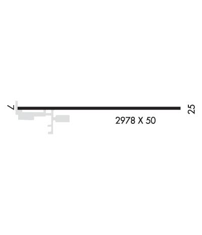
| 2978x50 | 2708' | 2978x50 | 2978' | |||||
| Runway ID | Single Wheel | Double Wheel | Double Tandem Wheel | Dual Double Wheel |
| 07/25 | 5,000 | N/A | N/A | N/A |
| These numbers are Advisory and are not limits. The Airport Manager should have more accurate Weight Limits | ||||
| FltPlan does not have IFR approach charts available for K2S5. |
 Airport Diagram might not be current. | |
| Facility Name: | WATERVILLE |
| City Name: | WATERVILLE |
| County: | DOUGLAS |
| State abbrev: | WA |
| State Name: | WASHINGTON |
| Ownership: | PUBLICLY OWNED |
| Use: | OPEN TO THE PUBLIC |
| Owner's Name: | CHELAN DOUGLAS REGIONAL PT AUTHORIT |
| Address: | ONE CAMPBELL PARKWAY SUITE A |
| EAST WENATCHEE, WA 98802 | |
| Owner's Phone: | 509-884-4700 |
| Manager's Name: | TRENT MOYERS |
| Address: | ONE CAMPBELL PARKWAY SUITE A |
| EAST WENATCHEE, WA 98802 | |
| Phone: | 509-884-4700 |
| FAA Region: | NORTHWEST MOUNTAIN |
| FAA Field Office: | SEA |
| Date | Sunrise | Sunset |
|---|---|---|
| 04/25/24 Thursday | 5:52 | 20:05 |
| 04/26/24 Friday | 5:50 | 20:07 |
| 04/27/24 Saturday | 5:48 | 20:08 |
| 04/28/24 Sunday | 5:46 | 20:10 |
| 04/29/24 Monday | 5:45 | 20:11 |
| 04/30/24 Tuesday | 5:43 | 20:12 |
| 05/01/24 Wednesday | 5:42 | 20:14 |
| 05/02/24 Thursday | 5:40 | 20:15 |
| 05/03/24 Friday | 5:38 | 20:16 |
| 05/04/24 Saturday | 5:37 | 20:18 |
| 05/05/24 Sunday | 5:35 | 20:19 |
| 05/06/24 Monday | 5:34 | 20:21 |
| 05/07/24 Tuesday | 5:32 | 20:22 |
| 05/08/24 Wednesday | 5:31 | 20:23 |
| Airport Attendance Schedule | UNATTENDED |
| Airport Status | OPERATIONAL (This Status can change at any time - please check NOTAMS) |
| Airport Lighting Schedule | SS-SR |
| Airport Storage Available | Tie Downs |
| Extra Services Available | Crop Dusting |
| Wind Indicator | YES - (lighted) |
| Control Tower | NO |
| CTAF Frequency | 122.900 |
| Unicom Frequency | |
| Rotating Beacon Color | WG |
| Segmented Circle | NO |
| Landing Fee | NO |
| Airport Inspected | STATE - performed by STATE AERONAUTICAL PERSONNEL |
| Inspection Date | 07/14/2022 |
| Type of Fuel Available | None |
| Airframe Repair Service | NONE |
| Power Plant Repair Service | NONE |
| Latitude | N4739.4 |
| Longitude | W12003.4 (ESTIMATED) |
| Arpt Elevation | 2645ft (ESTIMATED) |
| Magnetic Variation | 20E |
| 1 miles NE | of WATERVILLE |
| Traffic Pattern Altitude | |
| Sectional Chart | SEATTLE |
| Operations (Reported) | Yearly | Avg. Daily |
|---|---|---|
| General Aviation Transient | 500 | 1 |
| General Aviation Local | 500 | 1 |
| Air Taxi | 0 | 0 |
| Commerical | 0 | 0 |
| Commuter | 0 | 0 |
| Military | 0 | 0 |
| Aircraft based on Field | |
|---|---|
| General Aviation Singles | 13 |
| General Aviation Multi | 0 |
| Jet Aircraft | 0 |
| General Aviation Helicopters | 0 |
| Military Aircraft | 0 |
| Gliders | 0 |
| Ultralights | 0 |
| FSS on field | NO |
| FSS tie-in | SEATTLE |
| FSS Phone | 1-800-WX-BRIEF |
| Who issues Notams | SEA |
| Notam D service at airport | YES |
| ARTCC Name | SEATTLE |
| Airport Certification | |
| Aircraft Rescue & Firefighting Index | None |
| Airport of Entry | No |
| Custom Landing Rights | No |
| Joint Civil/Military | No |
| Military Landing rights | No |
| HILL ON S SIDE OF RY IN TRAN SFC. |
| RWY SHOULDERS SOFT IN WET WEATHER. |
| FOR CD CTC SEATTLE ARTCC AT 253-351-3694. |
| Runway: 07 | Runway: 25 | ||
| Mag heading: | N/A | Mag heading: | N/A |
| Approach: | Approach: | ||
| Pattern: | Left Traffic | Pattern: | Left Traffic |
| Markings: | BASIC | Markings: | BASIC |
| Marking Condition: | GOOD | Marking Condition: | GOOD |
| Arresting Dev: | Arresting Dev: | ||
| Lat & Long: | N4739.4 W12003.8 | Lat. & Long.: | N4739.4 W12003.0 |
| Elev: | N/A | Elev: | N/A |
| TCH: | TCH: | ||
| Visual Glide Path: | Visual Glide Path: | ||
| Displaced Threshold: | 270 feet | Displaced Threshold: | No |
| Touchdown Zone: | NO | Touchdown Zone: | NO |
| Touchdown Elev.: | Touchdown Elev.: | ||
| Visual Glide Slope: | Visual Glide Slope: | ||
| RVR Equipment: | RVR Equipment: | ||
| RVV Equipment: | NO | RVV Equipment: | NO |
| Approach Lights: | Approach Lights: | ||
| REIL: | NO | REIL: | NO |
| Centerline Lights: | NO | Centerline Lights: | NO |
| Touchdown lights: | NO | Touchdown lights: | NO |
| Runway Category: | Runway with a Visual Approach | Runway Category: | Runway with a Visual Approach |
| Declared Distances: | TORA:2800' TODA:2800' LDA:2500' | Declared Distances: | TORA:2500' TODA:2500' LDA:2500' |
| Obstructions: | ROAD | Obstructions: | |
| Marked: | NOT Marked/Lighted | Marked: | |
| Clearance slope: | 2:1 | Clearance slope: | 20:1 |
| Obstruction height: | 20 feet AGL | Obstruction height: | |
| Dist. from runway: | 250 feet | Dist. from runway: | |
| Centerline offset: | 130 left of centerline | Centerline offset: | |
| Comments: | Comments: |
Thanks for using FltPlan.com
all rights reserved © 1999-2024 by Flight Plan LLC
