
| BEACH CITY BEACH CITY OH |
| |
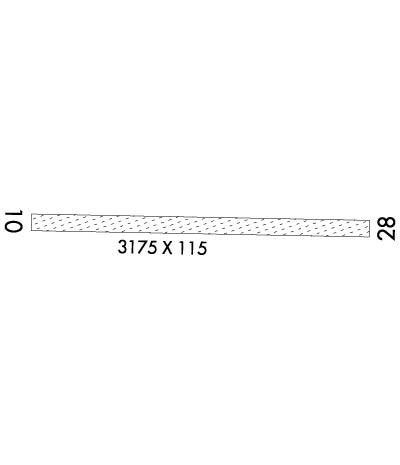
| Lat: N 4038.8 Long: W 08133.4 Elev: 984 Var: +06 Longest Runway: 3175 | ||
| CTAF: 122.8 | ||
| ||||||||||||||||||||||||||||||||
| ||||||||||||||||||||||||||||||||
| Rwy | Rwy | |||||||
| 3175x115 | 2750' | 3175x115 | 2441' | |||||
| Runway ID | Single Wheel | Double Wheel | Double Tandem Wheel | Dual Double Wheel |
| 10/28 | N/A | N/A | N/A | N/A |
| These numbers are Advisory and are not limits. The Airport Manager should have more accurate Weight Limits | ||||
| FltPlan does not have IFR approach charts available for K2D7. |
 Airport Diagram might not be current. | |
| Facility Name: | BEACH CITY |
| City Name: | BEACH CITY |
| County: | STARK |
| State abbrev: | OH |
| State Name: | OHIO |
| Ownership: | PRIVATELY OWNED |
| Use: | OPEN TO THE PUBLIC |
| Owner's Name: | BEACH CITY ARPT INC |
| Address: | PO BOX 82 |
| NAVARRE, OH 44662-0082 | |
| Owner's Phone: | 330-236-5041 |
| Manager's Name: | GARY SLUTZ |
| Address: | 10431 DOLPHIN ST SW |
| BEACH CITY, OH 44608-9760 | |
| Phone: | 330-704-5686 |
| FAA Region: | GREAT LAKES |
| FAA Field Office: | DET |
| Date | Sunrise | Sunset |
|---|---|---|
| 04/26/24 Friday | 6:31 | 20:18 |
| 04/27/24 Saturday | 6:29 | 20:19 |
| 04/28/24 Sunday | 6:28 | 20:20 |
| 04/29/24 Monday | 6:27 | 20:21 |
| 04/30/24 Tuesday | 6:25 | 20:22 |
| 05/01/24 Wednesday | 6:24 | 20:23 |
| 05/02/24 Thursday | 6:23 | 20:24 |
| 05/03/24 Friday | 6:22 | 20:25 |
| 05/04/24 Saturday | 6:20 | 20:26 |
| 05/05/24 Sunday | 6:19 | 20:27 |
| 05/06/24 Monday | 6:18 | 20:28 |
| 05/07/24 Tuesday | 6:17 | 20:29 |
| 05/08/24 Wednesday | 6:16 | 20:30 |
| 05/09/24 Thursday | 6:15 | 20:31 |
| Airport Attendance Schedule | UNATTENDED |
| Airport Status | OPERATIONAL (This Status can change at any time - please check NOTAMS) |
| Airport Lighting Schedule | ACTVT NSTD LIRL RWY 10/28 SS-SR - 122.85.; ACTVT ROTG BCN SS-SR - 122.85. |
| Airport Storage Available | Tie Downs, Hanger |
| Extra Services Available | NONE |
| Wind Indicator | YES - (lighted) |
| Control Tower | NO |
| CTAF Frequency | 122.800 |
| Unicom Frequency | 122.800 |
| Rotating Beacon Color | WG |
| Segmented Circle | NO |
| Landing Fee | NO |
| Airport Inspected | STATE - performed by STATE AERONAUTICAL PERSONNEL |
| Inspection Date | 09/26/2023 |
| Type of Fuel Available | None |
| Airframe Repair Service | NONE |
| Power Plant Repair Service | NONE |
| Latitude | N4038.8 |
| Longitude | W08133.4 (ESTIMATED) |
| Arpt Elevation | 984ft (SURVEYED) |
| Magnetic Variation | 06W |
| 1 miles E | of BEACH CITY |
| Traffic Pattern Altitude | 816 |
| Sectional Chart | DETROIT |
| Operations (Reported) | Yearly | Avg. Daily |
|---|---|---|
| General Aviation Transient | 2100 | 6 |
| General Aviation Local | 4000 | 11 |
| Air Taxi | 0 | 0 |
| Commerical | 0 | 0 |
| Commuter | 0 | 0 |
| Military | 0 | 0 |
| Aircraft based on Field | |
|---|---|
| General Aviation Singles | 25 |
| General Aviation Multi | 0 |
| Jet Aircraft | 0 |
| General Aviation Helicopters | 0 |
| Military Aircraft | 0 |
| Gliders | 0 |
| Ultralights | 0 |
| FSS on field | NO |
| FSS tie-in | CLEVELAND |
| FSS Phone | 1-800-WX-BRIEF |
| Who issues Notams | CLE |
| Notam D service at airport | YES |
| ARTCC Name | CLEVELAND |
| Airport Certification | |
| Aircraft Rescue & Firefighting Index | None |
| Airport of Entry | No |
| Custom Landing Rights | No |
| Joint Civil/Military | No |
| Military Landing rights | No |
| NO ULTRALIGHT ACFT WI 1 NMR. |
| ARPT CLSD TO MIL HELS. |
| FOR CD CTC CLEVELAND APCH AT 216-352-2323, WHEN APCH CLSD CTC CLEVELAND ARTCC AT 440-774-0223/0490. |
| DEER, BIRDS, & WILDLIFE ON & INVOF ARPT. |
| SEASONAL CROPS AT RWY EDGE, NORTH SIDE. |
| RWY 10/2 8 NSTD LIRL DUE TO LCTN ON YELLOW CONES & UNLGTD BFR EACH DTHR (2016 FT LGTD). |
Airport Communications & Frequencies:
| |||||||||||||||||
| Runway: 10 | Runway: 28 | ||
| Mag heading: | 98° | Mag heading: | 278° |
| Rwy Slope: | -.28% Down | Rwy Slope: | .28% Up |
| Approach: | Approach: | ||
| Pattern: | Left Traffic | Pattern: | Left Traffic |
| Markings: | Markings: | ||
| Marking Condition: | GOOD; 2016 FT MKD WITH LIRL ON YELLOW CONES; DTHR MKD WITH 1 GREEN LGT ON YELLOW CONE EACH SIDE; NO MKGS BFR EACH DTHR. | Marking Condition: | GOOD; 2016 FT MKD WITH LIRL ON YELLOW CONES; DTHR MKD WITH 1 GREEN LGT ON YELLOW CONE EACH SIDE; NO MKGS BFR EACH DTHR. |
| Arresting Dev: | Arresting Dev: | ||
| Lat & Long: | N4038.8 W08133.7 | Lat. & Long.: | N4038.8 W08133.0 |
| Elev: | 984.0 ft. MSL | Elev: | 975.0 ft. MSL |
| TCH: | TCH: | 40 ft. AGL | |
| Visual Glide Path: | Visual Glide Path: | 3.00 degrees | |
| Displaced Threshold: | 425 feet | Displaced Threshold: | 734 feet |
| Touchdown Zone: | YES | Touchdown Zone: | YES |
| Touchdown Elev.: | 984.0 feet | Touchdown Elev.: | 975.0 feet |
| Visual Glide Slope: | Visual Glide Slope: | 2-Box VASI on RIGHT side of Runway | |
| RVR Equipment: | RVR Equipment: | ||
| RVV Equipment: | NO | RVV Equipment: | NO |
| Approach Lights: | Approach Lights: | ||
| REIL: | NO | REIL: | NO |
| Centerline Lights: | NO | Centerline Lights: | NO |
| Touchdown lights: | NO | Touchdown lights: | NO |
| Runway Category: | Runway with a Visual Approach | Runway Category: | Runway with a Visual Approach |
| Declared Distances: | Declared Distances: | ||
| Obstructions: | PLINE; ALSO +10 FT ROAD, 0 FT DIST, 0:1. | Obstructions: | TREES; ALSO +13 FT BLDG, 61 FT DIST, 0 FT B, 4:1. |
| Marked: | NOT Marked/Lighted | Marked: | NOT Marked/Lighted |
| Clearance slope: | APCH SLP 9:1 TO DTHR OVR +35 FT PLINE, 321 FT DIST, 157 FT L. | Clearance slope: | 4:1; APCH SLP 0:1 TO DTHR OVR +16 FT HNGR, 0 FT DIST, 110 FT L. |
| Obstruction height: | 35 feet AGL | Obstruction height: | 79 feet AGL |
| Dist. from runway: | 0 feet | Dist. from runway: | 389 feet |
| Centerline offset: | 125 right of centerline | Centerline offset: | |
| Comments: | Comments: |
Thanks for using FltPlan.com
all rights reserved © 1999-2024 by Flight Plan LLC
