
| KROELINGER VINELAND NJ |
| |
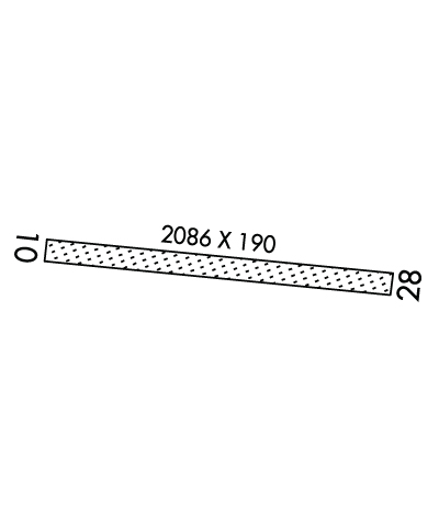
| Lat: N 3931.4 Long: W 07502.8 Elev: 93 Var: +10 Longest Runway: 2086 | ||
| CTAF: 122.9 | ||
| ||||||||||||||||||||||||||||||||
| ||||||||||||||||||||||||||||||||
| Rwy | Rwy | |||||||
| 2086x190 | 2086' | 2086x190 | 2086' | |||||
| Runway ID | Single Wheel | Double Wheel | Double Tandem Wheel | Dual Double Wheel |
| 10/28 | N/A | N/A | N/A | N/A |
| These numbers are Advisory and are not limits. The Airport Manager should have more accurate Weight Limits | ||||
| FltPlan does not have IFR approach charts available for K29N. |
 Airport Diagram might not be current. | |
| Facility Name: | KROELINGER |
| City Name: | VINELAND |
| County: | CUMBERLAND |
| State abbrev: | NJ |
| State Name: | NEW JERSEY |
| Ownership: | PRIVATELY OWNED |
| Use: | OPEN TO THE PUBLIC |
| Owner's Name: | BDGS. INC. |
| Address: | 317 W. ELMER ROAD |
| VINELAND, NJ 08360 | |
| Owner's Phone: | 856-692-8098 |
| Manager's Name: | ROBERT PANTALEO |
| Address: | 1242 W. GARDEN ROAD |
| VINELAND, NJ 08360 | |
| Phone: | 856-794-2134 |
| FAA Region: | EASTERN |
| FAA Field Office: | HAR |
| Date | Sunrise | Sunset |
|---|---|---|
| 04/25/24 Thursday | 6:08 | 19:49 |
| 04/26/24 Friday | 6:07 | 19:50 |
| 04/27/24 Saturday | 6:05 | 19:51 |
| 04/28/24 Sunday | 6:04 | 19:52 |
| 04/29/24 Monday | 6:03 | 19:53 |
| 04/30/24 Tuesday | 6:01 | 19:54 |
| 05/01/24 Wednesday | 6:00 | 19:55 |
| 05/02/24 Thursday | 5:59 | 19:56 |
| 05/03/24 Friday | 5:58 | 19:57 |
| 05/04/24 Saturday | 5:57 | 19:58 |
| 05/05/24 Sunday | 5:56 | 19:59 |
| 05/06/24 Monday | 5:54 | 20:00 |
| 05/07/24 Tuesday | 5:53 | 20:01 |
| 05/08/24 Wednesday | 5:52 | 20:02 |
| Airport Attendance Schedule | UNATTENDED |
| Airport Status | OPERATIONAL (This Status can change at any time - please check NOTAMS) |
| Airport Lighting Schedule | |
| Airport Storage Available | NONE |
| Extra Services Available | NONE |
| Wind Indicator | YES - (unlit) |
| Control Tower | NO |
| CTAF Frequency | 122.900 |
| Unicom Frequency | |
| Rotating Beacon Color | |
| Segmented Circle | NO |
| Landing Fee | NO |
| Airport Inspected | STATE - performed by STATE AERONAUTICAL PERSONNEL |
| Inspection Date | 07/26/2023 |
| Type of Fuel Available | None |
| Airframe Repair Service | None |
| Power Plant Repair Service | None |
| Latitude | N3931.4 |
| Longitude | W07502.8 (ESTIMATED) |
| Arpt Elevation | 93ft (ESTIMATED) |
| Magnetic Variation | 10W |
| 3 miles N | of VINELAND |
| Traffic Pattern Altitude | |
| Sectional Chart | WASHINGTON |
| Operations (Reported) | Yearly | Avg. Daily |
|---|---|---|
| General Aviation Transient | 125 | 0 |
| General Aviation Local | 820 | 2 |
| Air Taxi | 0 | 0 |
| Commerical | 0 | 0 |
| Commuter | 0 | 0 |
| Military | 0 | 0 |
| Aircraft based on Field | |
|---|---|
| General Aviation Singles | 5 |
| General Aviation Multi | 0 |
| Jet Aircraft | 0 |
| General Aviation Helicopters | 0 |
| Military Aircraft | 0 |
| Gliders | 0 |
| Ultralights | 0 |
| FSS on field | NO |
| FSS tie-in | MILLVILLE |
| FSS Phone | 1-800-WX-BRIEF |
| Who issues Notams | MIV |
| Notam D service at airport | YES |
| ARTCC Name | WASHINGTON |
| Airport Certification | |
| Aircraft Rescue & Firefighting Index | None |
| Airport of Entry | No |
| Custom Landing Rights | No |
| Joint Civil/Military | No |
| Military Landing rights | No |
| RY 10 TREES NEAR APCH END & ALONG RY SIDES. |
| TALL TREES ON SHORT FINAL RY 28. |
| FOR CD CTC WASHINGTON ARTCC AT 703-771-3587. |
| DEER & BIRDS ON & INVOF ARPT. |
Airport Communications & Frequencies:
| ||||||||||||
| Runway: 10 | Runway: 28 | ||
| Mag heading: | 106° | Mag heading: | 286° |
| Rwy Slope: | .00% | Rwy Slope: | .00% |
| Approach: | Approach: | ||
| Pattern: | Left Traffic | Pattern: | Left Traffic |
| Markings: | Markings: | ||
| Marking Condition: | Marking Condition: | ||
| Arresting Dev: | Arresting Dev: | ||
| Lat & Long: | N3931.5 W07503.0 | Lat. & Long.: | N3931.4 W07502.6 |
| Elev: | 80.0 ft. MSL | Elev: | 80.0 ft. MSL |
| TCH: | TCH: | ||
| Visual Glide Path: | Visual Glide Path: | ||
| Displaced Threshold: | No | Displaced Threshold: | No |
| Touchdown Zone: | YES | Touchdown Zone: | YES |
| Touchdown Elev.: | 87.0 feet | Touchdown Elev.: | 87.0 feet |
| Visual Glide Slope: | Visual Glide Slope: | ||
| RVR Equipment: | RVR Equipment: | ||
| RVV Equipment: | NO | RVV Equipment: | NO |
| Approach Lights: | Approach Lights: | ||
| REIL: | NO | REIL: | NO |
| Centerline Lights: | NO | Centerline Lights: | NO |
| Touchdown lights: | NO | Touchdown lights: | NO |
| Runway Category: | Runway with a Visual Approach | Runway Category: | Runway with a Visual Approach |
| Declared Distances: | Declared Distances: | ||
| Obstructions: | TREE | Obstructions: | PLINE |
| Marked: | NOT Marked/Lighted | Marked: | MARKED |
| Clearance slope: | Clearance slope: | 2:1 | |
| Obstruction height: | 47 feet AGL | Obstruction height: | 32 feet AGL |
| Dist. from runway: | 20 feet | Dist. from runway: | 90 feet |
| Centerline offset: | 90 left of centerline | Centerline offset: | |
| Comments: | Comments: |
Thanks for using FltPlan.com
all rights reserved © 1999-2024 by Flight Plan LLC
